Archaeology of the Wren Garden
Colonial Williamsburg Foundation Library Research Report Series - 1760
Colonial Williamsburg Foundation Library
Williamsburg, Virginia
2015
Archaeology of the Wren Garden
July 2014
The Colonial Williamsburg Foundation
| List of Figures | 5 |
| Foreword | 7 |
| Introduction and Project Description | 9 |
| Acknowledgements | 13 |
| Historical Background | 15 |
| Research Strategy | 15 |
| Data Limitations | 16 |
| Historical Overview | 16 |
| Previous Archaeology | 27 |
| Field and Laboratory Procedures | 33 |
| Sampling and Excavation Procedures | 34 |
| Laboratory Methods | 35 |
| Excavation Description and Results | 37 |
| 2004-2005 Testing Strategies | 37 |
| Geophysical Survey | 37 |
| Test Units | 39 |
| 2005 Excavation Block | 44 |
| Methodology and Rationale for Location | 44 |
| Sampling and Excavation Procedures — 2005 | 45 |
| Twentieth-Century Features | 46 |
| Stratigraphy of the Excavation Block | 49 |
| Subsequent Interpretation of 2005 Stratigraphy | 53 |
| Ambiguous and Possible Colonial Features | 53 |
| Linear Features | 56 |
| Postholes | 58 |
| Drainage feature/brick crumb concentration | 58 |
| Artifacts | 58 |
| Interpretation | 59 |
| Additional Testing, October 2005 | 63 |
| 2006 Excavation Block | 66 |
| Methodology and Location Rationale | 66 |
| Page 4 | |
| Twentieth Century Features, Disturbances and Incompletely Excavated Units | 67 |
| Pre-twentieth Century Features | 68 |
| 2007 Excavation Block | 74 |
| 2006-2007 Excavation Block Locations | 74 |
| Twentieth-century Intrusive features | 75 |
| Eighteenth-Century/Bodleian Plate Design Features | 81 |
| November 2007 Supplemental Unit | 85 |
| Summary of Results | 86 |
| Laboratory Analysis and Student Projects | 87 |
| Environmental/Archaeobotany | 87 |
| Documentary Research | 88 |
| Mapping and Landscape Studies | 88 |
| Conclusions and Recommendations | 91 |
| Bibliography and References | 94 |
| Appendices | |
| 1. Archival Record — Jessica Way | |
| 2. Artifact Inventory, in separate volume | |
| 3. Geophysical Survey — Bruce Bevan | |
| 4. Context Records | |
| 5. Soil Chemistry | |
| 6. Geometry of the Wren Yard — Benjamin Skolnik | |
| 7. Additional Drawings | |
| Figure 1. Bodleian Plate, Bodleian Library, Oxford, UK | 10 |
| Figure 2. Detail of Desandroüins Map (1781) | 11 |
| Figure 3. Detail of Simcoe Map (1782) | 11 |
| Figure 4. College Building 1702, Franz Ludwig Michel, Bergerbibliothek, Bern, Switzerland | 12 |
| Figure 5. Detail of St. Simone Map (1781) | 23 |
| Figure 6. Detail of Berthier Map (1782) | 23 |
| Figure 7. Wren Yard Garden, Previous Archaeology, All Explorations Prior to 2005 | 29 |
| Figure 8. Detail of Previous Archaeological findings in the region of the President's House | 30 |
| Figure 9. Detail of Previous Archaeology to the West and South of the Wren Building | 31 |
| Figure 10. Context Record Sheet — CWF | 36 |
| Figure 11. Composite Geophysical Drawing | 37 |
| Figure 12. Test Unit and 2005 Block Unit locations | 39 |
| Figure 13. Test Unit 1 — North sidewall | 40 |
| Figure 14. Test Unit 2 — North Sidewall | 41 |
| Figure 15. College Building c. 1856 (CWF) | 42 |
| Figure 16. Test Unit 3 — North Sidewall | 43 |
| Figure 17. Completed 2005 Excavation Block (CWF) | 44 |
| Figure 18. 2005 Excavation Block — 20th-Century Features | 47 |
| Figure 19. Student Brian Davis and Burnt Fill Deposit (CWF) | 48 |
| Figure 20. Summary map of the 2005 Excavation Block showing all features | 49 |
| Figure 21. Profiles of Unit 498N/508E | 50 |
| Figure 22. Harris Matrix — 2005 Block | 52 |
| Figure 23. Detail Plan of Unit 494N/508E | 54 |
| Figure 24. Detail Plan of Unit 490N/516E | 55 |
| Figure 25. "Yellow Loam Trench", Linear Feature 1 | 56 |
| Figure 26. Profiles of Unit 486N/512E | 57 |
| Figure 27. Overall of 2005 Block. Pre-20th-Century Features | 60 |
| Figure 28. Location of 2005 Block and Test Units | 63 |
| Figure 29. Detail Plan of Test Unit 4 | 64 |
| Figure 30. Profile of North Wall, Test Unit 4 | 64 |
| Figure 31. Profile of North Wall, Test Unit 5 | 65 |
| Figure 32. Location of 2006 Excavation Units | 67 |
| Figure 33. Brick rubble layers with thin, continuous ash layer in-between | 68 |
| Figure 34. Plan view of Later Marl Walkway as excavated in 2006 | 69 |
| Figure 35. Cannon Balls in situ | 69 |
| Figure 36. Plan view of Cannonball Layer | 70 |
| Figure 37. Profiles of Unit 449N/478E | 71 |
| Figure 38. Plan of Planting Features along south edge of 2006 excavation | 72 |
| Figure 39. Major Features in the 2006 Excavation Block | 73 |
| Page 6 | |
| Figure 40. Location Plan of 2006 and 2007 Excavation Blocks | 75 |
| Figure 41. Profiles of Unit 453N/480E | 76 |
| Figure 42. Plan View of later Marl walkways | 78 |
| Figure 43. Excavation of Diagonal Walkway Fill #2. Note faunal remains intact. (CWF) | 79 |
| Figure 44. Plan View of Earlier Diagonal Walkway 2 | 80 |
| Figure 45. Detail of Bodleian Plate | 81 |
| Figure 46. 471N/490E — Unexcavated Features | 82 |
| Figure 47. Plan View of Unit 471N/490E and later Unit 471N/492E | 83 |
| Figure 48. Profiles of features in unit 471N/490E | 83 |
| Figure 49. Photograph of likely topiary planting hole 16GA-00405/406 in Unit 469N/484E | 84 |
| Figure 50. Close-up of Garden Features in 2007 Excavation Block 2 | 84 |
| Figure 51. 471N/492E — Plan of Excavated Features | 85 |
Foreword
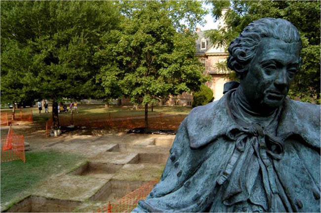
The reader should be excused for assuming that the oldest and most prominent landscape at the College of William and Mary has been fully studied, and that its evolution is well-understood. This report both charts the yawning limits of what is known and begins to answer central questions about development of one of British North America's most important public landscapes. The College's first and largest early building, now called the Wren Building, preceded the establishment of Williamsburg in 1699, and it has anchored the west end of the town's principal avenue ever since. Its dramatic setting has often been graphically portrayed, most memorably in the c.1740 copper engraving plate found in the Bodleian Library at Oxford University. This so-called Bodleian Plate shows a formal, open landscape with carefully-orchestrated ornamental plantings, in stark contrast to the present picturesque, heavily-wooded College yard.
It is only in recent years that we have begun to understand the degree to which the pre-Revolutionary campus was a controlled precinct, mirroring those at the Governor's Palace and Capitol, and how dramatically it changed after 1781. Unlike the Palace gardens and walled Capitol yard, now substantially excavated and restored, the College yard remains relatively intact archaeologically. Steven Archer's report, completed in 2014 with help from Andrew Edwards, contributes significantly to that understanding. It demonstrates that landscape elements shown on the Bodleian Plate existed, contributes detail about their form, and raises useful questions about how and when they developed. It also makes apparent the value of both excavating other areas of the yard and protecting it as an archaeological resource of much consequence. This and subsequent excavation around the adjoining Brafferton reveal that below-ground remains are rich but extremely delicate, worthy of gentle handling by future landscaping crews and archaeologists alike.
This three-year project would not have been possible without the enthusiastic support and generous funding provided by Suzann Wilson Matthews '71. We thank the College for the opportunity to study the Wren Yard, especially Louise Lambert Kale, Director of the Historic Campus, who commissioned the work.
Edward A. Chappell
Shirley and Richard Roberts Director of Architectural and Archaeological Research
Chapter 1
Introduction and Project Description
The intent of the 2004-2007 Wren Garden archaeological testing and excavations project was to characterize and determine what, if anything, remains of the formal landscape design of the College of William and Mary's historic campus, installed with the initial construction of the Wren Building beginning in the late seventeenth century. The project was primarily focused on the formal gardens east of the College that would have been the 'face' of the College to Williamsburg as it transformed from Middle Plantation to the colonial capital of Virginia beginning in 1699.
In addition to being a research project, the archaeological process has involved students of the College of William and Mary to a remarkable degree as an educational and pedagogical experiment. In partnership with the Colonial Williamsburg Foundation, undergraduate and graduate students not only participated in excavations during three summer field seasons, but also developed and addressed ancillary and supporting research projects, learned laboratory and analysis skills, and contributed to the interpretation of the project through follow-up courses conducted after each excavation season. To a large degree, the analysis reflects the questions present-day students at William and Mary wanted answered about their forbearers from previous centuries. As the modern archaeological profession endeavors to better incorporate indigenous and descendant communities in their practices, the Wren Garden excavations offer a unique perspective on this goal, where an educational institution forms the focal point of a culture that has evolved significantly over more than three hundred years.
As an archaeological project, the excavations have been limited to a boundary definition and site characterization program rather than the broad, open-area exposures typical of most Chesapeake historical archaeology (e.g., Noël Hume 1991). Because the College Yard is not a threatened resource, the overarching goal has been to do "more with less" by excavating minimally but doing more intensive data recovery (flotation, specialized soil sampling) on the excavated material where feasible. The intent is to leave unexcavated deposits for the future, where research will be guided by different questions and have access to potentially more refined technology and methods. As a result, the program has been limited to small test units, and moreover, a series of blocks of 2-by-2 meter units, excavated mostly in "checkerboard" pattern in the yard. Artifacts, samples, and records from the excavation are currently curated by the Colonial Williamsburg Foundation's Departments of Architectural and Page 10 Archaeological Research, as well as the Collections, Conservation, and Museums division, in Williamsburg, Virginia.
The spatial organization of the archaeological project has relied on three primary historic illustrations of the garden's space prior to the photographs which become common in the mid-nineteenth century, each depicting a slightly different layout of the space. The most notable and earliest of these depictions is the "Bodleian Plate" of 1740, discovered in the Bodleian Library at Oxford in 1929. This engraving proved to be instrumental in the 1930s restoration of not only the Wren Building, but also the reconstruction of the Governor's Palace and the Capitol building by Colonial Williamsburg.
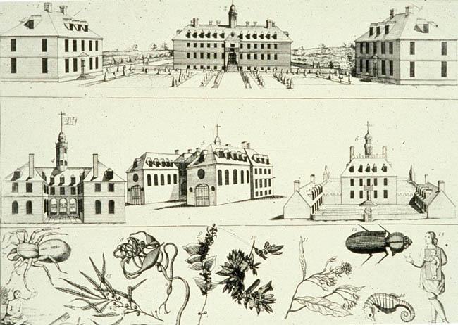 Figure 1. Bodleian Plate, Bodleian Library, Oxford, UK
Two much later maps, the only other eighteenth-century sources to show the gardens in any detail, are the "Simcoe" map of 1781 (Martin, 1991) and the Desandroüins map of 1782. The Desandroüins map appears to show six spatial divisions in the yard, all half-fenced on the north side, a decidedly unusual layout. Desandroüins map also indicates that the beds may be slightly offset rather than perfectly aligned.
Page 11 Figure 2. Detail of Desandroüins Map (1781)
The Simcoe Map, contemporary with the Desandroüins map, shows an altogether different layout of the yard space, one that is somewhat more in accordance with the Bodleian plate, featuring two large divisions, one north and one south of the central axis.
 Figure 3. Detail of Simcoe Map (1782)
None of the other early depictions of the College, such as the 1702 Franz Ludwig Michel drawing of the east elevation (Kornwolf, 1989, p. 42) shows elements of the formal landscape around the building.
Page 12
Figure 4. College Building 1702, Franz Ludwig Michel, Bergerbibliothek, Bern, Switzerland
The 2004-2007 archaeological work in the Wren Yard accomplished what was intended: finding evidence of the late seventeenth- early eighteenth-century formal garden on the east side of the College Building as depicted on the Bodleian Plate and recorded in historical documents. Although the geophysical survey conducted by Bruce Bevan and the first (2005) season of excavation produced no features relating to the garden, they certainly added to the record of activities that took place in the Wren Yard after the garden was long-since replaced by a tree park. Significant in the 2006 field season, however, was the discovery of three planting holes at the lowest stratigraphic level. Although compromised by later activities, the holes are consistent in size for small topiaries as those depicted on the Plate; they are spaced exactly nine feet apart and are aligned with the Wren Building, not with the town grid. The next season of field school excavation located part of what appears to be a ditch along the central path and plantings suspected to be part of the hedgerow shown in the 1740 Bodleian Plate. Late in the last season, two post holes along the hedgerow plantings were interpreted as a garden gate, meaningfully located along an axis if drawn between the southwest corner of the President's House and the northwest corner of the Brafferton. If this gate is a part of the original garden plan, it dates to after the 1732 construction of the President's House.
The archaeology of the Wren Yard was much more than an endeavor to find physical evidence of a historical feature; it was a significant learning Page 13 experience for the students that took part in both the excavation and the documentary and scientific research surrounding the project.
Acknowledgements
The Wren Garden Project was possible by a generous gift from Suzann Wilson Matthews '71. It was supported by the efforts, enthusiasm and contributions of time and money of many individuals, both at the College and Colonial Williamsburg. The largest efforts were those of the Anthropology Field School students who braved the heat and biting insects to unearth and record the physical evidence of the Wren Yard Garden.
From the College of William & Mary:
- Louise Lambert Kale, Director of the Historic Campus
- Ben Skolnik
- Billy Coyle
- Ben Pryor
From the Colonial Williamsburg Foundation:
- Marley R. Brown III, Director, Archaeological Research
- Lucie Vinciguerra completed the graphics for this report
- Jason Boroughs
- Dessa Lightfoot
- Nadejda Coonan
- Tony Herrmann
- Kelly Ladd-Kostro
- Jim Bowers
- Joanne Bowen
- Robert "Buddy" Paulett
- Steve Atkins
- Susan Christie
- Andrew Edwards
- Hans Schwartz formatted this report
Chapter 2
Historical Background
Martha C. McCartney
Research Strategy
Archival research was undertaken in support of archaeological investigations in the courtyard of the College of William and Mary's Wren Building. Research initially focused upon the examination of historical maps on file at the Colonial Williamsburg Foundation's Rockefeller Library, the Library of Virginia, the Virginia Department of Historic Resources, the Virginia Historical Society, the Library of Congress, and the National Archives. Use was made of bibliographical indices of Virginia maps. Maps reproduced in the Official Atlas of the Civil War, the American Campaigns of Rochambeau's Army, and Virginia in Maps were examined.
Research was carried out in published and unpublished sources that are on file at the College of William and Mary's Swem Library and at the Rockefeller Library. Background data on the development of the college and its campus were extracted from the Swem Index; the Virginia Gazette index; J. E. Morpurgo's book, Their Majesties' Royall College: William and Mary Colledge in the Seventeenth and Eighteenth Centuries; Wilford Kale's Hark Upon the Gale; Dr. James D. Kornwolf's work, So Good a Design, The Colonial Campus of the College of William and Mary: Its History, Background and Legacy; Parke Rouse's Cows on the Campus and his A House for a President: 250 Years on the Campus of the College of William and Mary; and John W. Reps' Tidewater Towns: City Planning in Colonial Virginia and Maryland. The works of Hugh Jones, William Byrd II of Westover, and others were utilized as were the works of Peter Martin and other garden historians.
Extensive use was made of research reports and data compiled by Colonial Williamsburg Foundation staff members. Due to the college's traditional link with the Virginia government, extensive research also was carried out in official records generated by the legislature and the governor's council. Use was made of eighteenth century issues of the Virginia Gazette, where information was found on gardening activities at the college. The garden journal kept by Joseph Hornsby, an avid horticulturist, was examined, as were garden journals kept by John Custis and others.
Because the Civilian Conservation Corps was known to have undertaken projects on the college's property, efforts were made to collect data on the Page 16 C.C.C.'s activities in the Williamsburg area and to learn whether C.C.C. workers ever undertook projects on the historic campus. Research was conducted at the Swem Library and the Daily Press Library in Newport News. John A. Salmond's The Civilian Conservation Corps, 1933-1942: A New Deal Case Study provided general background information on the C.C.C. Research was carried out in William and Mary's Buildings and Grounds map archives, where early site plans and plats of the College's campus and outlying properties are on file. The architectural files of the Colonial Williamsburg Foundation were searched. It was determined that data on specific C.C.C. units are on file at the Federal Record Center in Reston, Virginia.
Data Limitations
Despite the significance of the College of William and Mary as a historic property and educational institution, very little information has been compiled on the evolution of its campus. The late E. G. Swem, who extracted a considerable amount of information from surviving fragments of the Board of Visitors' minutes, and James D. Kornwolf, who utilized a relatively broad variety of primary resources, provided useful background on the college's history and the campus's older buildings. Wilford Kale, whose photo-documentary history of the college includes pictures of the campus during the late nineteenth and early-to-mid-twentieth centuries, provided much helpful information.
Thanks to the fact that the college was occupied by military personnel during the American Revolution, detailed maps were produced by wartime cartographers. These maps were extremely helpful in determining land use patterns within the study area. Civil War cartographers' maps provide little useful information but military accounts shed light upon how the campus was used. During the eighteenth and nineteenth centuries, several artists produced sketches and paintings of the college, focusing their attention upon the old campus.
Historical Overview
The Seventeenth Century
In 1693 the College of William and Mary was chartered by King William and Queen Mary, who endowed the newly-created educational institution with 20,000 acres of land. The monarchs also contributed public revenues (such as duties upon exported skins, furs tobacco, and imported liquors) toward its construction and support. The college, whose faculty was to consist of a president and six masters or professors, was to have a grammar school, a philosophical school, and a divinity school. One of the main goals in Page 17 establishing the college was to educate clergymen, who were then in short supply in the colony (Hartwell et al. 1964:69-70; Beverley 1947:265).
The main building of the College of William and Mary was constructed upon 330 acres that were purchased from Thomas Ballard on December 20, 1693, land that lay to the west of "the church now standing in Middle Plantation old fields." The property extended to Archer's Hope Swamp (at the head of College Creek) and straddled the forerunners of Richmond and Jamestown Roads. A plat that was made for Thomas Ludwell in 1678 defines the boundaries of the tract at the time it was conveyed to Thomas Ballard. In 1694 the college property's boundary stones were set out, two of which still survive (Kale 1985:20; Kornwolf 1989:35-36, 67).
Some scholars believe that the college's central building and gardens were designed in England by the Office of Public Works, with the assistance of Christopher Wren. By 1694 a grammar school was opened "in a little School-House" close to the site where the main building was to be erected. In August 1695 the first bricks were laid for what eventually became known as the Wren Building. Construction proceeded haltingly during 1696 and 1697 (Beverley 1947:265-266; Hartwell et al. 1964:69-70; Kornwolf 1989:33-37).
From the beginning, there was concern that the college being built would be properly landscaped. In May 1694 John Evelyn sent a letter to John Walker, discussing the matter. He indicated that George London, the king's gardener, had sent "an ingenious servant of his" named James Road to Virginia. Road was supposed "to make and plant the Garden, designed for the new Colledge, newly built in yr Country; & likewise enquire out, what plants, rare in this Kingdome, may be transported thither." Thus, he apparently went to Virginia with plans for the gardens designed for the new college. When Roads returned to England, he was supposed to bring American plant specimens that he collected. Scholars have noted that James Road's master, George London, was responsible for the landscape design at Hampton Court, a Tudor palace that was being improved under the direction of Sir Christopher Wren (Godson et al. I:30, 34, 75; Bourne 1970:27).
In 1697 the grammar school reportedly was "in a thriving way" and the main college building was said to be "carry'd up one Half of the design'd Quadrangle" (Hartwell et al. 1964:71). Theodorick Bland's 1699 drawing of Williamsburg and Princess Anne's and Queen Mary's Ports indicates that the Wren Building was then L-shaped. Bland's rendering indicates that only the north and east sides of the structure were complete. A student in May 1699 made reference to the college's kitchen, buttery, gardens, and woods. By midyear the Wren Building also was ready for use (Reps 1972:142, 150; Tyler 1907:129; Bullock 1961:45; Beverley 1947:97-100; Swem 1928:218).
The Eighteenth Century
Page 18In April 1700, when Virginia's capital was shifted from Jamestown to Williamsburg, the college building was used as the colony's statehouse. In 1705, only a year after government officials had vacated the premises, the Wren Building was destroyed by fire. Efforts were made to rebuild it and by 1716 construction was complete. In 1723 the Indian school, whose student body was small, moved into the newly erected Brafferton building (Kornwolf 1989:37; Bullock 1961:45-48; Swem 1928:218). A year later, Hugh Jones wrote that the piazza of the main college building was "approached by a good Walk, and a Grand Entrance by steps, with good Courts and Gardens about it" and that there was "a good House and Apartments for the Indian Master and his Scholars, and Out-Houses and a large Pasture enclosed like a Park with about 150 acres of Land adjoining, for occasional Uses." This statement suggests strongly that the gardens were on the west side of the Wren Building, where the piazza is located. It is probable that most of the plantings were utilitarian in nature: kitchen or vegetable gardens. No references pertaining to landscape features on the east side of the Wren Building have been found predating Robert Carter's September 11, 1727, comment about a proclamation's being given "at the Capitol, in the Marketplace, [and] on the Colledge green." He said that the herald was on horseback and that "ye Gov'r & myself [were] in the first coach" (Carter, September 11, 1727). The reference to the college green suggests that there was an expanse of grass on the east side of the Wren Building (Jones 1956:66-67; Kornwolf 1989:34, 37; Bullock 1961:45-48; Swem 1928:218; Godson et al. I:75-76).
However, during Governor William Gooch's administration, some landscape improvements may have been made. A February 1729 document, quoted in an 1874 history of the college, made reference to its main building's being "adorned with a handsome garden … [laid out] all in courts, gardens, and orchards." The writer, however, failed to specify where these landscape features were (Martin 1984:41). It is probable that construction of the Brafferton and the President's House brought attention to the east side of the Wren Building and its frontage on Duke of Gloucester Street.
On July 31, 1732, William Dawson, informed the Bishop of London that:
The foundations of a common brick House for the President was laid opposite to Brafferton. It is to be finished for £650 current money by October 1733, according to the articles of agreement. These two buildings will appear at a small distance from the East front of the College, before which is a Garden planted with Ever-Greens kept in very good Order. The Hall and Chapel, joining to the west Front towards the Kitchen Garden, form two handsome wings [Tyler 1900-1901:220].The Rev. Dawson's description sheds some light upon the types of plants that may have been present. It also tends to coincide with the image depicted on the Bodleian Plate, which suggests that on the east side of the Wren Building, Page 19 and flanked by the Brafferton and the President's House, was a formal planting of clipped shrubbery framed pathways and plots of grass. Absent were large trees.
In 1727, a set of statutes were formulated that governed the mission and management of the College of William and Mary. They were updated 1736, and again in 1758. While most of those statutes deal with the college's curriculum and the institution's hierarchy, one, which is entitled "Of the ordinary Government of the College," addresses practical matters, such as the personnel essential to maintenance and conducting day-to-day operations. Oversight was entrusted to the President and Six Masters: two professors of divinity, two professors of philosophy, the master of the Grammar School, and the master of the Indian School. Besides the need for an Usher in the Grammar School, a Bursar, and a Library-keeper, the college was to employ a janitor, a cook, a butler, workmen "for building or repairing," and a gardener. An addendum noted that "the President and Masters take Care to provide proper Quantities of Wheat and Corn, at such Seasons when they may be purchased upon the easiest Terms" so that "only one Sort of Bread may be used for the Masters and Scholars" (Goodwin 1970:Appendix II [from WMQ 16 (ser 1:241-256] 250-251, 256).
In accord with these statutes, the College of William and Mary's board of visitors commenced hiring gardeners, men who would have performed their duties with the assistance of slave labor. One of the tasks for which the college gardener was responsible would have been the production of food crops. In 1727 the Governor's Council authorized payment to Thomas Crease, who had served as palace gardener during Governor Hugh Drysdale's administration, "for his Service and labourers in assisting in putting in order the Gardens belonging to the Governor's house." Crease became the college's gardener around 1726 and held that position until at least January 1738. York County records dating to 1725 indicate that he was a gardener, a married man, and owned a half-acre lot in the city (Martin 1991:40-41).1
An advertisement that appeared in the January 13, 1738, edition of the Virginia Gazette reveals that college gardener Thomas Crease sold seeds and plant materials. He published a notice that:
GENTLEMEN and others, may be supply'd with good Garden Pease, Beans, and several other Sorts of Garden Seeds. Also, with great Choice of Flower Roots; likewise Trees of several Sorts and Sizes, fit to plant, as Ornamentals in Gentlemen's Gardens, at very reasonable Rates [Parks, January 13, 1738].Page 20 It is unclear whether Crease was propagating some of the plant materials he sold or obtaining all of them from outside sources. However, the seeds sold by Crease's successors at the college were imported, raising the possibility that his were, too.
Throughout much of the eighteenth century the college was supported by tax revenues, private endowments, royal warrants, and income from its dower lands. In 1747, when the colony's statehouse burned, the Virginia Assembly again convened in the Wren Building. Throughout the eighteenth century, the college played a significant role in the social and economic life of Williamsburg and the colony (Morpurgo 1976:88; Kornwolf 1989:46; Reps 1972:176; Colonial Williamsburg Foundation 1985:II:1-12).
On January 28, 1773, the Virginia Gazette, published by Alexander Purdie and John Dixon, announced the death of Mr. James Nicholson, the college gardener. The decedent had served "for many years as steward and gardener" and had performed his duties "with much satisfaction to all concerned." The author of Nicholson's obituary stated that "His Labour of almost 30 years, after much raking and scraping" had resulted in his saving a handsome sum, which he had bequeathed "to his Relations in Scotland" (Purdie and Dixon, January 28, 1773) .
The Virginia Gazette, published by Clementina Rind, also carried Nicholson's obituary. It stated that:
On Friday last departed this life, in a good old age, at William and Mary college, Mr. JAMES NICOLSON, who for upwards of twenty years discharged, with the most unshaken fidelity, the many important trusts that were reposed in him by the professors of that seminary. The warm zeal, and sincere regard, for the interest of the college, which animated all his proceedings, will ever render his memory sacred to every friend of it. The genuine humility of his soul was invariably indicated by that regularity of action, and independence of sentiment, which were the shining characteristics of his venerable conduct. By his indefatigable industry, and a moderate frugality, he was enabled to leave some mementos to friends and relations of his esteem and affection for them; and to all that knew him, the noble example of an honest man, and a good Christian [Rind, January 28, 1773).Thus, the late James Nicholson served as the College of William and Mary's gardener for between 20 and 30 years. On February 18, 1773, Robert Nicholson, the gardener's executor, asks all creditors and debtors to the decedent's estate to notify him. He also announced that he had "for sale a Quantity of Garden seeds" (Dixon, February 18, 1773) . Page 21
James Wilson succeeded James Nicholson as gardener at the College of William and Mary. He, like Thomas Crease in 1738, and James Nicholson's executor in 1773, advertised that he had seeds for sale. Wilson's announcement suggests that the college gardens produced a broad variety of vegetables for table use. On March 3, 1774, an announcement in the Virginia Gazette proclaimed:
Just Imported, and to be SOLD by James Wilson, Gardener at the College, the following SEEDS. which are all fresh and the best of their Kinds. PEASE: Earliest, best Charlton, Golden Hotspur, Nonpareil, Marrowfat, Green Rouncival, Spanish Moratto, and Glory of England. BEANS: Mazagon, Long Pod, Windsor, Early Hotspur, and White Blossom. Cabbage: Early Yorkshire, Early Battersea, Early Sugar Loaf, White Dutch, Red, and large Hollow. Turnip: Early Dutch, Norfolk, Early Green and Red Round. Radish: Salmon, Short Topped, White Spinach, and Black. Green and Yellow Savoy, White and Purple Broccoli, Early and Late Cauliflower, Red and White Beet, White Mustard, Round Leaf and Common Cresses, Solid Celery, London Leek, Early Carrot, Skirret, Lettuce seed of all sorts, fine Spinage Seed, Cucumber seeds of different kinds, and a great variety of other seeds too tedious to mention [Purdie and Dixon, March 3, 1774].During this period the college continued to have a pasture, where livestock could graze. In September 1774 someone stole a horse from the college's pasture (Purdie and Dixon, September 8, 1774).
At the onset of the American Revolution, an estimated 70 students were enrolled at the College of William and Mary. During the war, classes continued to be held despite the fact that many members of both the faculty and the student body joined military units. In 1775 Colonel Patrick Henry established a military encampment on the grounds of the college, where Virginia troops assembled and trained. Historical maps suggest that much of this activity occurred on the east side of the Wren Building. Later in the war, the President's House was used as a hospital for wounded French soldiers, at which time it was destroyed by fire (Kale 1985:52, 57-59). Undoubtedly all of these activities would have taken a toll upon any landscape features that were present. A 1777 announcement about a stolen horse states that it was taken from the "college gate" (Purdie, March 14, 1777, supplement).
On May 31, 1777, Ebenezer Hazard, who visited Williamsburg, commented that the town's principal buildings were the college, the public hospital, the governor's palace, and the capitol. He said that the college was "badly contrived, and the Inside of it is shabby; it is 2½ Stories high, has Wings & dormer Windows. He added that "At each End of the East Front is a two Story brick House, one for the President, the other is for an Indian School." He noted that "At this Front of the College is a large Court Yard, ornamented with Gravel Walks, Trees cut into different Forms, & Grass." He stated that on the Page 22 west was "a Court Yard and a large Kitchen Garden" (Shelley 1954:405). Historian Peter Martin noted that the Bodleian Plate and Ebenezer Hazard's comments indicate that the acreage on the east side of the Wren Building was symmetrical and formal, a design suitable for a public building. Martin stated that the orderliness and grace this view presented was "an emblem of what the college stood for in the New World. Martin also noted that "Archaeological investigations in the 1930s proved the Bodleian Plate's depiction of the Palace gardens to be correct in outline and shape, so there is every reason to trust what it shows of the college gardens" (Godson et al. 1993:1:76; Martin 1991:41) .
Late in 1779, when the college was experiencing serious financial problems, an attempt was made to make it self-supporting. On December 18, 1779, college officials placed an advertisement in the Virginia Gazette, offering for rent the kitchen and gardens. The public notice also offered for hire the slaves who worked in the kitchen and garden (Dixon, December 18, 1779). Undoubtedly, loss of the slaves who maintained the garden would have precipitated a decline in its condition.
In 1781-1782, several French cartographers prepared maps of Williamsburg, depicting the sites at which many of the town's buildings were located. Rochambeau's senior engineer, Colonel Jean-Nicholas Desandroüins, whose signed watercolor rendering of Williamsburg was particularly sensitive, indicate that large and relatively elaborate gardens were present on the west side of the Wren Building. He indicated that the study area, defined by the Wren Building, the Brafferton, and the President's House, contained three pairs of planting beds that seemed to have been enclosed. Desandroüins arrived in Virginia in September 1781 on the eve of the Yorktown Campaign. In early October he had what he described as a "cruel accident," perhaps an injury or illness, while he was in Williamsburg. Although he was unable to participate in the siege of Yorktown, in 1782 he asked for a promotion on account of the services he had performed, which he deemed essential to the army's success. In December 1782 Desandroüins and the troops from the Bourbonnaise Regiment set sail from Boston (McCartney 1999-2000:46-47). Jean-Nicholas Desandroüins' dates of arrival and departure indicate that his detailed map of Williamsburg was prepared between September 1781 and December 1782.
Page 23
Figure 5. Detail of St. Simone Map (1781)
Figure 6. Detail of Berthier Map (1782)
The maps prepared by St. Simone (1781a) and Berthier (1781a, 1781b) confirm Desandroüins' interpretation. Other military mapmakers identified the college and indicated that its campus was occupied by the Allied Army, but they failed to portray the layout of its landscape setting (St. Simone 1781b; Chesnoy 1781; Chantavoine 1781). John Simcoe's map (1781-1782) suggests that the gardens on the east side of the Wren Building were symmetrical; however he depicted a simpler design than Desandroüins had suggested. The anonymous Frenchman who prepared a detailed map of Williamsburg in 1782 and identified some of the buildings on the campus of the College of William and Mary failed to provide information on the study area (Anonymous 1782).
After the close of the American Revolution, the College of William and Mary entered a period of decline, for its official connection with the British monarchy was severed and no support was forthcoming from the newly-organized Commonwealth of Virginia. In 1787 the college was largely divested of its public funds and real estate comprised its primary source of revenue. The size of the college's student body dwindled as Tidewater Virginia's population declined. Also, a new university was established in Charlottesville.
The Nineteenth Century
Although only 17 students were enrolled at the College of William and Mary in 1833-1834, by 1839-1840 that number had increased significantly. On February 8, 1859, a fire at the college severely damaged the Wren Building. However, it was quickly repaired and restored to use (Reps 1972:191; Swem 1928:292).
Much damage was inflicted upon the college and its campus during the Civil War. On the eve of the Battle of Williamsburg, Confederate troops reportedly used as firewood many of the wooden fences that enclosed the Page 24 college's grounds. During the Peninsular Campaign, when Williamsburg fell under the control of the Union Army, the 5th Pennsylvania Cavalry occupied the town. During that period, the Brafferton was used as the office and quarters of the military officer in command of the town, the Wren Building became a depot of commissary stores, and the President's house and Brafferton sustained considerable damage (Swem 1928:218, 292; Kale 1985:87).
A map prepared by A. A. Humphreys (1862) reveals that a primitive roadway then extended into the woods to the northwest of the college (Gilmer 1863, 1864). On September 9, 1862, a detachment of Confederate soldiers made a surprise raid upon Williamsburg, briefly routing their adversaries. Later in the day, after the Union Army regained control, some of the 5th Pennsylvania Cavalry's men (who were intoxicated) set fire to the Wren Building (Swem 1928:292).
In 1865 attempts were made to revive the College of William and Mary as an educational institution. The United States government contributed toward the reconstruction of the Wren Building, since it had been destroyed by the unauthorized actions of Federal troops. Although the structure was rebuilt upon its former site, the college faltered and then failed in its struggled to survive. By 1881 the institution was forced to close due to lack of funds. In 1888, however, the College of William and Mary again opened its doors to students, thanks largely to the efforts of Lyon G. Tyler, who succeeded in restructuring, modernizing, and expanding the college's curriculum. Enrollment grew steadily and in 1889 the college had 104 students and seven professors. In 1906 William and Mary became a state-sponsored educational institution, a transition that significantly strengthened its financial position (Swem 1928:218; Rouse 1973:101).
The earliest photographs that depict the WESTERN part of the campus date to the 1890s, and reveal that it was then devoid of buildings (Kale 1985:103). In 1904 when a topographic quadrangle sheet was prepared that included Williamsburg, the Wren Building and three other structures were shown on the campus of the college (USGS 1904). In 1919, when Dr. Julian A. C. Chandler became president of the College of William and Mary, he set about strengthening its curriculum and constructing a number of new buildings. It was likely during that period that the college's campus was expanded. During the 1920s Jefferson, Monroe, Trinkle, Rogers (Chancellor's), Barrett, Old Dominion, Phi Beta Kappa (that is, the original structure of that name) and Washington Halls were built, along with the Blow Gymnasium and the dwellings that comprise Sorority Court. During the 1930s, Marshall-Wythe, the King Infirmary (later renamed Hunt Hall) and Brown and Chandler halls were constructed. In 1935 the Sunken Garden was built, as was Cary Stadium, which was named for T. Archibald Cary (Kale 1985:122-124, 132, 148-151, 167-168; Colonial Williamsburg Foundation Architectural Vertical Files).
Page 25It was during the mid-1930s, when the Civilian Conservation Corps (CCC) was active throughout the United States that the men of the CCC came to the Williamsburg area where they were employed in a variety of public works projects that were under the auspices of the Emergency Conservation Work (ECW) program. The CCC and associated groups were part of a Depression-era governmental experiment that combined social welfare with conservation work, part of President Franklin D. Roosevelt's New Deal. The CCC went out of business when the United States entered World War II. During the nine years that the CCC was in existence, an estimated 2,500,000 young men participated in its programs. Not only were numerous public works projects completed and CCC workers trained in useful skills, the families of CCC enrollees received monthly allotment checks that enabled them to sustain themselves during the Depression (Salmond 1967:1-12).
In spring 1933 CCC workers' camps were established in the Williamsburg and Yorktown areas. One of their first tasks was repairing some of the damage done in the 1932 hurricane. During the time that CCC workers were employed in the Williamsburg area, they conducted archaeological excavations at Jamestown and built what was called the Lake Matoaka State Park on the campus of the College of William and Mary. These men, who were employed under the ECW program, worked at the direction of the Department of the Interior but were under the supervision and management of the army. The CCC installation in Williamsburg was Camp Company No. 2303 (Camp EM-5) (Daily Press, December 17, 1990).
Chapter 3
Previous Archaeology
Most of the previous archaeology of the Wren Yard has focused on the building itself, notably Prentice Duell's 1932 report documenting the four forms of the Wren Building. Colonial Williamsburg's files also have annotated maps by James M. Knight, noting locations of trenching around the north, south, and west sides of the Wren Building in 1931, including the location of brick clamp remains on the south side of the main college building and a brick-lined well to its northeast. Knight also excavated four widely-spaced north-south trenches (as opposed to his then-standard diagonal trenches) through the east yard in 1950 and 1953. The 1950 trenching revealed brick footings that corresponded to the plan of an unfinished addition designed by Thomas Jefferson in 1772. Very little was discovered in the 1953 trenching; Knight's annotations on the map include brief descriptions of layers of brick atop marl (very near 2005 Test Unit 1), a few ash deposits, and packed marl and slate inclusions near the radar anomaly Bevan located in 2004 in front of the Brafferton. Knight's methods, however, were ill-suited to detecting subtle features in subsoil such as planting beds or postholes. Prior to 2004, Knight's excavations remain the most recent archaeological attempt at examining the east yard.
Further work in the historic campus has been relegated to areas outside the present study area. Colonial Williamsburg archaeologist Ivor Noël Hume conducted the first stratigraphic excavation at the College when he examined the basement of the President's House in 1972, finding evidence of the brick drainage system that likely relates to what was later discovered during monitoring activities in 2006, and potentially a very ambiguous feature found in the 2005 block excavations (discussed as "Drainage Feature/Brick Crumb in Chapter 5).
In the late twentieth and early twenty-first centuries, a series of compliance surveys documented various additional archaeological resources within the historic campus. In 1975, archaeologists from Virginia Research Center for Archaeology (VRCA) recorded another portion of the Jefferson addition to the Wren Building that was exposed in a utility trench (Kale 1977 in Moore and Miller 2010:9). In 1980 the VRCA also monitored the excavation of trenches for air conditioning service into the President's House, yielding fragments of stoneware, Chinese and European porcelain, tin-enameled earthenware, creamware, glass and metal, all dating from the 1730s to the late 1800s (Rouse 1983:47, 218). In 1997, Colonial Williamsburg's Department of Archaeological Research tested the area north of the Wren Building and west of Page 28 the President's Guest House that resulted in the discovery of a possible Middle Plantation-era foundation (Muraca 1997). Two years later, however, a more substantive investigation by the William and Mary Center for Archaeological Research (WMCAR) revealed the foundation likely dates to the early nineteenth century rather than seventeenth century (Higgins and Underwood 2001). WMCAR also documented the various uses of the yard areas north and south of the Wren Building over three centuries. Their investigation recovered thousands of artifacts and revealed dozens of features, including evidence of the yard's cultivation prior to the Wren Building's construction as well as a long-maintained service yard fence line (Higgins and Underwood 2001). WMCAR also excavated a portion of the President's House Parking Lot in advance of utility upgrades in 2006. This investigation revealed the remains of at least four structures and twenty features (Moore 2006). Also in 2006, archaeological monitors from Colonial Williamsburg's Department of Archaeological Research recorded an eighteenth-century brick drain west of the President's House as well as a previously undocumented well shaft in the north yard of the Wren Building (Archer and Vinciguerra 2006) (Kostro 2013:23).
All of the testing prior to the current project is depicted in Figure 7, and available only in the printed report as an accompanying large-scale map, "Wren Yard Garden, Previous Archaeology, All Explorations Prior to 2005."
Page 29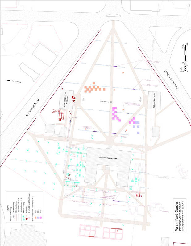 Figure 7. Wren Yard Garden, Previous Archaeology, All Explorations Prior to 2005
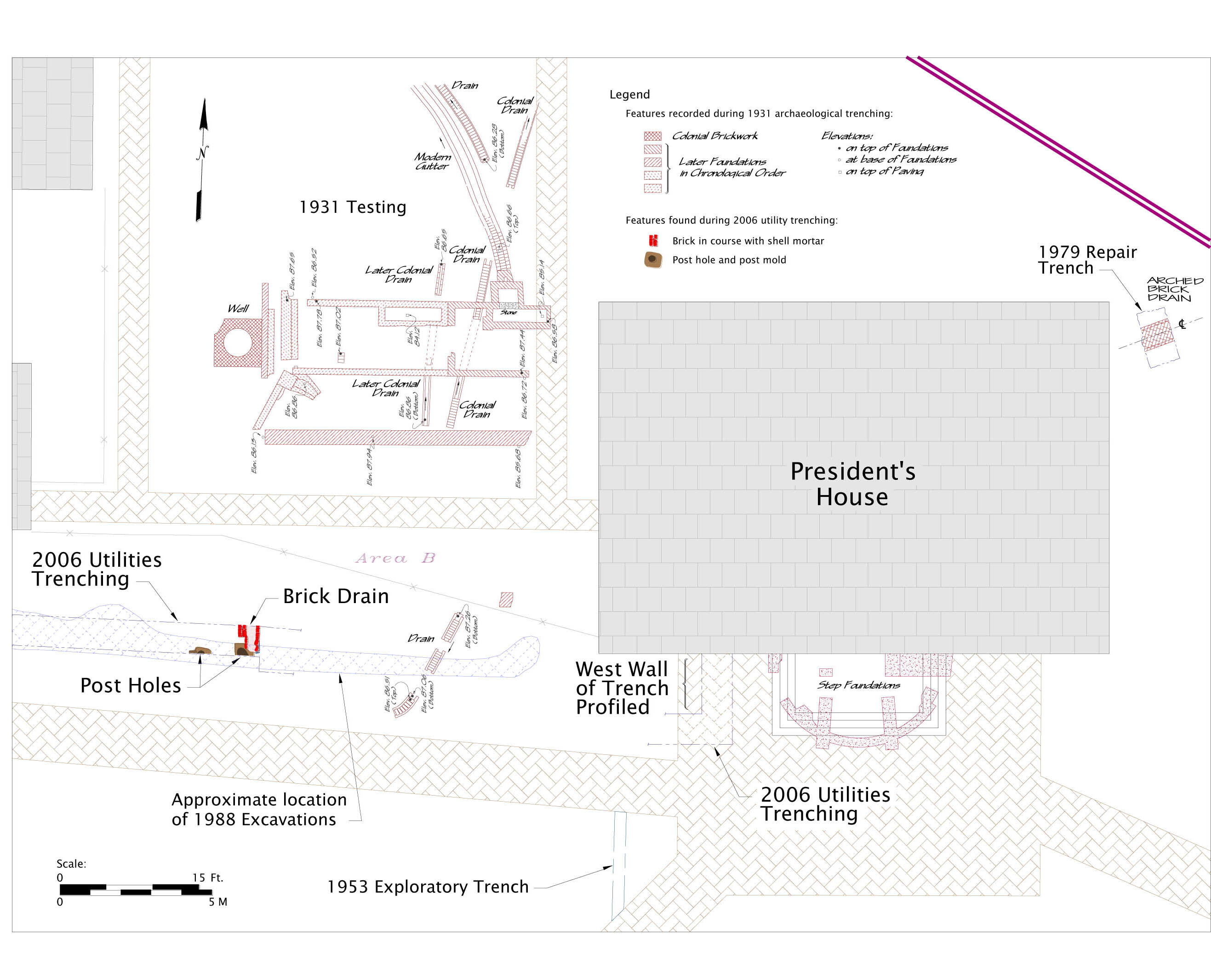 Figure 8. Detail of Previous Archaeological findings in the region of the President's House.
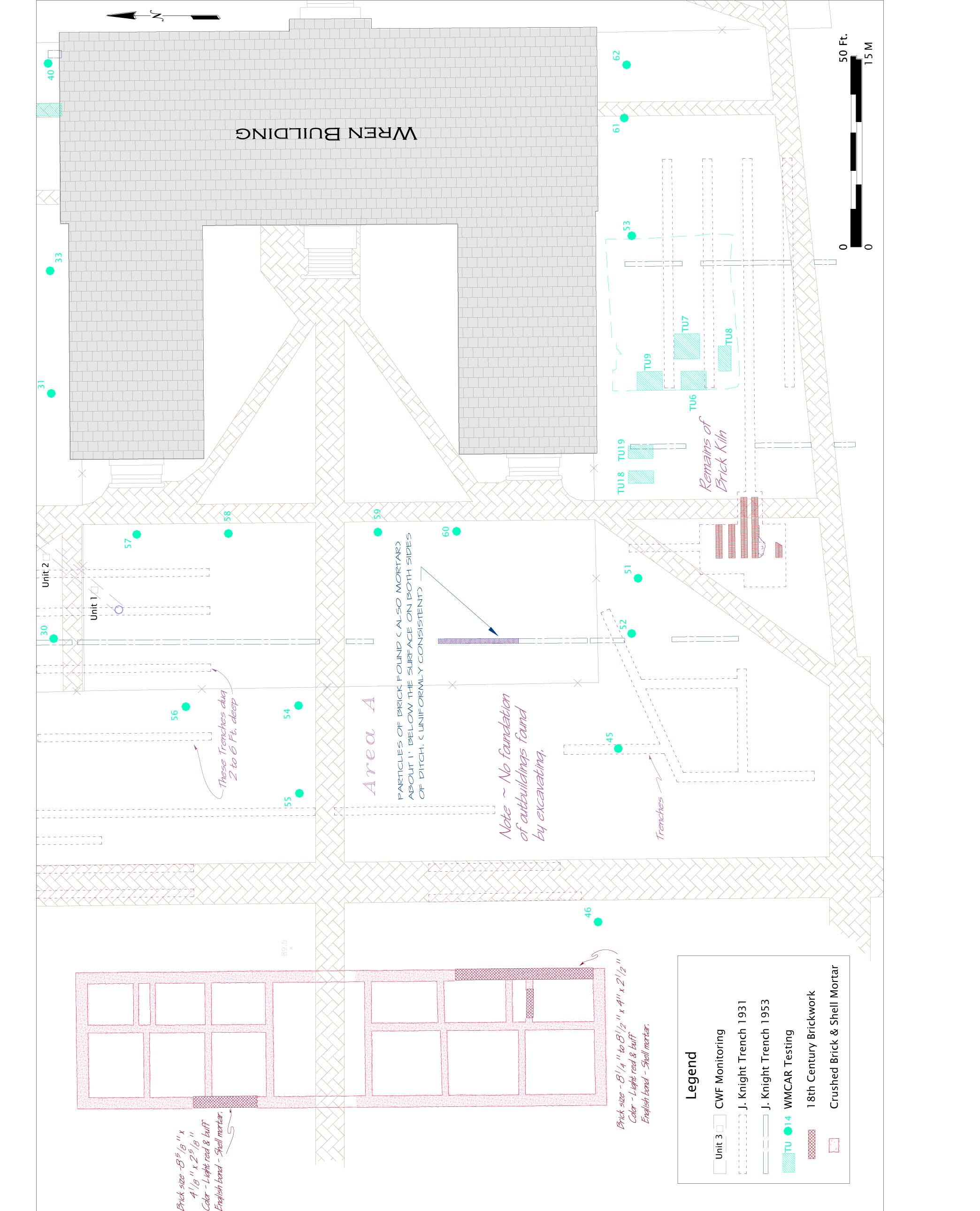 Figure 9. Detail of Previous Archaeology to the West and South of the Wren Building
Chapter 4
Field and Laboratory Procedures
A grid was established just south of the President's House for the summer 2005 block excavation. A permanent datum point ("Station 1"), was selected. This was the southwest corner of the storm drain grate immediately in front of the President's House, a feature unlikely to be altered in the near future. This point was given the arbitrary grid coordinate point of 500 North/500 East, to eliminate the untidy practice of needing negative grid numbers depending on how the excavation would eventually expand.
The excavation block was designed as a "checkerboard" pattern of 2m x 2m units. While one-meter square units afford better spatial control over artifacts and sampling, and are commonly used on domestic sites, such smaller units were impractical for the large garden features expected (cf. Yentsch and Kratzer 1994). It was hoped the larger sized excavation units would provide a better understanding of any features in the subsoil. The checkerboard pattern allows not only a greater physical area to be examined for any features that may connect through the unexcavated portions of the "checkerboard", but at the same time preserves half of the overall excavation block area as untouched, in-situ deposit for any future research.
The block was primarily intended to view a north-south path, and also expanded slightly east and west. The rationale for the excavation block design was to first get a linear transect across the yard between the President's House and the central walkway. All depictions of the formal garden show bilateral symmetry between the north and south halves of the yard. If any evidence for the colonial garden was found in the northern portion of the yard, there would presumably be a mirror image of the same features in the unexcavated south half of the yard, assuming the disturbance and post-depositional modifications of the yard were similar in both halves. Therefore, the north-south excavation transect was not planned to cross the central walkway, but rather expand with units east and west of the central axis.
All contexts found within a 2 by 2-meter unit would receive a discrete number. Features such as post holes, that require unique numbers for their act of creation would receive "cut" numbers. The Harris Matrix system of stratigraphic control was used to "phase" the various features and strata into their respective temporal contexts. Each context would require the completion of a Context Record Sheet, and example of which is shown in Figure 10. The paper record was entered into The Museum System database, and then stored Page 34 in the Documentation Room at the Archaeological Collections Building (ACB) for safe-keeping.
Contexts and features deemed significant were drawn to scale using standard 10 by 10 to the centimeter metric graph paper, and a drawing frame. All elevations and some features and interfaces between strata would be recorded using the total station and data logger. Both forms of data collection are brought in to AutoCad design software to create the site's graphic record.
Artifacts recovered from each context were bagged in plastic zipper bags upon which were written the unique context number, grid coordinates, description, date, and initials of the excavator and, if appropriate, screener. When a context was completed, the artifact bag received an "F" (finished) mark and was transferred to the ACB for processing and curation.
Sampling and Excavation Procedures
Each two-meter square was excavated as a single unit, with no attempt to maintain general spatial control over the artifacts from layers other than the two-meter grid coordinates. Features were all mapped precisely to the grid using a laser theodolite/total station.
Excavation proceeded stratigraphically, using "natural" visual and textural changes in deposit composition to indicate a context change as opposed to arbitrary levels of a given thickness (e.g., 10 centimeter levels). Closing elevations of each stratigraphic level were taken with the transit to permit accurate 3-D mapping of the layers.
Features were also excavated stratigraphically, each feature being assigned a "cut" and "fill" number in accordance with the Harris Matrix system of recording (Harris, 1979). Each context was assigned a number in accordance with Colonial Williamsburg's recording system, consisting of a block/area designation, plus an individual context number. "16GA-00001" therefore consists of Block 16 (the historic college campus on CWF's base map), excavation area GA (the garden excavation project), and a sequential context number. Artifacts from each context are later catalogued by a two-letter extension indicating an individual artifact from a specified context "16GA- 00001-AA" is then the first coded artifact from context 16GA-00001 (a creamware fragment, in this case, from the topsoil of Test Unit 1).
Upon completed excavation of each unit, at least one profile drawing was made, further documenting the stratigraphic interfaces and the vertical composition of each unit. For features, both plan and profile drawings were Page 35 made prior to and during excavation. Features were generally bisected and profiled, followed by the excavation of the remaining portion of the feature.
Laboratory Methods
Material produced by archaeological excavation consists of several different types. Artifacts are generally either ceramic, glass, metal, or on rare occasions, organic. Faunal material is animal bone or shellfish shell, and environmental material is generally archaeobotanical in nature. All of these materials were recovered from sites and are remaindered to the ACB laboratory. Artifacts are cleaned and sorted into material type and then catalogued into a database program, currently The Museum System (TMS). Artifacts requiring conservation are sent to the Collections Building on the Bruton Heights Campus for conservation and stabilization. Contexts deemed significant by the site archaeologist will be retained for analysis and crossmending.
Faunal material (bone) was removed from the artifact lab after cleaning and sent to the faunal/environmental lab for identification and analysis. Botanical materials such as phytoliths and pollen are retained in the faunal/environmental lab for later analysis by outside consultants. Large (5- 10 liter) bags of soil collected from certain contexts by the archaeologist for the express purpose of flotation will be processed by the environmental lab using a Flote-Tech flotation machine. The "heavy" fractions were picked for seeds, small bones, and tiny artifacts, and a subset of the light fractions were analyzed as part of the student projects undertaken as part of this project.
Page 36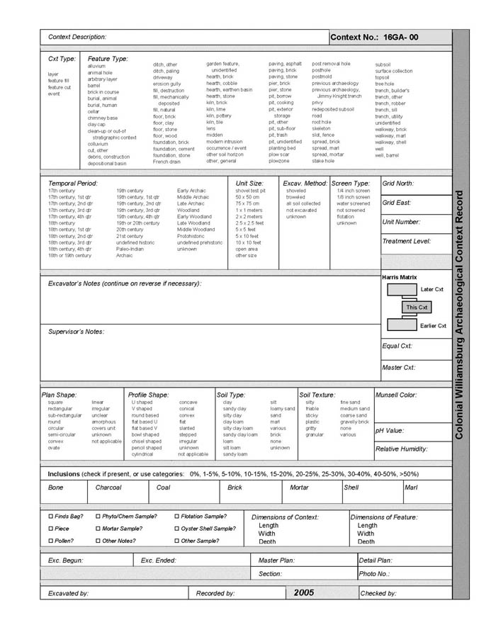 Figure 10. Context Record Sheet — CWF
Chapter 5
Excavation Description and Results
The archaeological work in the Wren Yard took place over several years and included geophysical testing, two exploratory test unit projects in 2005, three block excavations in 2005 through 2007, and additional testing in 2007 in order to explore what was believed to be a garden gate. This work is discussed below:
2004-2005 Testing Strategies2
Geophysical Survey
 Figure 11. Composite Geophysical Drawing
In September of 2004, geophysicist Bruce Bevan conducted a non-invasive survey of the College Yard using ground penetrating radar and conductivity instruments (Appendix 3). This assessment was intended to determine locations of potential anomalies that might indicate relict garden features or potential fruitful areas for archaeological excavation. Bevan's report noted several unusual anomalies, including indications that the central east-west walkway of the College yard was likely wider than its current configuration. Also, radar echoes indicated some type of flat, prepared surface approximately 20 meters north of Brafferton Hall, at approximately 40 centimeters below the surface. During the 2006 field season, a one-by-one meter excavation square (458N/503E) was placed over this anomaly but no unusual surface or deposit was found.
Overall, the geophysical evidence did not characterize any regular geometric patterning of anomalies that would be consistent with the garden layout as depicted on the Bodleian plate, or any of the other historic descriptions or depictions. Furthermore, Bevan notes that the survey also failed to distinguish known archaeological trenching in the yard from the James Knight excavations in the 1930s and 1950s. This suggests that the geophysical methods may be too limited in resolution to find discrete locations of soil disturbance such as garden beds, given the possibility that more permanent garden architecture in the yard such as borders or walkways were removed or heavily disturbed. However, one anomaly located by Bevan seems to be consistent with the Civil War era earthwork ditch that was identified in 2006 (see discussion in 2006 excavation season section)
Test Units
 Figure 12. Test Unit and 2005 Block Unit locations
Three one meter by one meter test units were excavated in the College Yard in the spring of 2005. Following on the geophysical survey, the test units were excavated in an attempt to characterize the stratigraphy of the yard, obtain preliminary soil samples, and assess potential locations for the planned block excavation during the summer field school season. The testing locations were spaced widely across the yard, one close to the Wren Building in the northwestern portion of the yard (Test Unit 1), another in the southeastern area of the yard (Test Unit 2), and a third immediately south of the central walkway near the center of the yard (Test Unit 3). Students from Anthropology 150W, Approaches to Ethnobotany (Spring 2005), anthropology graduate student Nadejda Coonan, and Colonial Williamsburg Department of Archaeological Research volunteers assisted with the testing. Excavation methods were consistent with general practice of Colonial Williamsburg's standard procedures, including excavation in stratigraphic (rather than arbitrary) levels, ¼-inch screening of all deposits for artifacts, and metric standard measurements.
Test Unit 1
Test Unit (TU) 1 was the first indication of the complexity of the college yard. Amusingly, the first excavated topsoil context in search of clues regarding the structure and content of the colonial formal gardens yielded an (obviously modern) plastic gardening tag fragment clearly marked with the word "JUNIPER" (16GA-00001-AR). The remaining layers of TU 1 provided a more forthright sense of the challenges to come with the Wren excavations.
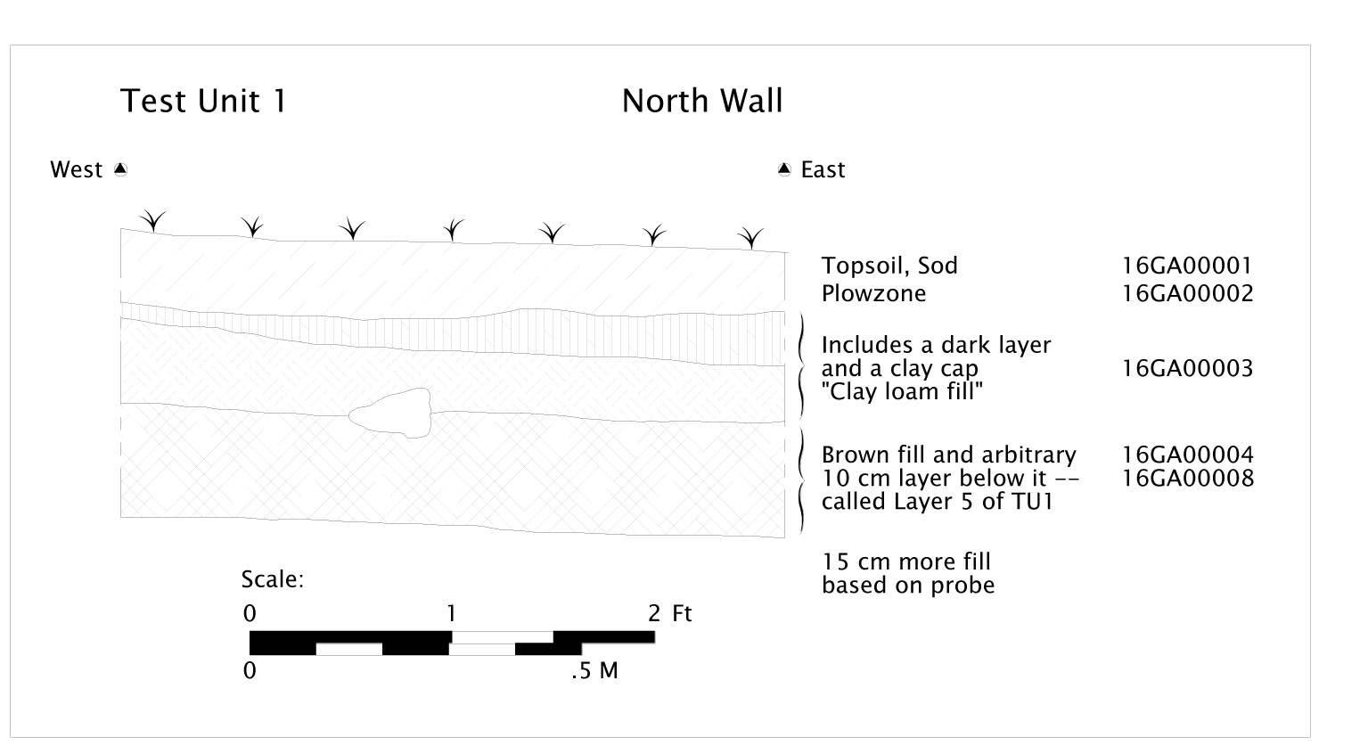 Figure 13. Test Unit 1 — North sidewall
TU 1 could not be completely excavated to the subsoil level due to logistical constraints of needing to excavate and backfill the units the same day. Nonetheless, TU 1 revealed several layers of discrete fills beneath the topsoil context.
A dark layer immediately below the topsoil terminated in a thin clay cap, beneath which a loamy layer dense with artifacts appeared.
The artifacts in the fills (particularly 16GA-00004 and 16GA-00008, below the modern surface) were rich with primarily architectural debris (window glass, nails, brick, roofing slate, lime mortar, plaster) as well as domestic artifacts. Terminus Post Quem (TPQ) dates from the artifacts place the excavated deposits to no earlier than the first quarter of the nineteenth century. Because many, but not all, of the artifacts appear to have been burned, much of TU 1 may likely relate to re-deposited materials from the various destruction, rebuilding and restoration episodes of the Wren Building itself (Duell, 1932).
Approximately 45 centimeters of artifact-rich deposit were excavated in TU 1. Because daylight was being lost, the decision was made to simply use a Page 41 soil probe to determine the extent of remaining cultural deposit before subsoil was reached. The probe showed that at least another 15 centimeters of cultural deposit remained.
Test Unit 2
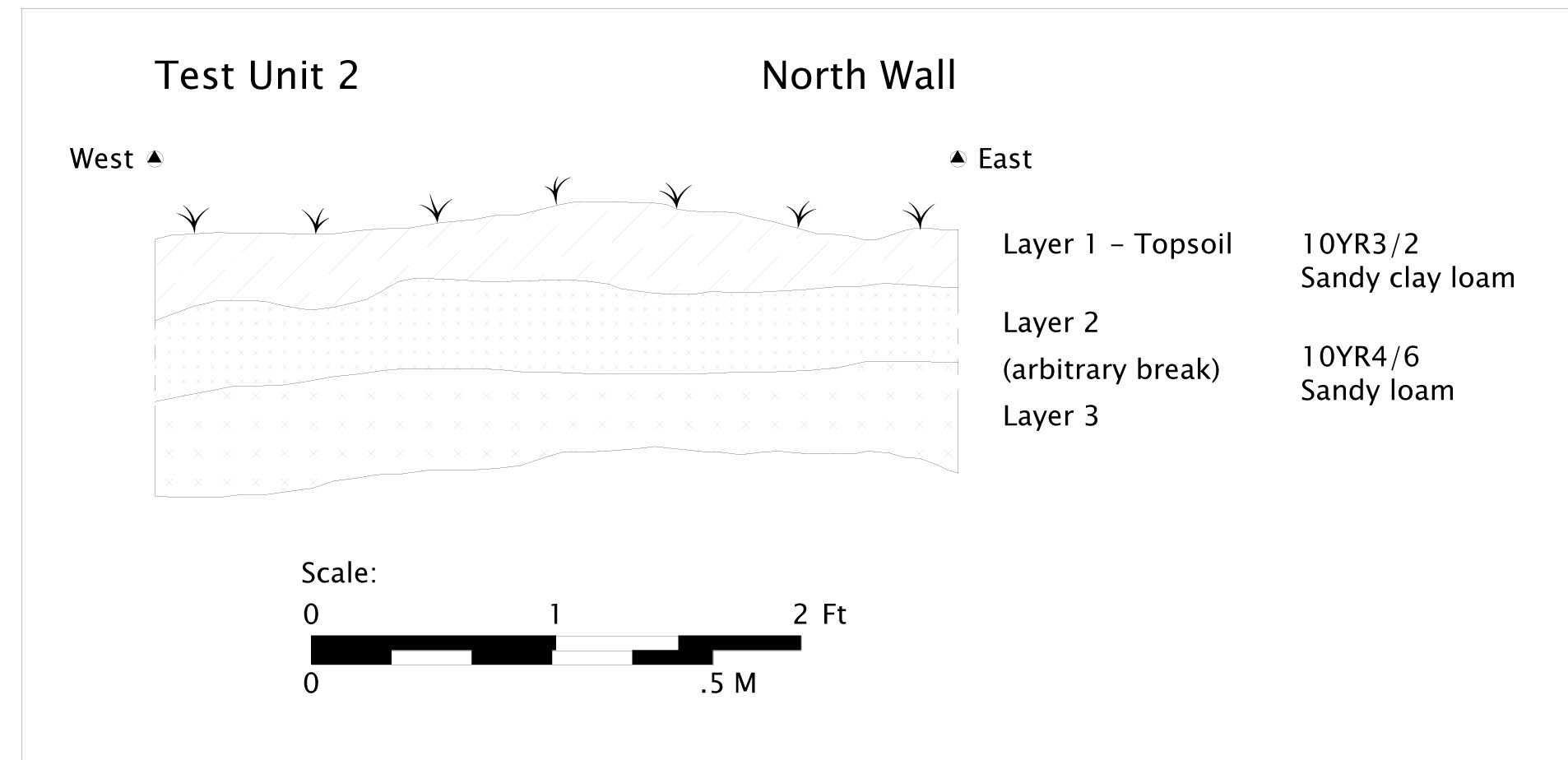 Figure 14. Test Unit 2 — North Sidewall
TU 2, however, in the southeast corner of the yard, appeared to be relatively straightforward and more typical of minimally altered landscapes. The stratigraphy seen in TU 2 indicated natural soil profile development of an A horizon atop a sandy loam B horizon/archaeological deposit that included a very scant amount of artifacts including small fragments of window and bottle glass, metal fragments (including lead casting waste) and a possible buckle fragment. A single piece of creamware ceramic produced a TPQ date of no earlier than 1762 for TU 2.
Upon review of the later evidence, however, it is unclear if TU 2 reached the natural base of excavation to sterile subsoil, or whether the very thick layer of re-deposited clay present throughout the eastern portion of the Wren yard was misidentified in the field in this initial testing as the natural subsoil.
Test Unit 3
Test Unit 3 was placed immediately south of the central east-west walkway in the approximate center of the college yard. The unit was placed here in part to "ground-truth" or physically examine the expanded walkway seen by Bevan's geophysical analysis.
Page 42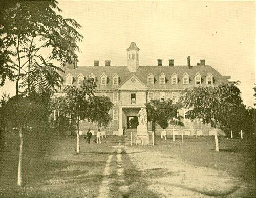 Figure 15. College Building c. 1856 (CWF)
Less than 10 centimeters below the surface a modest layer of crushed shell was apparent in TU 3. Stratigraphically, this appears to be comparatively recent, and the presence of aluminum foil generated a TPQ date of no earlier than 1947 for this surface. The earliest known photograph of the Wren yard, dated 1856, shows a well-trodden but not bricked walkway leading to the original statue of Lord Botetourt and presumably westward toward the Wren Building. It is unclear from the photograph whether crushed shell or marl would have been a component of the nineteenth-century walkway. Other early twentieth-century photographs show somewhat different layouts for walkways than are presently seen in the Wren yard.
Below the shell deposit was again found the clay fill or cap layer now known to extend through most of the eastern half of the Wren yard. Below the cap was a rich loam layer again replete with artifacts, primarily architectural (shell plaster, brick, shell, slate roofing tiles) but also bottle glass, a bone button fragment, and an "Indian head" type U.S. one cent piece providing a clear TPQ date of 1903 for the lower excavated layer of TU 3.
Page 43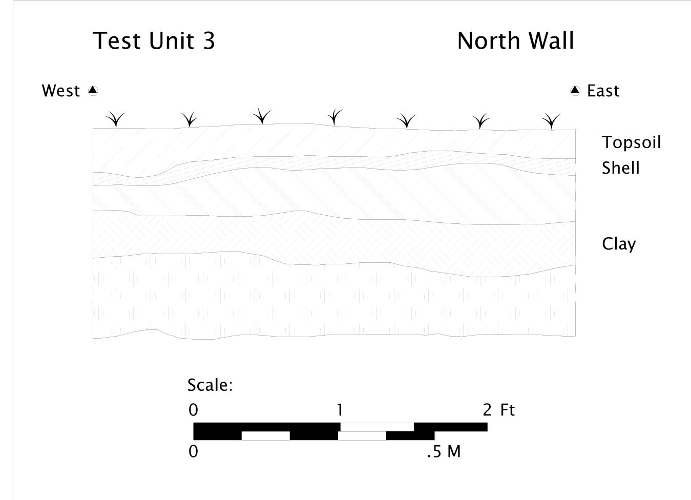 Figure 16. Test Unit 3 - North Sidewall
As with TU 1, the unit could not be completely excavated due to a combination of inclement weather and the need to backfill the test unit the same day it was excavated. Overall the stratigraphy of TU 3 seems to accord best with that seen in the general block excavation.
2005 Excavation Block
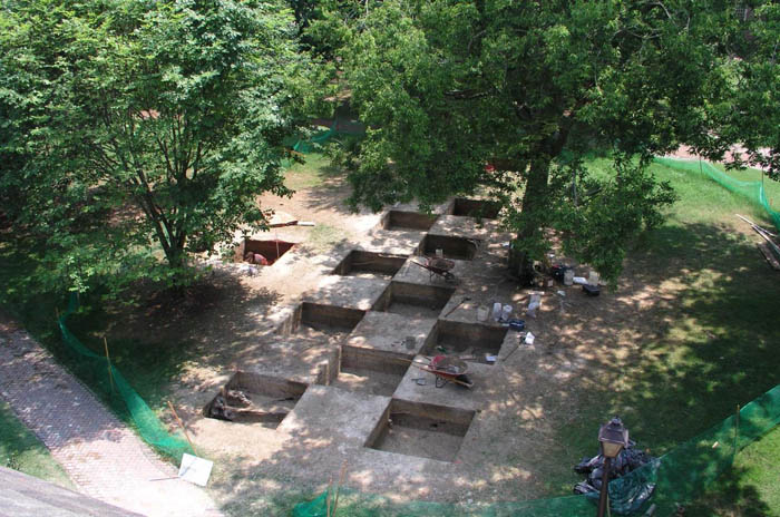 Figure 17. Completed 2005 Excavation Block (CWF)
Methodology and Rationale for Location
Following the geophysical survey and the spring 2005 testing, it was decided that the best evidence of any relict garden features would likely be in the eastern portion of the College yard. Based on TU 1, as well as examining the distribution of known modern utilities, it appeared that the western portion of the yard, near the Wren building would be more extensively disturbed. Moreover, the archaeological evidence seen in TU 1, and presumably elsewhere in the western half of the yard, was more related to the Wren building itself, its destruction episodes and modification, as opposed to the formal garden landscape. In all probability, the traces of destruction and modification of the Wren building would obscure rather than elucidate evidence of gardening beds and parterres being sought.
A grid was established just south of the President's House for the summer 2005 block excavation. A permanent datum point ("Station 1"), was selected. This is the southwest corner of the storm drain grate immediately in front of the President's House, a feature unlikely to be altered in the near future. This point was given the arbitrary grid coordinate point of 500 Page 45 North/500 East, to eliminate the untidy practice of needing negative grid numbers depending on how the excavation would eventually expand.
The block was primarily intended to view a north-south path, and also expanded slightly east and west. The rationale for the excavation block design was to first get a linear transect across the yard between the President's House and the central walkway. All depictions of the formal garden show bilateral symmetry between the north and south halves of the yard. If any evidence for the colonial garden was found in the northern portion of the yard, there would presumably be a mirror image of the same features in the unexcavated south half of the yard, assuming the disturbance and post-depositional modifications of the yard were similar in both halves. Therefore, the north-south excavation transect was not planned to cross the central walkway, but rather expand with units east and west of the central axis.
Sampling and Excavation Procedures — 2005
Each two-meter square was excavated as a single unit, with no attempt to maintain general spatial control over the artifacts from layers other than the two-meter grid coordinates. Features were all mapped precisely to the grid using a laser theodolite/total station.
All deposits from the first half of the excavation season were screened through ¼- inch mesh. All artifacts aside from brick and oyster shell were saved and catalogued, with samples of brick and oyster retained from deposits overwhelmed by these artifact types. Once it had been established that the layers above and including the "orange clay fill" (see stratigraphic discussion below) were clearly twentieth-century, during the second half of the excavation season, those layers were no longer screened in the expansion units, resulting in a fifty-percent screened sample of the upper layers of fill. Deposits below the clay cap were all screened for all units.
Flotation samples were also taken for every unit and layer below the clay cap. A standardized 35 liter sample was taken from layers. Experience with regional samples at CWF's Department of Archaeological Research environmental archaeology labs indicates that a 35 liter sample is a good volumetric compromise between the generally macrobotanical-poor deposits in the Tidewater region and a manageable volume of soil to transport and process efficiently. Feature soils were either floated in their entirety where feasible or fifty-percent sampled in the case of excessively large features such as 16GA- 00155/00156. Flotation sampling is a high-resolution approach to deposits, recovering not only plant remains, but also all artifacts greater than 2mm in the heavy fraction component. These samples can serve as a cross-check against the data from field screening for artifact categories such as microfaunal Page 46 remains and other small materials (straight pins, beads) that may not be consistently recovered in hardware cloth screens.
Furthermore, additional small-volume analytical samples were taken from each sub-clay cap layer, and also from each feature. These samples are commonly referred to as "phyto/chems" as they generally are used for phytolith or soil chemistry analysis, although they also serve as an archive of the matrix of each deposit, that which is destroyed by the excavation process, and may also be used for additional types of characterization analysis.
Twentieth-Century Features
Tile and Brick Drains
The most commonly encountered and time-consuming twentieth century features to excavate were terra cotta tile drains. Three separate segments on different orientations were uncovered in the excavation block.
These features have commonly been encountered during excavations in Williamsburg's historic area and date to the 1930s era restoration of the town. They appear to have been an unsuccessful experiment with an inexpensive type of drain. Each "D" shaped tile is simply placed in the trench abutting another tile; no joining compound is placed between the individual tiles. On either side of the drain tiles are placed brick fragments, likely pulled from the restoration projects as the buildings were renovated. In each case, these tiles were found filled in with silt. They likely became clogged quite soon after their installation through rainwater percolation washing silt into the drains.
Two of the drain lines were of this type of construction, one oriented slightly off east-west, and another on northwest-southeast orientation. The east-west line was found in unit 498/508 and 496/510, while the northwest-southeast line extends almost directly through the center of 484/510, 486/512, and 490/516. This drain segment also had associated evidence of the trench excavation 'heaped" alongside the cut for the drain, in the form of a brick crumb trampled area along the northwest side of the drain cut, especially obvious in 486N/512E and 484N/510E (contexts 16GA-00090 and 16GA- 00120).
One drain segment, found in 484N/510E and oriented east-west, appears to be more recent than the others, revealing no brick "supports", and is constructed of a higher-quality, more burnished hexagonal terra-cotta tile as opposed to the "D"-shaped tiles. It cuts through the path of the long northwest-southeast oriented segment that extends through 484/510, 486/512, and 490/516.
Page 47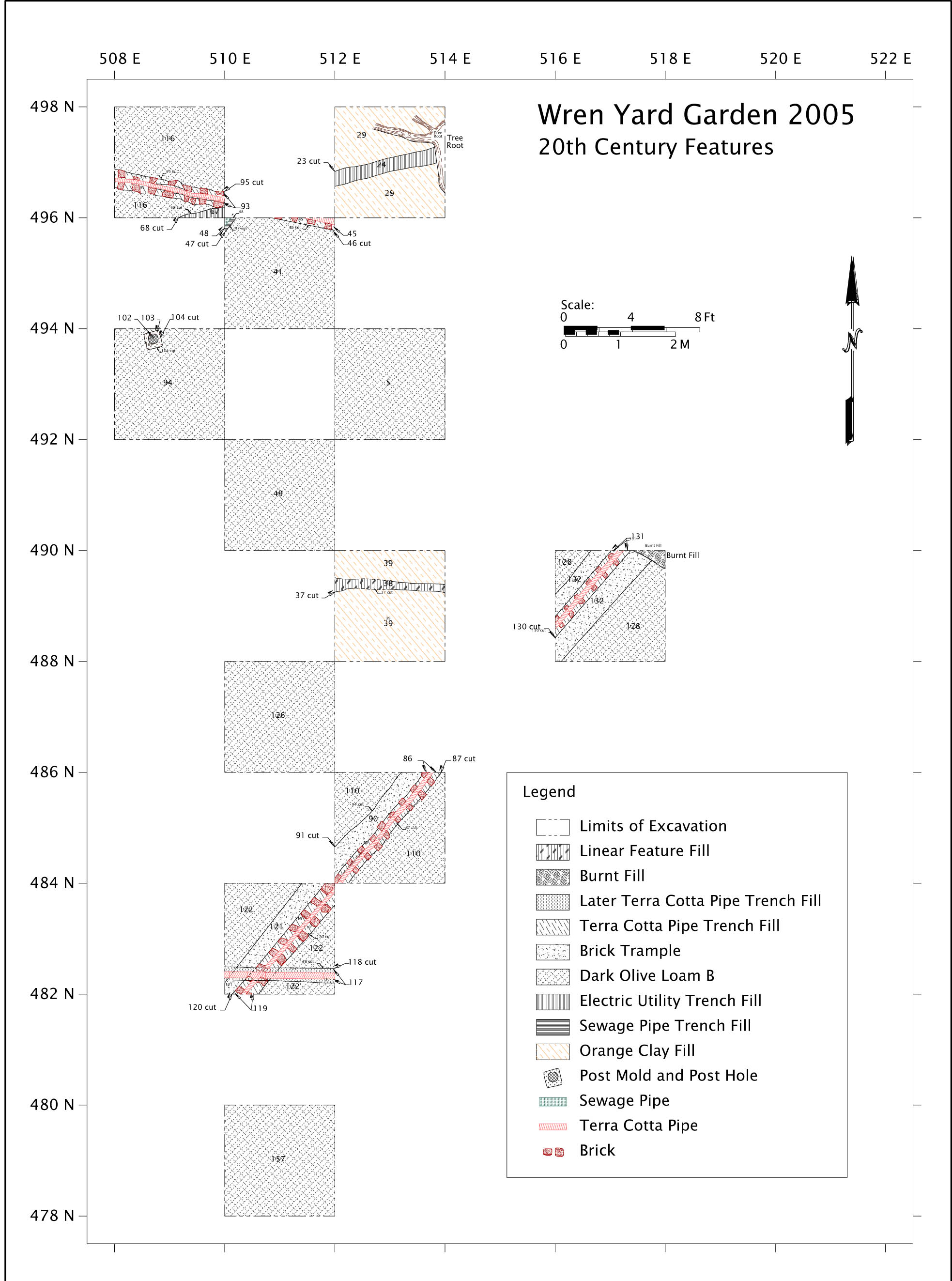 Figure 18. 2005 Excavation Block — 20th-Century Features
The historic campus has a long history of drainage problems and creative solutions for alleviation of the same. Both colonial and restoration-period drain segments have appeared frequently in recent excavations (Archer, 2006) as well as James M. Knight's excavations of the President's house property in the 1930s.
The tile drains are immediately capped by the orange clay fill layer. While cuts are discernible, indicating the drains were dug in, and not just placed on the surface and buried by the fill, it is clear they were installed contemporaneously with the landscaping/grading episode that presumably completed the restoration work being done to the President's House and/or the Wren Building by the Williamsburg Holding Corporation (later known as the Colonial Williamsburg Foundation).
Lead-Wrapped Electric Wire
One unwelcome modern feature appears to be a potentially still-active electrical wire that is part of the streetlamp network in the College yard. This cable runs directly into a large, partially decayed tree stump in 498N/512E. This tree (several candidates for the stump's former above-ground component can be seen in historic photos) may have supported lighting fixtures as are seen in other portions of the yard today. The presence of a potential live wire, which was left supported by a soil pedestal and the stump disturbance in 498N/512E precluded much visibility of the subsoil/any potential colonial features in this unit. A small portion of 498N/508E is also intersected by the wire, in the south wall of the excavation.
Burnt Fill Deposit
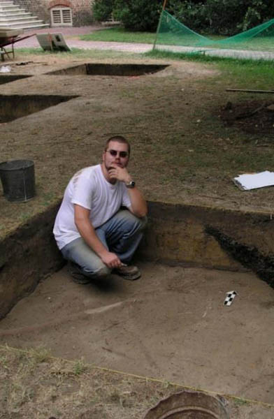 Figure 19. Student Brian Davis and Burnt Fill Deposit (CWF)
The northeast corner of Unit 490N/516E revealed a heavily burned, deeply dug pit containing a great deal of cinder/clinker, charcoal and ash. Only a portion of the pit was revealed and interpreted as a later twentieth century event, perhaps the remnants of a campus bonfire. The feature begins immediately below the topsoil level and clearly cuts through the orange clay fill layer established to date from the 1930s, so it postdates the restoration period. This feature was not extensively documented.
Page 49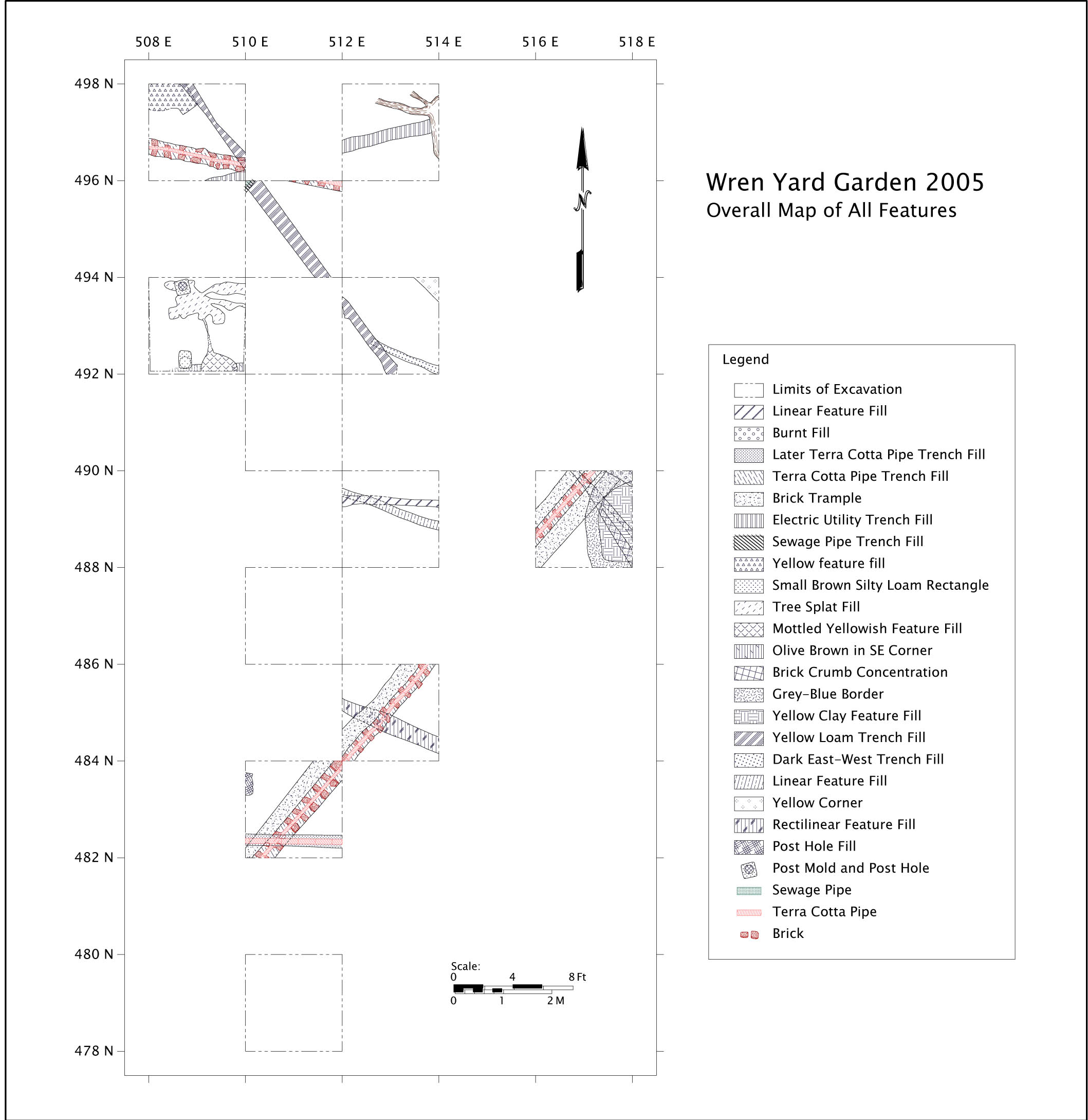 Figure 20. Summary map of the 2005 Excavation Block showing all features
Stratigraphy of the Excavation Block
Six major layers of overburden fill were distinguished in the block excavations. These are primarily twentieth-century fill episodes, although they contain a great number of redeposited colonial artifacts that have been displaced from Page 50 their original context. The base of the excavation block is much less clear in terms of its temporal association. At present, it is not possible to determine whether the two very thin, and sometimes indistinguishable layers at the base of the excavation represent a remnant of a colonial deposit, or if all such deposit has been destroyed. These six deposits were largely consistent from unit-to-unit across the excavation block, with minor variations noted below.
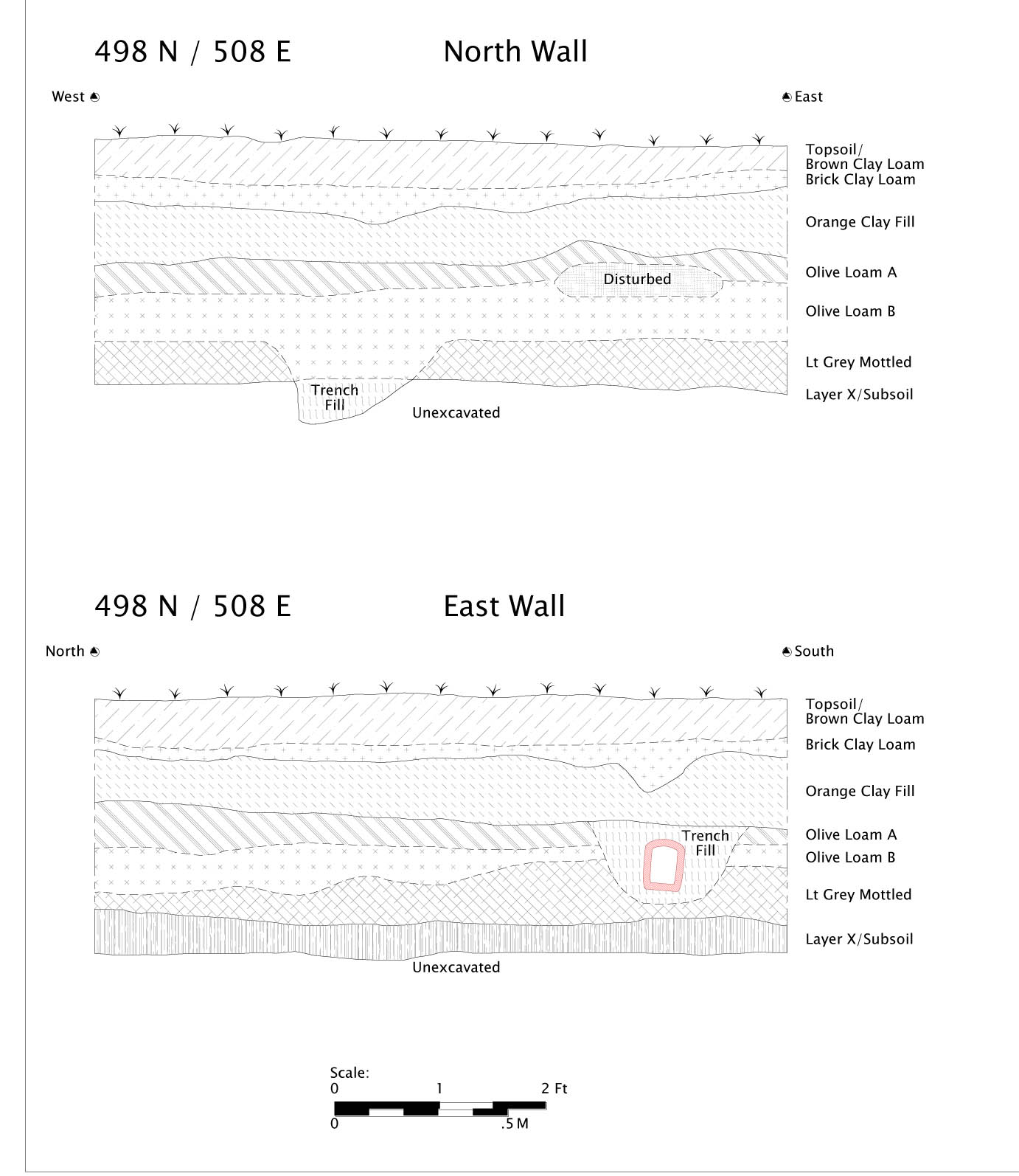 Figure 21. Profiles of Unit 498N/508E
Topsoil Layer
The topsoil layer was simply established as the AO horizon, where the sod was removed down to an initial compaction and lightening of the soil profile.
Brown Clay Loam
The "Brown Clay Loam" layer is essentially an incipient AB soil horizon developing, with evidence of leaching and is slightly more compact than the Page 51 topsoil. Although excavated separately stratigraphically, it is essentially an extension of the topsoil, not a separately deposited layer, and can be analytically combined with the topsoil layer as modern. This layer extends to approximately 10-12 centimeters below the surface across the excavation.
Brick Clay Loam
The "Brick Clay Loam" layer seems to be the most recently imported fill to the Wren yard; this is the deposit the natural surface is weathering to form the topsoil. It contains redeposited artifacts, notably brick inclusions that distinguish it from the "Brown Clay Loam" above it. The texture of the Brick Clay Loam is otherwise similar to Brown Clay Loam although it is somewhat more compact. The Brick Clay Loam layer varies from 6-10 centimeters in thickness across the site.
Orange Clay Fill/Orange Clay Fill II
The "Orange Clay Fill" layer is a compact clay fill varying from 20 to 30 centimeters in thickness. The clay appears to be a redeposited subsoil, likely taken from an unknown local borrow source. Artifacts are present throughout the fill, spanning the colonial period through at least 1930, based on a camera flash bulb fragment found in the fill. This accords well with the assumption this fill was imported as the 'capstone' for subsurface work of the restoration work done by the Williamsburg Holding Company to the historic buildings. One unit, 490N/512E contains a designation of "Orange Clay Fill II", based on a feature (Context 16GA-00037/16GA-00038) found within the layer. It now appears that the feature was simply a stain from a rotted plank incorporated within the clay fill. Orange Clay Fill II simply designates the same natural stratigraphic layer, but below this ephemeral feature. No other unit contains the Orange Clay Fill II layer designation.
Dark Olive Loam/Dark Olive Loam B
"Dark Olive Loam" appears to represent the late nineteenth/early twentieth Century ground surface that was likely extensively disturbed by restoration activities. A "Dark Olive Loam B" was defined, mostly because some remnant soil development could be seen differentiating the upper few centimeters of the deposit from the remainder. A very sharp contact differentiates the Dark Olive Loam from the capping Orange Clay Fill. Analytically, however, both Dark Olive Loam and Dark Olive Loam B can be considered the same cultural deposit. The Dark Olive Loam is a more organic, and much less compact, deposit than the clay fill immediately above it. The restoration-era brick drains are all cut into this layer, but not through the clay fill above. Terminus Post Quem dates from the combined Dark Olive Loam place the deposit at no earlier than 1885. The layer is approximately the same thickness as the clay fill layer, averaging approximately 20 centimeters.
Light Gray Mottled Layer
The transition to the "Light Gray Mottled" layer is a markedly more diffuse contact than that between the Orange Clay Fill and the Dark Olive Loam strata. The Dark Olive Loam gradually gives way to a sandy loam fill; this Light Gray Mottled deposit is notably less dense in artifacts, and appears to have less organic content than the Dark Olive Loam levels.
"Layer X"
Layer X was given its mysterious designation, as it is something of a stratigraphic enigma. There is not a clear visual boundary between the lower Light Gray Mottled layer, "Layer X" and the subsoil; however, certain features (e.g., Linear Feature 1, discussed below) appear to be cut into lower Light Gray Mottled, and this level has to be removed further to expose the additional features (e.g., Linear Feature 2). Therefore, a stratigraphic division is logically apparent, but visually not detectable. "Layer X" was defined as necessary by excavating in comparison with depths of adjacent units, and fully exposing the subsoil as defined by the complete absence of cultural material, such as brick flecking, and a uniform, mottled subsoil appearance across the unit. A soil chemistry analysis by student Richard Williams (2005, see also soil chemistry results in Appendix 5) seems to confirm the "reality" of Layer X having a different composition from the Light Gray Mottled layer, as clearly different patterns of element distributions are present when comparing one to the other.
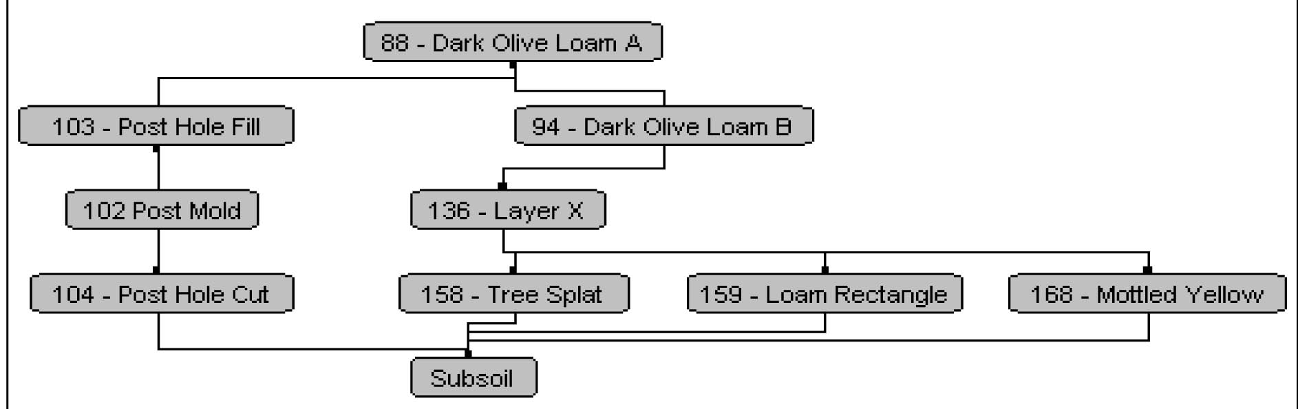 Figure 22. Harris Matrix — 2005 Block
Subsoil
The subsoil, or AC soil horizon, is somewhat unusual in the block excavation area. Its gray, mottled pattern and more loamy texture is atypical of the subsoil deposits found throughout Williamsburg, which is typically a pure yellow-orange clay. The subsoil was defined by an absence of cultural materials, and probes indicated that the subsoil continued indefinitely beyond Page 53 the depth of probing. The bluish gray mottled appearance, however, can indicate the past presence of standing water on the site (Limbrey, 1975). Several features were cut into this subsoil deposit, while others appear to interface with the Layer X.
Subsequent Interpretation of 2005 Stratigraphy
Upon completion of additional research and interpretation of subsequent field seasons, it is clear now that the puzzling layer beneath the orange clay fill represents a disturbed historic layer that is the product of the historic "spading up" of the Wren Yard during the 1930s restoration of the historic campus (Way, 2008, this volume Appendix 1). Although predominantly containing eighteenth-century artifacts, it yields a light presence of post-nineteenth-century materials, clearly dating it later than the Colonial/Antebellum era, but at the same time it appears to retain a modicum of horizontal integrity, unlike the plowzones present regionally in the Tidewater. It appears to have been disturbed by this single event of "turning up" the College Yard soil to a spade's depth across the yard, unfortunately damaging any integrity but at the same time not completely homogenizing the deposit. Features cut into subsoil, for example, would sometimes faintly appear in this layer during excavation. This spading event was capped by the orange clay fill. The "Light Gray Mottled" and "Layer X" levels are the interface with the subsoil where the "spading up" was not as severe — the spading likely did not reach a completely uniform depth across the yard, leaving patches of more and less intact deposit just above the subsoil. Feature edges (outside the 2005 block) were still generally clearly defined only in the subsoil cuts, however.
Ambiguous and Possible Colonial Features
Tree Plantings
Two features in the block excavations can be identified as deliberate plantings of trees. While neither is in any obvious alignment with the garden layout as depicted on the Bodleian plate or other depictions, they are the best evidence of formal landscaping revealed within the excavation block. There are subtle differences in the features that may indicate that they were not planted contemporaneously; each feature extended into the sidewall of an adjoining, unexcavated unit, but were excavated as a de facto "bisection" of the features. The paucity of artifacts in the features is both disappointing (in terms of securing a precise date for their planting), but also suggests a possible early date; considering the comparative density of artifacts in the later fills, it would be expected that if the trees were planted in the later eighteenth century or more recently, more artifacts would be redeposited into the planting holes.
Page 54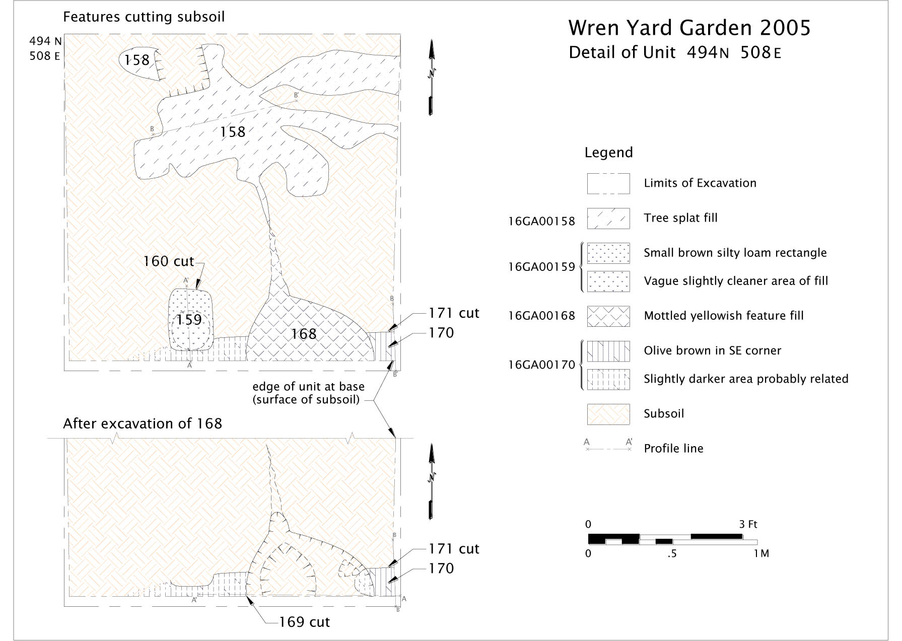 Figure 23. Detail Plan of Unit 494N/508E
The tree planting in 494N/508E (16GA-00169/16GA-00168) is abutted by a posthole (16GA-00159/16GA-00160). The two features may be contemporaneous, but there is no apparent cutting of one feature by the other. It is possible that the posthole, not large enough to be a structural post, was some type of support or a component of fencing for the planted tree. One freeblown glass wine bottle base fragment was the only artifact recovered from flotation of the entire excavated planting hole fill, providing a terminus post quem date of 1650 for the planting.
Tree "Splat" in 494N/508E
This shallow, amorphous feature (16GA-00158) appears to represent a burned/decayed root mass of a tree. No evidence for a planting hole itself appears to survive, suggesting either a natural, early tree in the yard predating the formalization of the landscape, or, alternatively a nineteenth/early twentieth-century tree that lasted only a short while and whose evidence for deliberate planting is obscured by the more recent fills. No artifacts were recovered from the feature fill.
Tree Planting in 490N/516E
In contrast, the planting hole in 490N/516E (16GA-00155/16GA-00156) is considerably larger and more substantial than that in 494N/508E. This planting hole extends much further around the root stain than the other planting feature, suggesting a different type of planting practice, or larger tree being planted. This planting hole also has what was characterized in the field as a "halo", or diffuse bluish color change in the soil surrounding the actual feature cut. This kind of pattern is associated with older features, presumably because the contents of the feature have been reaching a chemical equilibrium over time and altering the surrounding deposit. Field screening and flotation of over 77 liters of the feature fill, however, failed to produce any artifacts whatsoever, again suggesting a possible early date for this tree planting. Unfortunately, a heavy rainstorm late in the field season somewhat damaged and saturated the clay in the feature, making its precise excavation difficult and resulting photographs less than satisfactory.
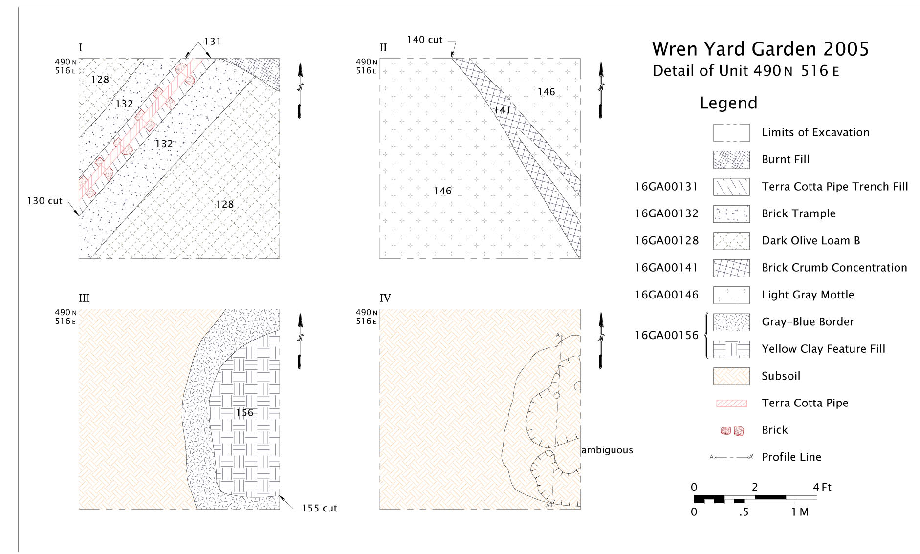 Figure 24. Detail Plan of Unit 490N/516E
Linear Features
A series of ambiguous linear subsoil stains comprise the majority of archaeological features found during the 2005 block excavation. Few of these features contained any datable artifacts, and their relationship, if any, to the colonial garden is unclear.
Linear Feature 1
The most extensively exposed linear feature extends through grid squares 498N/508E, 496N/510E and 494N/512E on a northwest-southeast orientation. Upon its initial exposure in the excavation, it was thought this feature was actually a line of subsoil (its yellow clay loam fill is similar to the most common subsoil pattern seen in the region), diagonally separating two "garden beds". The initial assumption was essentially a "negative image" of what we now know the feature to be, a linear ditch cut into "Layer X" and the subsoil. The feature is approximately 15-20 cm wide and extends beyond the excavated area in both directions. No datable artifacts were found in the fill, designated as "Yellow Loam Trench fill"; although glass and brick fragments were present.
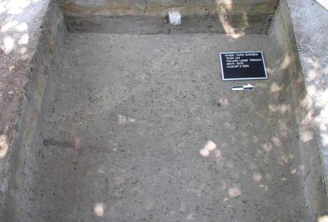 Figure 25. "Yellow Loam Trench", Linear Feature 1
Linear Feature 2
Linear Feature 2 was truncated by and therefore earlier than Linear Feature 1. It is 15cm wide, 3-6 centimeters deep, and has a U-shaped profile. The feature appears only upon the removal of "Layer X", whereas Linear Feature 1 appeared beneath the "Light Gray Mottled" layer. Inexplicably, the feature does not appear to continue west of Linear Feature 1. The dark (2.5Y 5/2) fill contained no artifacts whatsoever.
Linear Feature 3
Context 16GA-00055/16GA-00056, excavated in 490N/512E is a shallow (4.5 cm deep) trench cut into subsoil, with a flat-based "U" shaped profile. The feature has a north-northwest-east-southeast orientation. The feature contained one window glass fragment and several brick fragments; a clear terminus post quem date could not be generated from this evidence. The feature does not appear to extend into other excavated areas of the block excavation.
Linear Feature 4
Context 16GA-00123/16GA-00124, excavated in 486N/512E, runs roughly parallel to Linear Feature 3, although it appears to be unrelated. This feature is notably wider (38 cm), deeper (15cm) and has a V-shaped profile and contains differently colored and textured fill (2.5Y 5/3). Again, the artifacts recovered from this feature are unhelpful in providing a date; flotation of the feature produced indeterminate nail and brick fragments as well as a scrap iron fragment. Iron staining was noted in the fill during excavation.
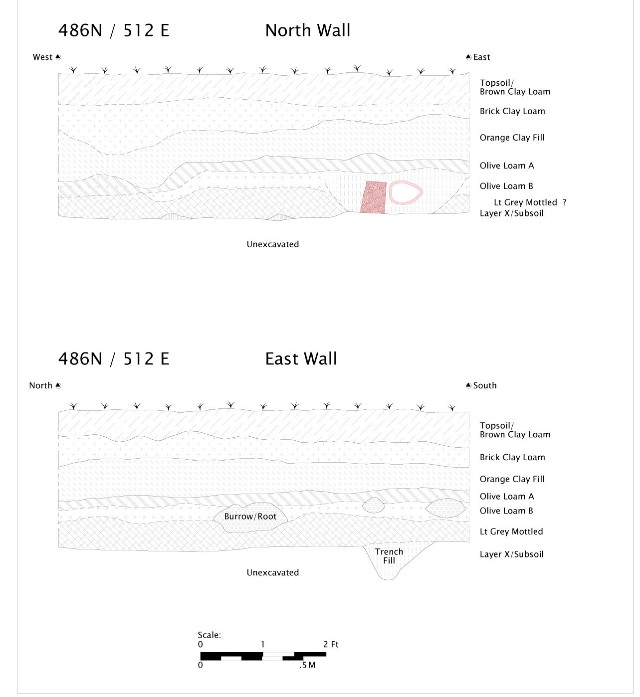 Figure 26. Profiles of Unit 486N/512E
Page 58
Postholes
In addition to the posthole adjacent to Tree Planting Hole 1, in 494N/508E, and the twentieth-century posthole in the same grid square, one additional posthole cut into subsoil was identified (see Figure 23). Context 16GA-00147/16GA-00148 was located in the northwest ¼ of grid square 484N/510E. Because the majority of the feature appeared to be beneath the adjacent, unexcavated square 484N/508E, the feature was not excavated. Based on the visible portion, however, the post was too small to represent a structure and is most likely an isolated post or fence component of indeterminate age.
Drainage feature/brick crumb concentration
Cutting the tree planting hole in 490N/516E is what appears to be a heavily decayed drainage feature, very likely associated with the unexcavated feature 16GA-00163, in 494N/512E. No intact brick (or earthenware tile) was found in association with this feature; it survives simply as a linear concentration of brick crumb. The feature dives sharply eastward into the unexcavated east wall of 490N/516E.
This feature is interpretively perplexing; if it is indeed a drainage feature, the sharp angle at which it dives eastward makes little functional sense; projecting the slope outward would quickly place the drain well below the street grade if the feature represented some attempt to transport water from the yard. The majority of this feature, whatever it may connect to, and any better-preserved components of it, remain unexcavated.
Artifacts
The overwhelming majority of artifacts recovered from the block excavation are clearly displaced from their original context, with artifacts from multiple time periods commingled in the fills. As such, they are of very limited interpretive value in understanding the structure of the formal garden in the East Yard. The fills are undoubtedly local, likely from elsewhere in Williamsburg and the college environs.
Both domestic and architectural materials are common in the fills, as well as brief glimpses of college and colonial life over the past three centuries. Cast lead bullets and shot, faunal remains, a wide variety of common domestic ceramics, coins, a rubber shoe heel, escutcheon plates and lock mechanisms, slate pencils, as well as a great deal of architectural debris all attest to the Page 59 wide variety of activities occurring in the immediate environs. Unfortunately, they are deprived of their original context as far as is discernible from the stratigraphic interpretations in the site.
Context 16GA-00122 contained a wine bottle seal commonly linked to Royal Governor Francis Nicholson, dating to the 1690-1710 period, as well as associated fragments of the bottle to which it was attached; clearly an artifact related to a critical player in the history of the College. However, the same context also contained fragments of pearlware, dating the deposit to no earlier than 1780. Nonetheless, there is a relatively straightforward pattern to the terminus post quem dates of the fills; the overlying fills that can be associated with the restoration period and afterward (Topsoil, Brown Clay Loam, Brick Clay Loam, Orange Clay Fill); all have post-1920s TPQ dates. With one possibly intrusive exception providing a 1920 TPQ, the Dark Olive Loam layers date to no earlier than 1885. However, the Light Gray Mottled and Layer X TPQ dates are 1775 and 1650, respectively.
This leaves the as yet unresolved conundrum of how "colonial" these lower strata truly are. While we can be reasonably certain the overlying layers are maintaining consistent TPQ dates with our current interpretation, the lower strata and the features cut into them are drastically less dense in terms of artifact content. Although we have no evidence that the lower strata are post-eighteenth century, the inference is made on far fewer artifacts, increasing the possibility of sampling error.
The features fare even more poorly in terms of artifact density. Many of the features, as discussed, have virtually no artifacts to enable dating, and those that do have artifacts largely contain materials for which dating is imprecise, such as brick.
Interpretation
As has been noted throughout, the preliminary interpretation of the excavations is uncertain, insofar as asserting definitive evidence for the colonial period garden(s) having extant archaeological traces. Features such as the tree plantings have aspects that are encouraging in terms of possible relict garden features (lack of intrusive artifacts in the planting holes), yet also confusing traits (the planting holes, as well as the linear features bear no obvious relation whatsoever to the illustration on the Bodleian plate or the other depictions).
Page 60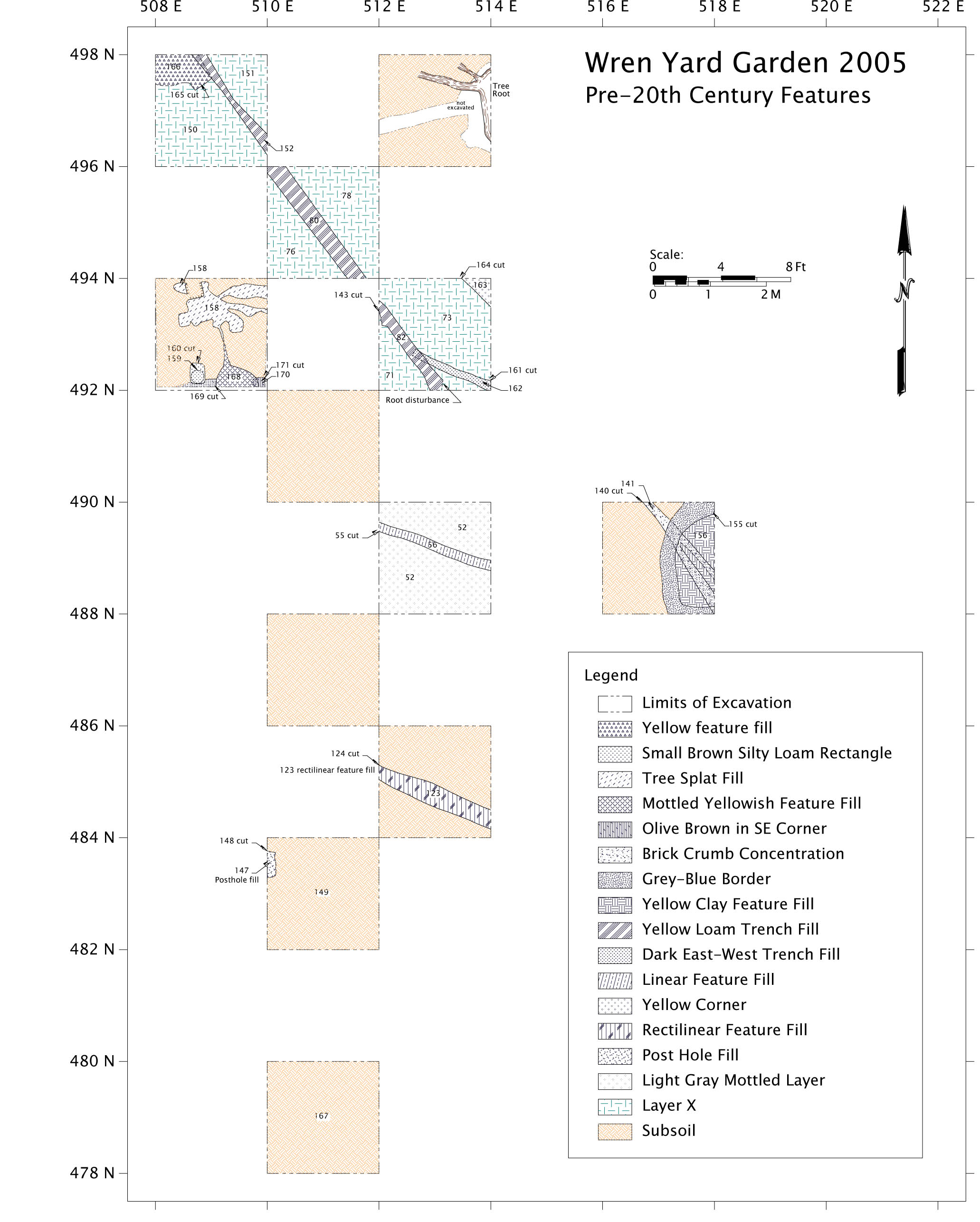 Figure 27. Overall of 2005 Block. Pre-20th-Century Features
One critical clue as to the in-filling processes occurring in the Wren Yard comes from an offhand remark in Prentice Duell's 1932 report on the Wren Building:
The grade of the building was raised on all sides and especially at the front by Governor Spotswood who appears to have taken charge of the rebuilding of the structure after the fire of 1705. The reason for raising the grade was unquestionably owing to the fact that water collected in front of the building and made the low entrance at times practically inaccessible; it is possible also that water actually flowed into the building. The poor drainage of this area gave all subsequent occupants of the college building, Brafferton Hall and the President's House, considerable annoyance. Spotswood raised the grade at the front of the building approximately three feet and in doing so was forced to raise the entrance of the building itself. He removed the whole central portion and built the pavilion with an entrance at the first floor level; a porch and steps were added outside of the building. A basement door was placed beneath the porch and within the basement a sewer was constructed which passed through the foundations of the rear pavilion, the erection of which was a part of the same operation. Any water that collected in front of the building or in its basement would thus have been carried away.
However, the raising of the grade around the Wren building caused the water to form two large ponds in front of Brafferton Hall and the President's House. The Botetourt statue apparently was above the water; probably the walk to the building had been raised by Spotswood.
Various attempts were made to drain these ponds throughout the subsequent history of the building, and only in recent years Dr. Chandler3 raised the grade of these areas about two feet.
Spotswood, in raising the grade of the building to such an extent, was confronted with the problem of redesigning the main entrance of the building, although his primary purpose in changing the building was a utilitarian rather than an aesthetic one. As a matter of fact, he took the design into serious account and unquestionably improved the appearance of the building; in doing so however, he completely changed its architectural character.
(Duell, 1932, emphasis and note added)
The topic of the "grade-raising" around the Wren Building has been a persistent, perplexing issue in terms of understanding the archaeological patterning of the yard. No 2005 excavation in any area of the yard, or previous archaeological testing, as far as can be discerned from the records, indicates a Page 62 consistent fill deposit three feet thick, or anywhere near such a thickness. It is possible, in fact, likely, that the grade raising has been obscured by the later restoration activities, yet how the grade was raised and where the fill originated has significant implications for understanding the preservation potential of the garden, as well as the patterning seen in the block excavation. If the eastern portion of the yard was mined for fill to move to the western portion of the yard around the Wren Building, this would explain why the President's House and Brafferton buildings drainage problems continued or worsened up through the first quarter of the twentieth century, when those low areas were in-filled. It would also accord well with the fill layer dates as well as the grayish, mottled subsoil patterning in the block excavation, which indicates standing water conditions at some point in the past.
Given this evidence, it appears likely that if "low spots" were worsened in the early eighteenth century, and deposits moved westward in the yard toward the Wren Building, there may be more potential for extant garden features to be sealed under imported deposits in the western portion of the yard as opposed to the area in front of the President's House, where the features encountered (if they do indeed relate to the colonial garden) may have been truncated by this activity.
Additional discussion with historian Martha McCartney has also centered on the historical circumstances surrounding the drafting of the Desandroüins map. The initial assumption was that at least two discrete formal layouts of the garden were designed, the one represented on the Bodleian plate, and a later eighteenth- century modification as apparently depicted on Desandroüins' map. However, Desandroüins created his map at an economic and functional low-point for the College; in the fall of 1781 it was no longer functioning as a college, but rather a hospital, and was intermittently sheltering Revolutionary War troops. As such, it seems unlikely any major formal landscaping or maintenance was occurring during this time. Indeed, different, later drafts of the Desandroüins map altogether omit the beds depicted in the east yard. It is possible Desandroüins was depicting not the formal layout of the east garden, but rather some kind of temporary alteration highly specific to the time in which the map was created, such as short-term subsistence gardens, animal pens, or encampments. Such an interpretation, though uncertain, would lend support to why the nearly contemporaneous Simcoe map depicts a garden structure much more in keeping with the Bodleian design. It is hoped that future research may shed more light on the "one garden design or two" question. Minimally, the results of the 2005 excavation indicate a single potential colonial surface rather than overlapping features cut into the subsoil.
Additional Testing, October 2005
As one component of class research by student Brian Davis, who also used Surfer to experimentally model layer patterns between excavated units, further excavation testing was done in an attempt to clarify some of the stratigraphic issues that remained unresolved by the block excavation. Two additional 1 meter by 1 meter test units were excavated in the Wren Yard in October of 2005. One was located in the south-central portion of the yard and another south of the central walkway but proximate to the Wren Building.
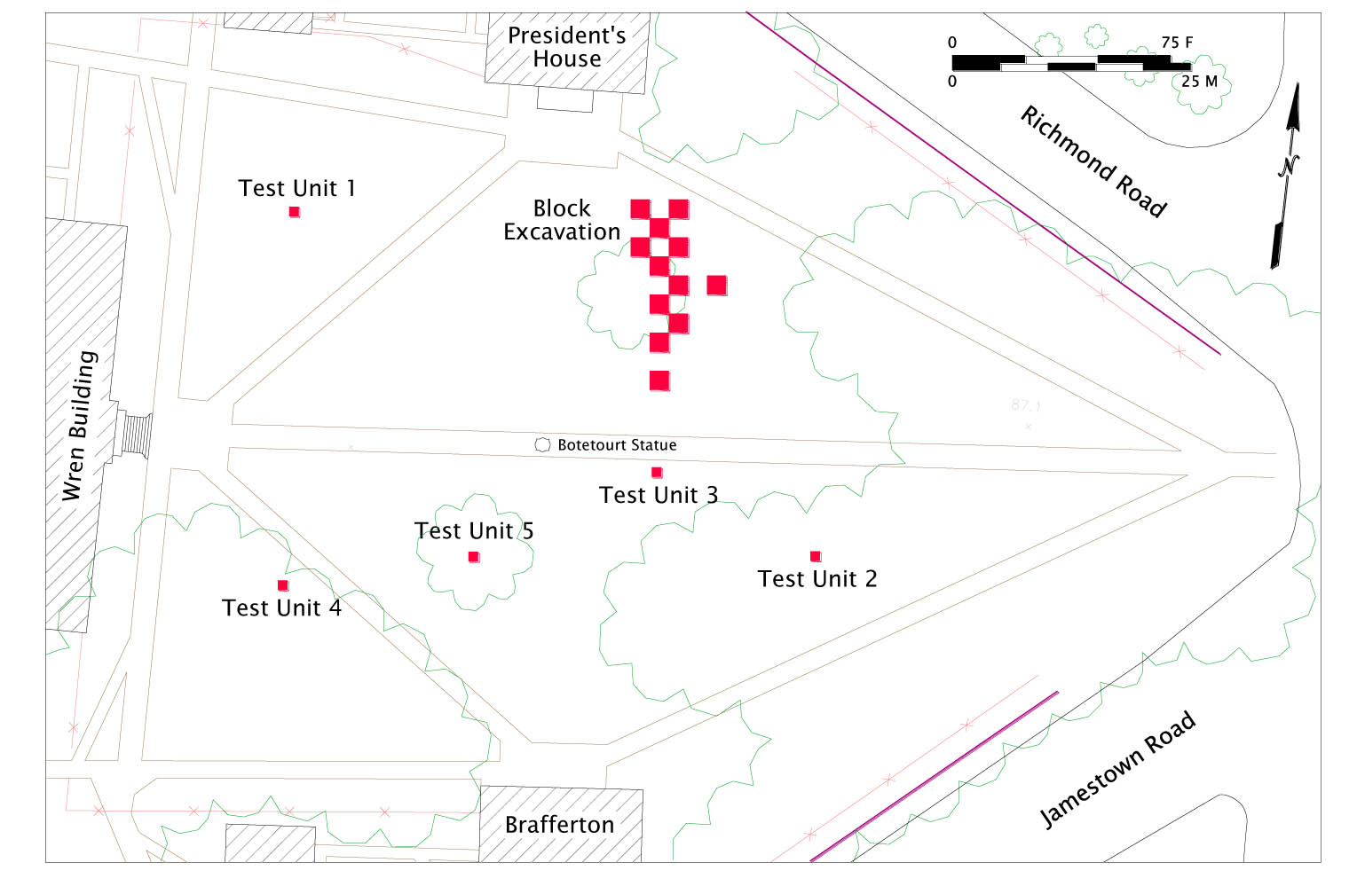 Figure 28. Location of 2005 Block and Test Units
Test Unit 4
TU 4 contained a deeply buried unmarked utility, a waffle-patterned probable steam line, so was largely disturbed. Nonetheless, TU 4 seemed to validate our assumptions that the stratigraphy closer to the Wren Building, while more disturbed, also had intriguing traces of potential earlier surfaces. What could be discerned from TU 4 was encouraging with respect to complexity of deposition, which was not apparent in the block excavation. While nothing definitive relating to the garden could be identified, particularly given the disruption by the steam conduit, hints of shell paving indicate this area may be a more productive portion of the yard for further analysis.
Page 64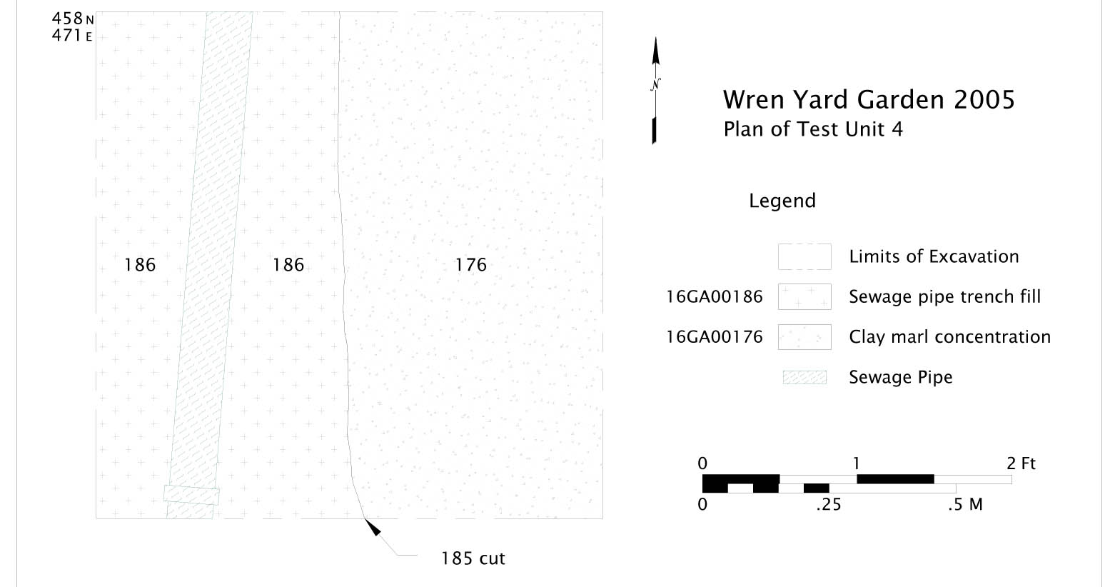 Figure 29. Detail Plan of Test Unit 4
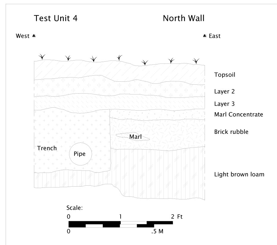 Figure 30. Profile of North Wall, Test Unit 4
Test Unit 5
TU 5 largely seemed to validate the assumption that the stratigraphy in the south portion of the yard, across from the summer 2005 excavation block, mirrors that found in the north half of the yard. No features were identified in TU 5, although the stratigraphy is very comparable to the block excavation, a series of apparent twentieth century fills. TU 5 renders further excavation on the Brafferton / southeastern portion of the yard a less viable option for further garden investigation.
Page 65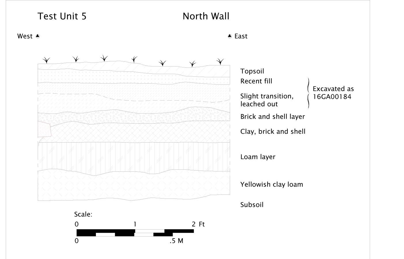 Figure 31. Profile of North Wall, Test Unit 5
2006 Excavation Block
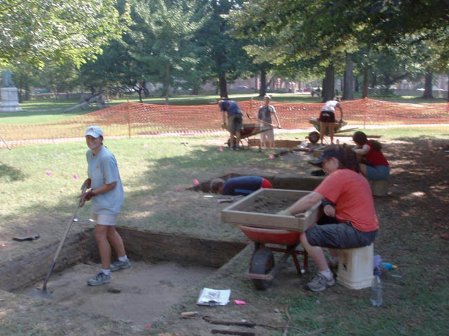
Methodology and Location Rationale
The 2006 season involved fewer field school students and a concordantly smaller overall excavated area. Considering the paucity of definitively garden-related features found in the 2005 block in front of the President's House, excavation was moved to the south side of the College Yard and closer to the Wren Building in the hopes of better preservation, as based on the 2004 Test Unit samples, which showed artifact concentrations closer to the building. A new excavation block, consistent with the numbering of the 2005 grid and datum, was established north of the Brafferton kitchen. Again, excavation units were 2 meters by 2 meters.
Page 67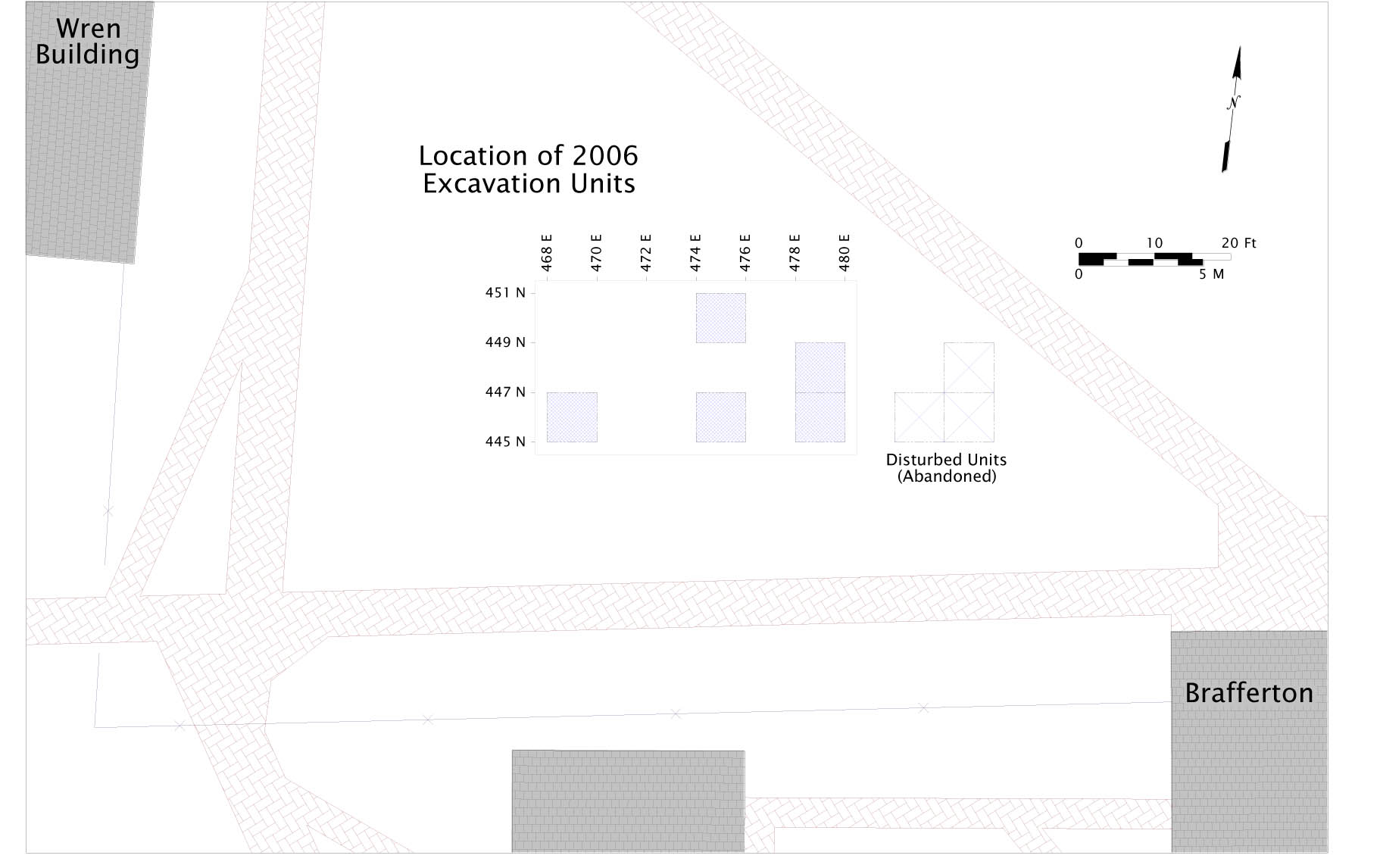 Figure 32. Location of 2006 Excavation Units
Excavation and sampling procedures remained largely consistent with the 2005 protocol, although a better understanding of the stratigraphy resulted in scaling back of flotation sampling of clearly twentieth century deposits.
Twentieth Century Features, Disturbances and Incompletely Excavated Units
Of the initial three units opened, 447N/478E, 447N/482E and 447N/484E, the latter two revealed immediately upon stripping of the topsoil that there was a recent, unmarked buried utility trench in these units, running East-West, as evidenced from redeposited subsoil. Because intact deposit would be minimal — less than 50 percent of the units after removal of the recent backfill, these units were not further excavated. Instead, we expanded the grid west and north of these units.
One Unit, 449N/484E, was excavated to subsoil, but had apparently been entirely homogenized by a modern tree planting. While eighteenth- and nineteenth- century artifacts were present, including a cannonball from the earthwork (see below), there was no stratigraphic differentiation remaining from the unit. The tree planting likely destroyed a portion of the earthwork remnant.
Pre-twentieth Century Features
Brick Rubble Layers
These layers were initially thought to be the remnants of the 1859 and 1865 fires that destroyed parts of the Wren Building, appearing in some locations as a single deposit, in other areas as multiples separated by thin layers of ash. The Brick Rubble layers now appear to be associated with the tearing down of the Italianate towers after the 1862 fire and other additions to the Wren Building removed during Colonial Williamsburg's 1930s restoration. Disposal of the architectural debris seems haphazard; it is present in some areas of the yard, absent in others, and in some places, such as the 2006 excavation block, highly concentrated. The debris is most notably present in the southernmost excavation units.
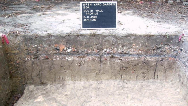 Figure 33. Brick rubble layers with thin, continuous ash layer in-between
Walkways
The first obvious indication of intact, pre-restoration features in the yard came in the form of compacted, crushed marl paving in 449N/478E. Marl is a common colonial paving material in Williamsburg (Noël Hume, 1979). Marl is also likely the paving material seen in the earliest nineteenth-century photographs and other depictions of the Wren Yard. Because gravel does not naturally occur in the marine-derived geology of Tidewater Virginia, marl was an effective and readily available substitute for it. Marl from the Yorktown geologic formation is exposed in several outcroppings around the Williamsburg area, including the present-day College Woods nearby.
Page 69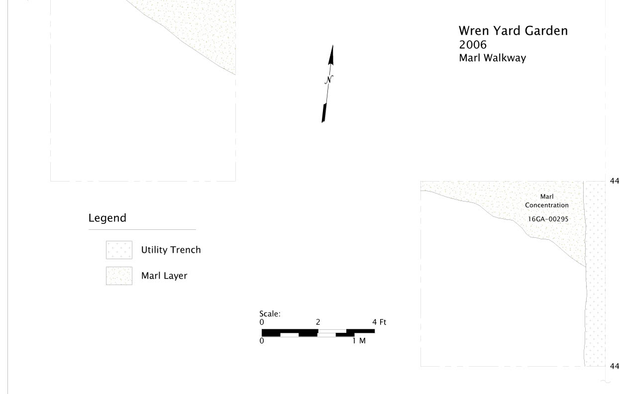 Figure 34. Plan view of Later Marl Walkway as excavated in 2006.
The paving, while somewhat disturbed, occurs on a diagonal orientation probably connecting the entrances of the Brafferton and the Wren Building, a direct path that is not present in the current bricked pathways in the yard.
Cannonball Layer / Earthwork Remnant
The most visually dramatic feature uncovered in the excavation block is not garden-related, but a remnant of the ditch-and-embankment defensive earthworks constructed in the Wren Yard during the Civil War.
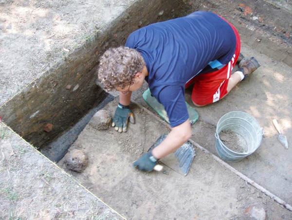 Figure 35. Cannon Balls in situ
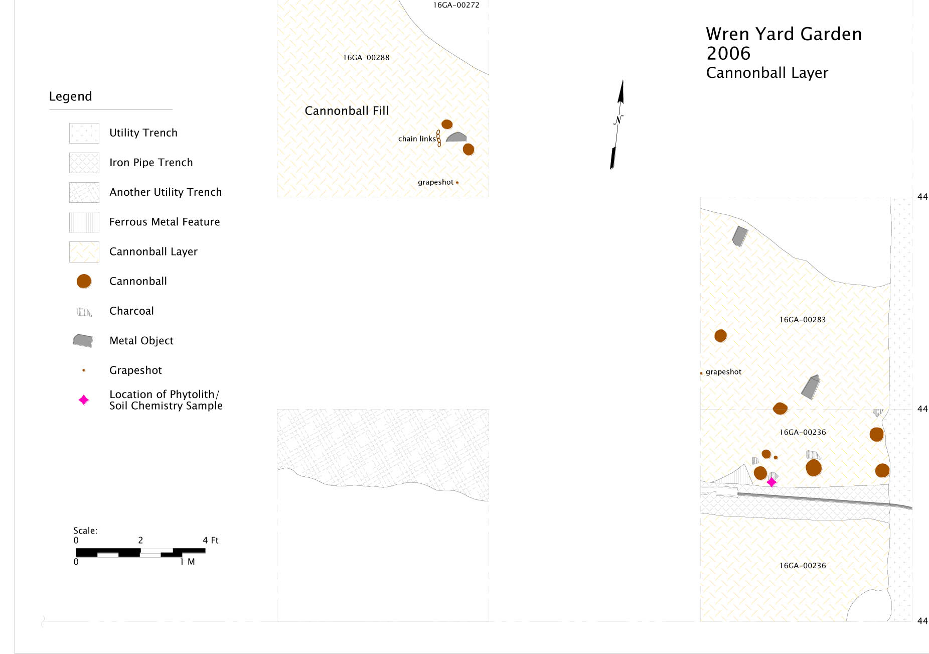 Figure 36. Plan view of Cannonball Layer
This feature was first seen in excavation unit 449N/478E, as a sloping trench cut through marl walkways dating to the mid-nineteenth century. The feature, after excavation units were expanded to the south and north-west, eventually yielded multiple 12-pound cannon shot, and an unfired canister filled with grapeshot. Swem (1928) briefly touches on this little-known, but significant modification to the landscape of the College Yard following an attack on the Union-occupied campus by a band of rebels in 1862: "(They) threw a line of defensive works across the college yard, of which the walls of the Main building, the remaining portion of the brick kitchens near it, the Brafferton & the President's House formed a part…".
Page 71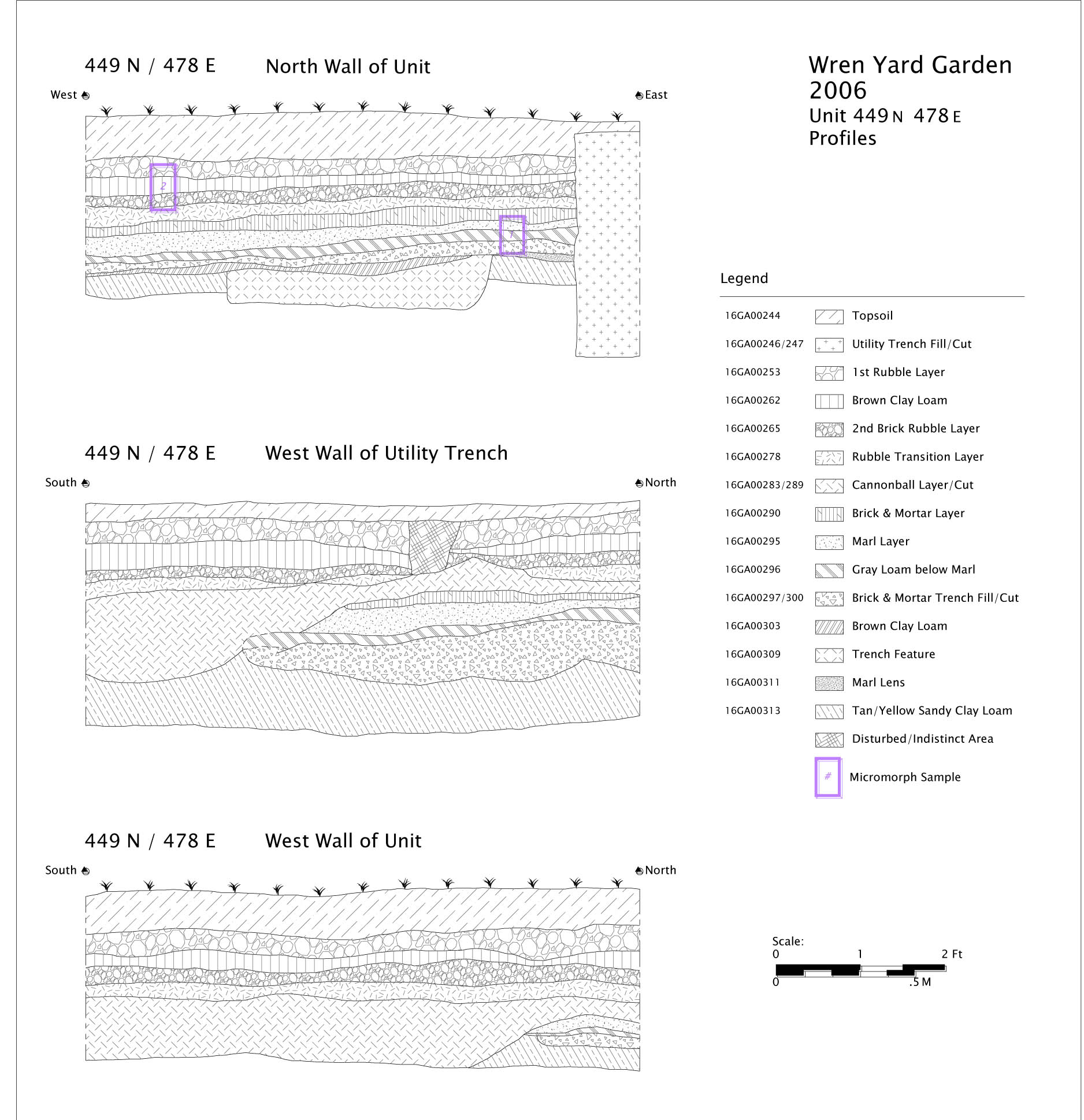 Figure 37. Profiles of Unit 449N/478E
The feature likely extends from approximately the Brafferton kitchen to the south wall of the Wren Building, although evidence from adjacent units indicates it is patchy and not intact. The mortar and cannon shot were clearly incorporated into the deposit as it was filled in following the conflict.
As an archaeological marker, however, the earthwork ditch provides a clear cut date; features cut by the ditch obviously predate 1862, indicating that the Marl walkway it intrudes upon is, at the latest, a mid-nineteenth-century landscape feature in the yard.
Planting Holes
From the 2006 excavation block, however, the most significant with respect to the research questions about the formal eighteenth-century garden, were a series of planting holes. From center to center, each of these three holes, (Context Numbers 16GA-00241, 249, 298), were spaced exactly at 18- foot intervals.
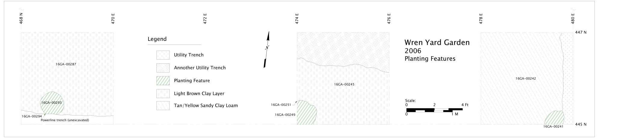 Figure 38. Plan of Planting Features along south edge of 2006 excavation.
While all of the planting holes were truncated, by utilities or excavation sidewalls, they can be estimated at approximately 50cm in diameter; small for large tree plantings, and strongly suggestive of smaller topiary plants.
Moreover, their alignment with the Wren Building (rather than the town grid), gives credence to their eighteenth- century origin. The line of three holes deviates from the axis established by the Brafferton building which they front. As discussed in the later summary, the competing visual axes of the College Yard, established by the three main buildings and garden, hold significant clues as to the dates of the features and the nature of the town planning's attempt to create visual connections between the College and the town of Williamsburg.
Each of the planting holes, however, was severely truncated by what we have now established as the restoration period "spading-up" of the yard. Only about 10-12 centimeters of intact, identifiable vertical deposit remain of what were certainly much deeper original planting holes. The feature fills consisted of a sandy clay loam that was grayer and apparently more organically rich than the surrounding subsoil. Like most of the colonial features in the yard, they are usually recognized as somewhat more amorphous features upon initial observance, that gradually clarify as the deposit is excavated; the contact is very diffuse, consistent with the damaging, but not obliterating, spading rather than plowing of the yard.
Nonetheless, a strong inference can be made that the line of planting holes from 2006 can be matched to what is depicted on the Bodleian plate. Having proven to be remarkably accurate in other respects, the plate appears to show more widely spaced plantings on the outer border of topiaries, in contrast with the more closely spaced plantings along the central path Page 73 extending to the front of the Wren Building. We can likely infer that the two planting intervals used in the design were 18 and 9 feet, respectively. This was confirmed by additional features excavated in 2007.
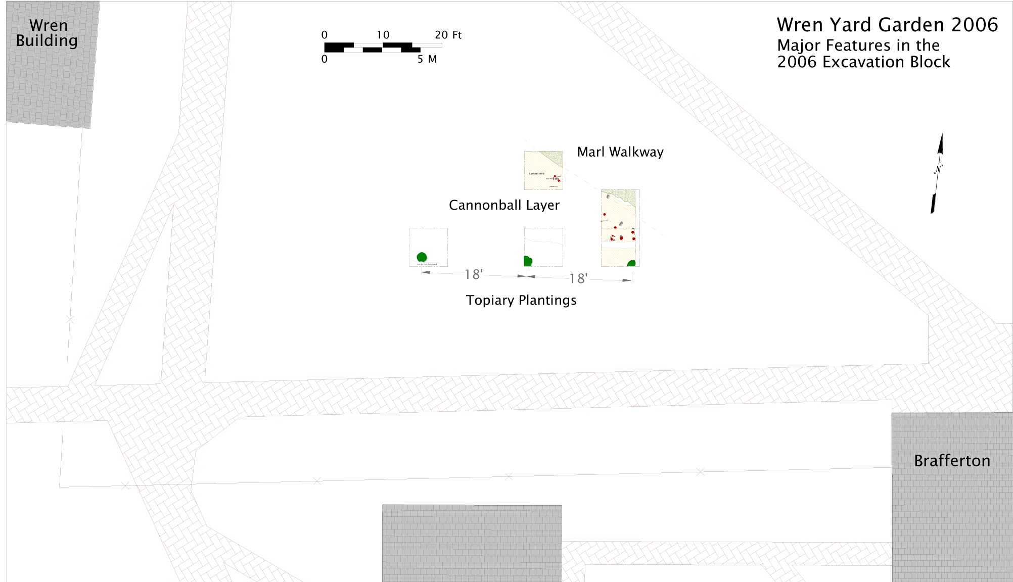 Figure 39. Major Features in the 2006 Excavation Block
2007 Excavation Block
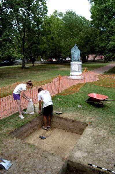
The discovery of the line of three planting holes in 2006, as well as the walkway and earthwork remnants, encouraged additional excavation, as the first indications of preservation of the colonial garden became better understood. Two excavation areas were opened, one continuing the checkerboard pattern from the 2006 season, and a second area immediately south of the modern central walkway of the College Yard.
2006-2007 Excavation Block Locations
For the 2007 field season, excavation continued from the known, preserved features found in 2006. In particular the marl walkways, at the time Page 75 still possibly thought to be of an eighteenth- century date, and a possible remnant of the original garden design. While they now appear to be nineteenth-century in origin, the marl walkway remnants eventually proved to be helpful in ascertaining a likely "ending date" for the existence of the Bodleian plate design garden.
The second major block was established to look for garden features within an area shown in the Bodleian Plate depiction as having a high density of features, including two rows of plantings and multiple walkways or bed transitions in a fairly small spatial area. Two additional units between Block 1 and Block 2 were excavated to look for stratigraphic continuity between the excavation areas.
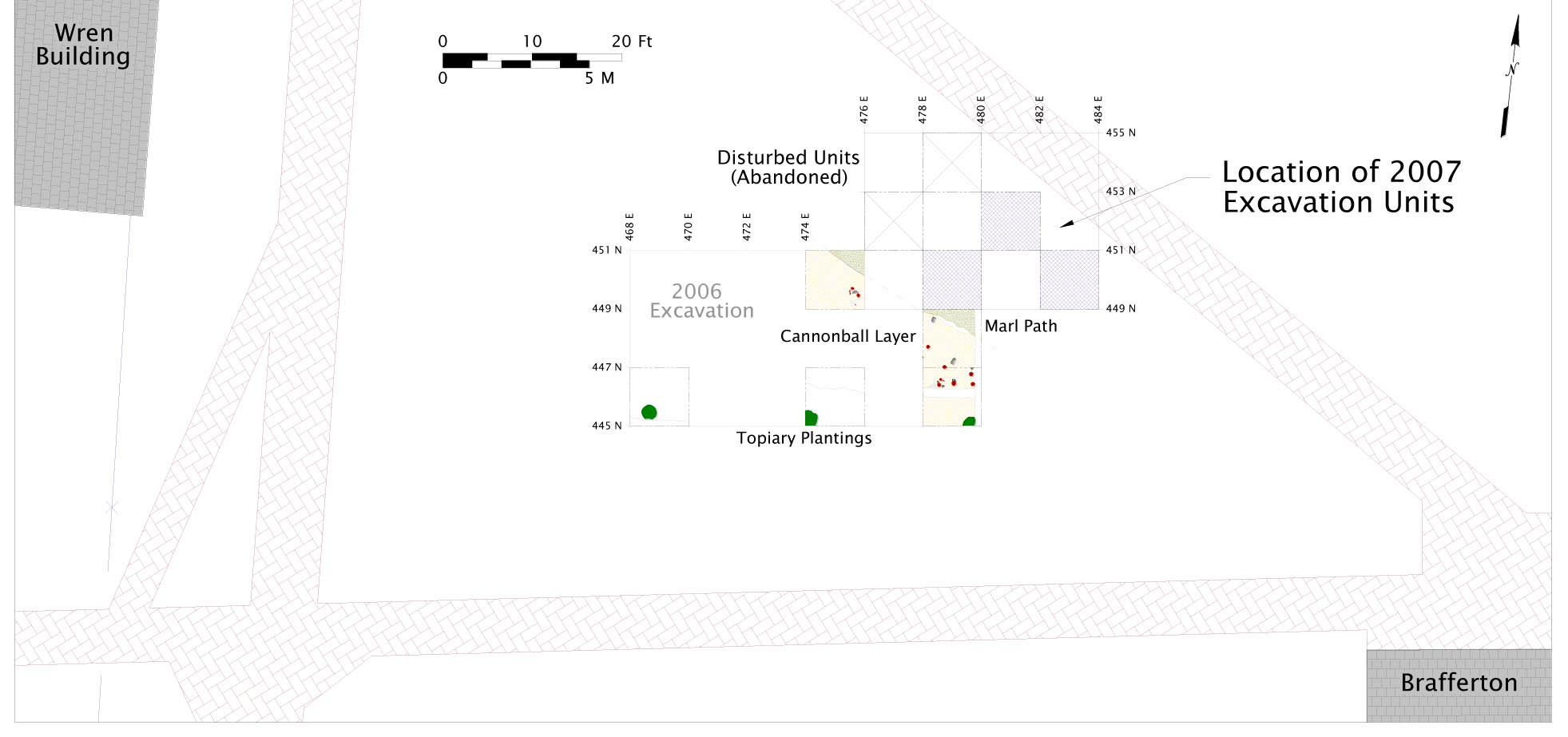 Figure 40. Location Plan of 2006 and 2007 Excavation Blocks
Twentieth-century Intrusive features
Units 465N/480E and 467N/482E in Block 2 contained a series of features that were determined to be 20th century utilities. Because width of the modern trench, exposed shortly after removal of topsoil in 467N/482E left so little potential intact deposits within the excavation unit, this unit was terminated upon exposing the utility trench. The features in Unit 465N/480E however, were not immediately clearly recognized as utilities, and were excavated until the utility, a north-south oriented terra-cotta sewer or drain pipe was exposed. It is unknown if the utility was still active; it appeared to be early, possibly predating the restoration fills.
Page 76Additionally, units 453N/476E and 455N/478E in Block 1 were found to be too disturbed by 20th century features to provide any useful information.
2007 Block 1
Block 1 began excavation in 451N/478E, the 2x2m unit immediately north of the two squares revealing the marl walkway and earthwork remnant from 2006. The intent was to better define the marl walkway's orientation, extent, and date.
Complex Walkway Deposits
451N/482E and 453N/480E
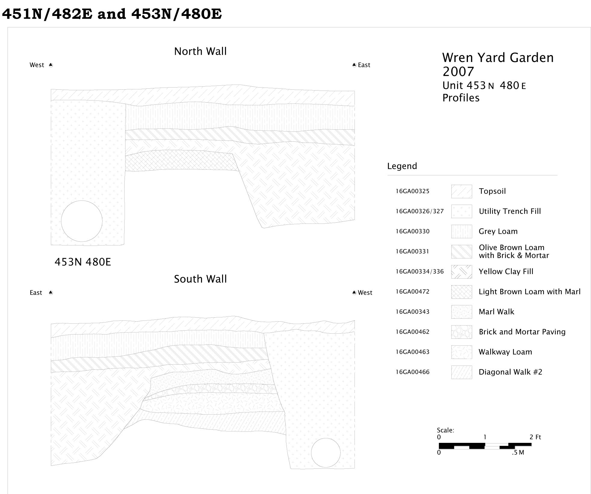 Figure 41. Profile s of Unit 453N/480E
Context 16GA-00466 (Diagonal Walkway #2 Fill) is one of the key points in understanding the evolution of the walkways and landscapes in the Wren Yard. While its exact date is unclear, it seems to represent the transition between the
Page 77
formal garden and the later nineteenth-century modifications of the yard. Located beneath at least four distinct archaeological layers of walkway material, 16GA-00466 has a TPQ date of 1720, based on a fragment of white salt-glazed stoneware. In contrast to all other deposits excavated in the Wren
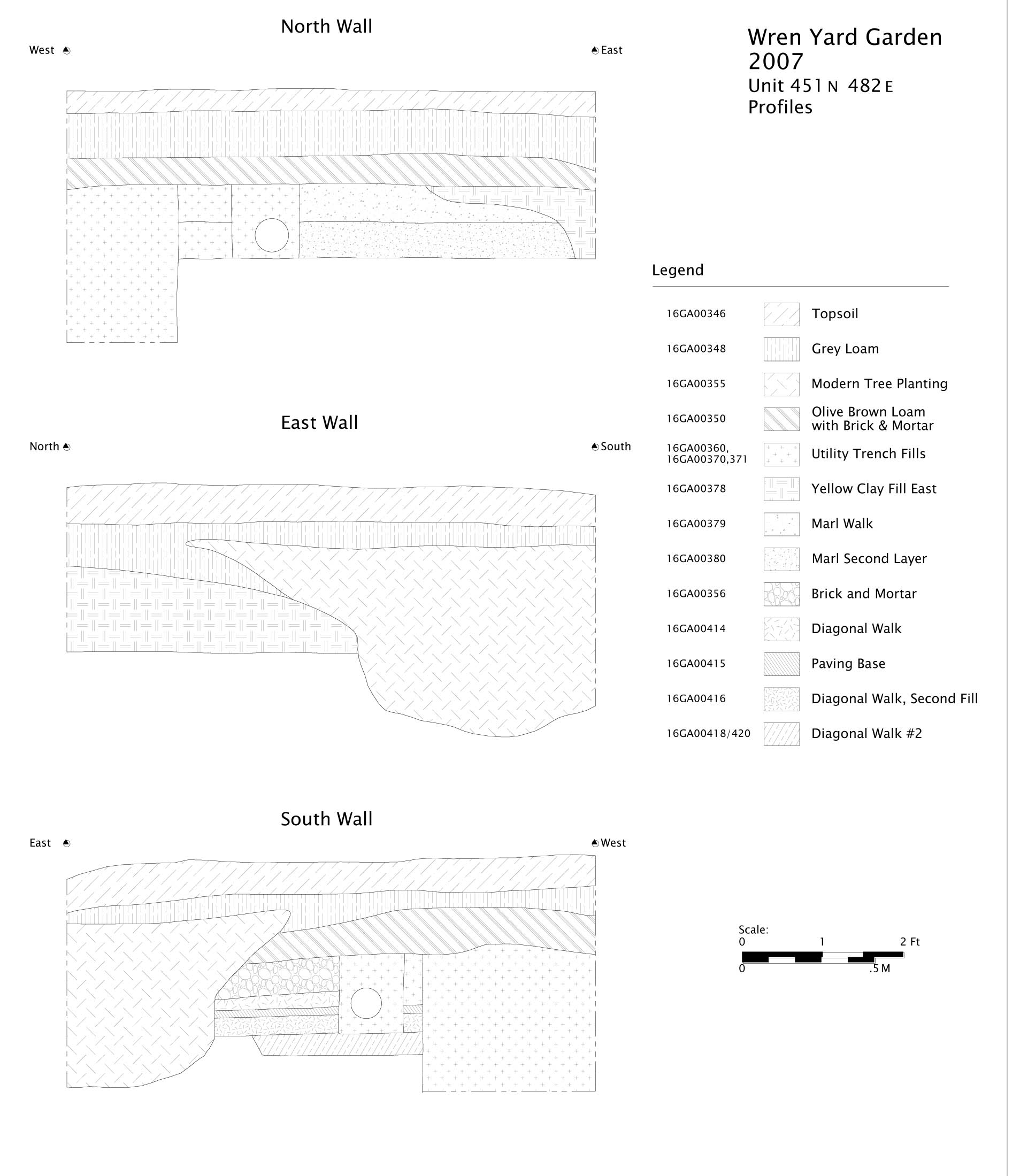 Yard, 16GA-00466 contained significant quantities of faunal bone and may represent domestic refuse originating from the Brafferton or Brafferton Kitchen. If the garden went through some "interim" period between the end of the formal
Page 78
Bodleian design and the restructured nineteenth-century landscape (as the cryptic depictions on the Desandroüins map seem to indicate), it is possible that less permanent and more crude utilitarian pathways were constructed circa the Revolutionary War period, in this case, perhaps connecting the Brafferton to the Wren Building. However with so little of the deposit being
intact and excavated, defining the alignment is difficult. Nonetheless, the deposit is distinct; stratigraphically, the subsequent walkway pavings over the Walkway fill yield nineteenth-century TPQ dates of 1852 (Walkway Loam, Context 16GA-00463), 1807 (16GA-00462, Brick and Mortar Paving), and 1886 (Marl Walkway).
Yard, 16GA-00466 contained significant quantities of faunal bone and may represent domestic refuse originating from the Brafferton or Brafferton Kitchen. If the garden went through some "interim" period between the end of the formal
Page 78
Bodleian design and the restructured nineteenth-century landscape (as the cryptic depictions on the Desandroüins map seem to indicate), it is possible that less permanent and more crude utilitarian pathways were constructed circa the Revolutionary War period, in this case, perhaps connecting the Brafferton to the Wren Building. However with so little of the deposit being
intact and excavated, defining the alignment is difficult. Nonetheless, the deposit is distinct; stratigraphically, the subsequent walkway pavings over the Walkway fill yield nineteenth-century TPQ dates of 1852 (Walkway Loam, Context 16GA-00463), 1807 (16GA-00462, Brick and Mortar Paving), and 1886 (Marl Walkway).
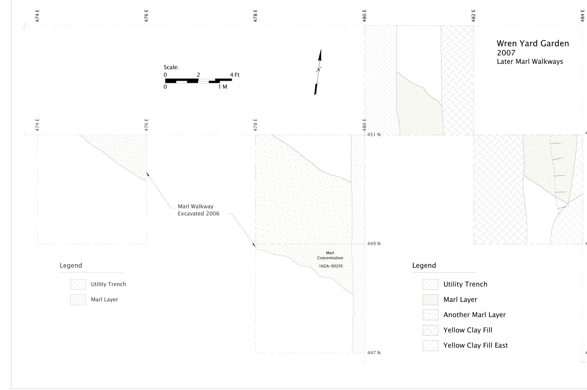 Figure 42. Plan View of later Marl walkways
The walkway trench is narrower and offset from the larger, more robust nineteenth-century deposit which has already been excavated.
Page 79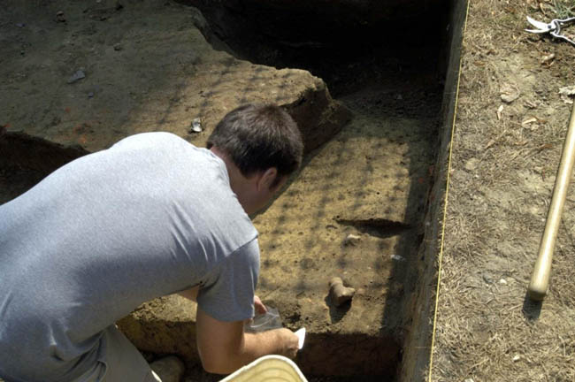 Figure 43. Excavation of Diagonal Walkway Fill #2. Note faunal remains intact. (CWF)
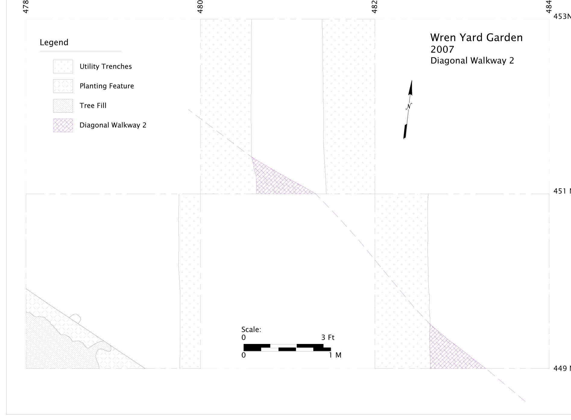 Figure 44. Plan View of Earlier Diagonal Walkway 2
465/480 and 467/482
465N/480E was also excavated in an attempt to link the stratigraphy of the 2006 block with the areas excavated as 2007 Block 2. Unfortunately, both this and the adjacent unit of 467N/482E yielded large utility trenches. The terra cotta pipe running North-South through the center of 465N/480E only appeared upon excavation of the overlying restoration-era fills, so the utility dates to at least that period. Excavation was begun on 467/482E and the East-West trending utility trench fill became apparent quite quickly in the upper layers and excavation was terminated in this unit. The feature was clearly modern and little intact deposit would be revealed via excavation.
2007 Block 2
The second block of excavation in the 2007 season was located just south of the modern central axis walkway that links the façade of the Wren Page 81 Building to the intersection of Duke of Gloucester Street, Richmond and Jamestown Roads.
Block 2 produced the clearest and least ambiguous evidence to date of the Bodleian Plate design, with features matching the copperplate engraving almost identically. While, like other portions of the yard, it has been disturbed by utilities and other ground disturbance, including the restoration "spading", remnant features could clearly be associated with the Bodleian Plate depiction.
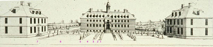 Figure 45. Detail of Bodleian Plate
Examining the Bodleian Plate, the engraving clearly depicts on either side of the central axis: 1. A solid hedgerow, with the upper portions trimmed into conical topiary ornaments; 2. A strip of negative space, without the same graphic detailing that seems to indicate the lawn beds in other areas of the engraving, and 3. An east-west line of individual topiary plantings. Moving southward or northward, there is another "negative space" (4), approximately the same width as the combined hedgerow/negative space/topiary line, followed by an additional topiary line, a large lawn bed, and an additional line of topiary plantings (5 through 7) before reaching the facades of the Brafferton or President's House.
Archaeological features are present confirming the first three elements of the design. In all cases, they are aligned to the orientation of the Wren Building, rather than the later town grid. All features occur below the restoration-era disturbed deposit and are consistent with the "remnant" nature of other original features found in the Wren Yard, i.e., they are clearly truncated by the restoration period spading event and exist primarily as shallow impressions in the subsoil.
Immediately south of the modern walkway, in units along the 471N gridline, there is a feature interpreted as a bounding or drainage ditch; the feature contains very little material and its date is somewhat unclear. If original, it likely represents the edge of the original central axis pathway. The feature was somewhat variable in width (although some of the variability may Page 82 be attributed to inconsistent excavation between student groups), generally between 35 and 45 centimeters.
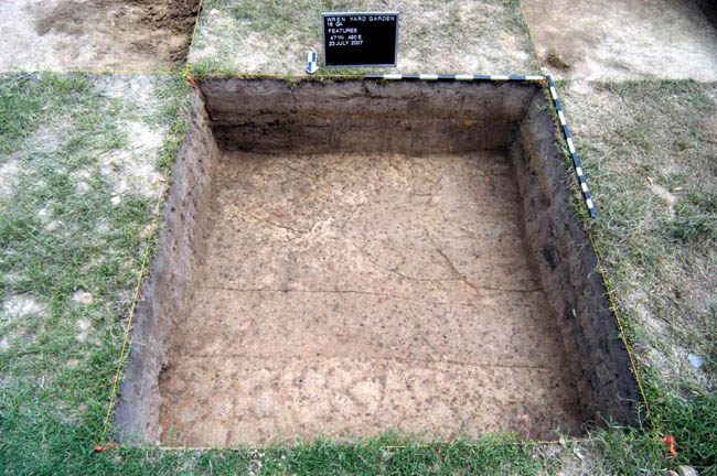 Figure 46. 471N/490E - Unexcavated Features
Moving South, the second line of features, (also within the 471N line of units) consists of large planting holes at variable spacing. Unlike the regular, uniform planting holes seen in the 2006 excavation block near the Brafferton, these planting holes are large, irregularly spaced and slightly more amorphous than the topiary plantings. This would be consistent with a hedge planting, where individual plants of perhaps varying size would be placed in order to create the illusion of a seamless whole, rather than as discrete points at regular intervals. In Excavation Unit 471N/490E, one hedge planting hole cuts another, indicating that one of the individual hedge plantings was replaced at some point. This unique archaeological feature speaks to the care and maintenance of the Wren Garden, and, at a minimum, the durability of the Bodleian design — it lasted at least as long as was needed to replace a planting lost through death or damage of one of the hedgerow plants.
In the line of excavation units along gridline 469N, as students excavated through the spaded "gray loam" layer, it was noticed in these units that there were marl/shell inclusions in only the north half of the deposit in this unit. Not coincidentally, matching the Bodleian Plate with this area of excavation would indicate that the 469N line of excavation units straddle the "negative space", likely a marl-paved walkway, and the subsequent line of topiary Page 83 plantings to the south. While the walkway/marl bed feature had been destroyed by the spading event, the marl retained enough horizontal integrity to be detectable as an inclusion in the disturbed deposit.
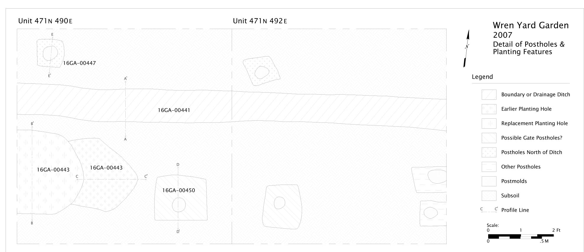 Figure 47. Plan View of Unit 471N/490E and later Unit 471N/492E
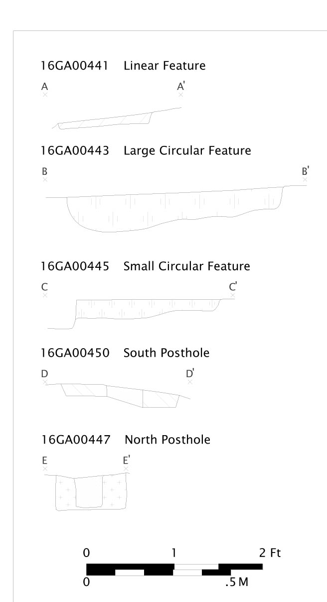 Figure 48. Profiles of features in unit 471N/490E
Context 16GA-00405/406, in Unit 469N/484E, is likely a topiary planting hole from the line depicted on the Bodleian Plate. While the feature was located in the southeast corner of the unit, and extends into the three Page 84 adjacent unexcavated units, it is on nine- foot spacing from the center of the hedgerow line, once again confirming the recurring nine- foot spacing unit used in the garden design. Unfortunately, other topiary planting holes in the 469N line were not evident, likely being destroyed by the more recent intrusive features.
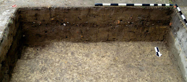 Figure 49. Photograph of likely topiary planting hole 16GA-00405/406 in Unit 469N/484E.
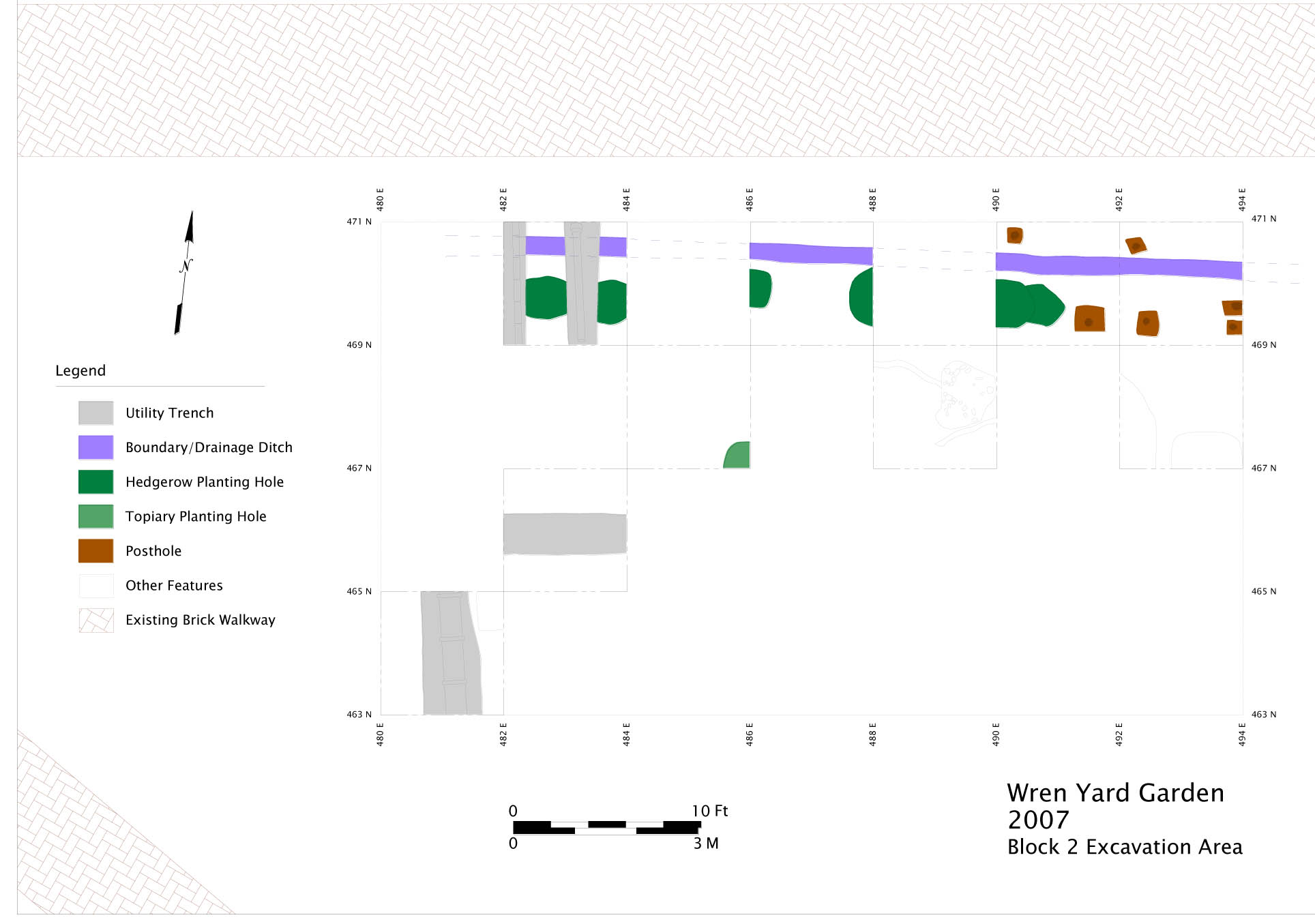 Figure 50. Close-up of Garden Features in 2007 Excavation Block 2
November 2007 Supplemental Unit (471N/492E)
Posthole Clusters and "gate"
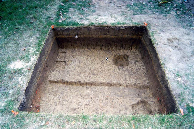 Figure 51. 471N/492E — Plan of Excavated Features
On the eastern end of the 471N line, in units 16GA-00471/490 and 16GA-00471/492 (excavated after the summer 2007 season), the hedge planting row is interrupted by a series of posthole and postmold features, their function and temporal relationship of which is unclear. Because the hedgerow planting holes do not appear to continue in this easternmost portion of the excavation block, it was thought that the postholes might represent a gate for a break in the hedgerow. Two of the postholes, which are larger, fence-like rather than driven post size, spaced three feet apart, may possibly represent a gate. A line drawn between the southwestern corner of the President's House and the northwestern corner of the Brafferton passes exactly through this "gate", suggesting some planned component of the yard; however, there is no evidence to directly date the postholes. The presence of the bounding ditch, too, complicates this interpretation, as the bounding ditch would likely be an obstacle if it were contemporary with the "gate".
Additionally, two smaller postholes occur North of the Bounding ditch in 471/490 and 471/492, but they do not appear to be related to the garden, and likely served a more ephemeral purpose.
Summary of Results
The discovery of several areas of archaeological features closely matching the Bodleian Plate design has two major implications for stewardship and future investigation of the College Yard as an archaeological resource.
The primary concern is preservation from additional damage from landscaping and utilities work in the yard. Throughout the course of the three excavation seasons, it was clear that these activities had caused significant destruction to the site of the formal garden, as well as later historically important features such as the Civil War earthwork remnant.
The "spading" of the yard during the CWF restoration of the Wren Building is the source of most of the broad-scale damage to the site. However, the presumed nature of this activity suggests that, while vertical strata are mostly absent since the spading, some horizontal integrity is likely intact. One of the key markers, present in most but not all tested areas of the yard, is the "orange clay cap" stratigraphic layer. It is still unclear when and why this clay cap was put into the Yard, although it is hinted at in the grading plans for the restoration. It does provide a clear boundary between post-1930s additions to the yard, and the more significant (although somewhat disturbed) deposits below. Any excavation work, including tree replacement and removal, that goes deeper than this layer should be subjected to archaeological excavation in advance of the work. The clay cap layer is of a variable depth and thickness, but can start as early as 20cm below the current ground surface. The clay cap layer itself is not significant, so impacts to this layer are not problematic. However, as noted, it can significantly vary in thickness from a few centimeters to 20 or 30 centimeters in some locations.
Although the 2005 excavation block did not yield garden features, in retrospect with how we now understand the stratigraphy and presence of the garden, it should not be assumed that the 2005 excavation block area is disturbed or destroyed archaeologically any more than other areas of the yard. In fact, the 2005 block may simply be located in an area of the original garden without planting holes or other recognizable features. The deposits, however, may still retain integrity in the form of microscopic or chemical evidence, and adjacent unexcavated units may still yield garden-related or other historical features. Everything below the orange clay cap would appear to be the spaded-up 1920s surface, incorporating the colonial deposits atop a thin possible remnant stratum which may yield subsurface features such as planting holes, postholes, etc.
Laboratory Analysis and Student Projects
Another of the goals of the College Yard excavations was to allow William and Mary undergraduates to participate in the analysis and interpretation of archaeological data beyond the initial training in archaeological field methods provided for in the summer field school. To this end, a series of "Special Topics in Garden Archaeology" classes were held after each summer session during the regular terms. Students could join either having taken the field class or not, and choose a data set to work with that would further the interpretation of the project. Over the course of a semester, students would work with documents or archaeological samples, under the supervision of professional archaeologists, using the resources of the Colonial Williamsburg Foundation, culminating in a final paper and public presentation wherein each student contributed a chapter to their own College's history. This report cannot be considered complete without the students' efforts as a complement to the overall narrative. The final paper reports were collected in three volumes following the conclusion of each class; the post-field analysis and interpretation aspects of the project were largely student-driven. A brief overview of the contributions most germane to the archaeological interpretation follows.
Environmental/Archaeobotany
Several student projects involved looking at different classes of archaeobotanical data to help inform the interpretation of the garden. Unlike a domestic or industrial site, the goals of historic period garden archaeology are less dependent on artifact analysis than looking at the site structure itself as well as alternate forms of data in such as macro- and micro-botanical remains in conjunction with the documentary record and historic depictions (e.g., Currie 2005).
Initial student papers focused on looking at the non-garden contexts from the 2005 season and comparative research (Coyle 2005, Montalvo 2005). Following clear identification of garden features in the 2006 and 2007 field seasons, these contexts were available for archaeobotanical analysis that shed some potential light on the botanical structure of the garden. While due to the restoration period damage to the yard, the features are "thinly" preserved, without a significant amount of in-context soil present, Alex Bergman's (2007) analysis pointed to the possibility of Eastern Red Cedar (Juniperus virginiana) as a potential plant used for topiary plantings in the Wren garden. Scott Babinowich's (2006) analysis examined in detail the composition of the ubiquitous marl used in features throughout the Wren Yard, and as with other colonial paving in Tidewater Virginia, concluded that the local Yorktown formation marl was the source of the material used in the Wren Garden. These studies, plus initial phytolith scanning indicating that old-world Pooidae subfamily grasses contributed heavily to the silica profile of the garden features Page 88 contribute to the understanding that the Wren Garden was uniquely "Virginia", not simply an identically transplanted European formal Williamite garden style. Local plant and landscaping materials either more suited to, or more available in, this part of the New World formed the structure of the garden alongside imported materials and forms, something not apparent from simply looking at the Bodleian Plate depiction, and is a testament to what garden archaeology can bring to garden history.
Documentary Research
Features identified during the field season excavations inspired lines of thought and research for numerous students who followed lines of inquiry through the documentary record in order to shed more light on the archaeological features. From looking at the historical trends in garden history from which the Williamite Dutch-influenced style of the Wren Garden emerged, to understanding of the social and ethnic groups who would have used, seen, and experienced the garden in different ways as part of the early College community, students provided additional context and insight to the archaeological features.
The most significant piece of documentary research in terms of understanding the formation of the College Yard as an archaeological site however, proved not to be on the 18th century, but rather on the 20th. Jessica Way's (2007) report on the Colonial Williamsburg "restoration" of the Wren Building and grounds uncovered the "smoking gun" of a 1929 landscaping plan including an order to manually "spade up" the yard and amend the soil with manure. This, and the associated grading plan iterations clearly point to the time when the intact archaeological garden features were largely, but fortunately not completely, obliterated. The spading effort, while deep, was shallow enough to leave the ephemeral traces of planting holes and hedgerows that remain of the original design. Moreover, since the spading effort was a massive, but single event disturbing soils more vertically than horizontally, some traces, such as marl concentrations, remain within the disturbance to indicate where marl-paved surfaces may have existed in the original Bodleian plate design.
Mapping and Landscape Studies
Exploring new technologies available to supplement and complement excavation as non-intrusive archaeological tools, in addition to the earlier geophysical study by Bevan, Graham Callaway (2007) looked at application of LiDAR-like methods of close interval surface mapping of an excavation unit in the College yard to test whether LiDAR could predict subsurface archaeological features; the results were encouraging for more substantial features such as the bounding ditch along the central walkway.
Page 89Ben Skolnik's (Skolnik and Archer, 2010) careful comparative work exploring the angles of orientation and planes of symmetry between the Wren Yard, associated buildings, and the establishment of the town of Williamsburg, led to one of the most remarkable inferences about the planning of the space between the two unaligned flanking buildings of the Wren building, the Brafferton and the President's house. In order to make the symmetric garden design work in an asymmetric space, it appears that, as Skolnik puts it, "the rules of symmetry were broken in order to maintain the illusion of symmetry", namely, based on these clues, that if the "original" garden uncovered in the archaeological excavations existed prior to construction of the President's House, the orientation of the garden features was likely revised and offset in order to accommodate an optical illusion of continuity between the College and the Town.
Chapter 6
Conclusions and Recommendations
The first paragraph in Chapter 1 of this report describes the intent of the three seasons of archaeology in the Wren Yard: to "…characterize and determine what, if anything, remains of the formal landscape design of the College of William and Mary's historic campus…". These intentions were realized with the discovery of the planting holes for three of the topiaries, the remnants of the hedgerow, and a segment of the bounding ditch that are clearly depicted in the south section of the Wren Yard on the so-called Bodleian Plate engraved in the 1740s. In addition to fulfilling these goals, the project was successful in involving William and Mary Anthropology students in the archaeology and research of their own campus through three field school summer session courses and two regular semester courses in environmental archaeology.
While the principal goal was to learn more about the historic gardens, the archaeology also found significant features relating to the College's role in the Civil War, changes in the Wren Yard landscape from the seventeenth through the mid-twentieth centuries, and developed a theory of how the Brafferton and the President's House were designed and sited to produce a trompe l'oeil of symmetry. The legacy of the first on-campus William and Mary/ Colonial Williamsburg field school was continued in the 2011 through 2013 Brafferton and Bray School projects.
There is, however, a significant unresolved research question with the formal garden that could readily be answered with additional small scale excavation. The primary issue is that it is unclear to what period the garden can be assigned; specifically, whether the excavated garden features relate to the original (or, perhaps second) phase of the Wren Building (circa 1705), or whether the garden features were installed in conjunction with the Brafferton and President's House buildings some 20 years later, as depicted on the 1740s era Bodleian Plate.
With continuing analysis, following on the work of archaeologists (e.g., Leone and Shackel 1990) and other historical clues (Kornwolf, 1983, 1989, 2002; Nelson, 2008), a pattern suggesting an intricate plan linking the established College to the town of Williamsburg was implemented in the eighteenth century, with the College yard being a landmark focal point in the design. This entailed "retrofitting" the misaligned, already existing College with the newly established town grid of Williamsburg through the creation of illusionary sightlines using architecture and landscape.
Page 92
The age of the garden could be established archaeologically by moving from the located features in the south portion of the yard, across the central axis to excavating corresponding "symmetric" features in the north portion of the yard. The symmetry and orientation of the planting features and walkways would be able to answer two significant, as yet unresolved questions: 1. Does the Bodleian plate era-garden predate the construction of the Brafferton building in 1723, linking it with either the first or second forms of the Wren Building? and, 2. Was the garden modified or, if of later construction, designed to create an "optical illusion" of symmetry in the space between the College and Town. The second point, in particular, would be of tremendous importance in understanding late Williamite design overall and specifically the planning of Williamsburg's landscape.
The major goal would be locating matching remnant garden features in the North portion of the yard. Based on the 2004-2007 work, it appears highly probable that a series of excavation units near the center of the yard, north of the walkway axis, would be able to answer these questions, confirming the age of the garden and its relationship to the town plan. Assuming the features in Page 93 the north portion of the yard are located and preserved as well as those that are south of the pathway, there are three likely archaeological scenarios for interpretation of discovered features:
- 1.Features aligned with the Wren Building, which would suggest the garden was original to either the first building, or minimally original to the 1705-1723 period of the second building before the Brafferton.
- 2.Features aligned with the town grid, (or, splitting the difference between the two grids) suggesting the garden was not constructed until the President's House was designed, and planted to create an optical illusion of symmetry.
- 3.Features showing evidence of removal and realignment from Wren to town grids, indicating the garden was indeed of early construction, but was remodeled in the early eighteenth century in order to accommodate the flanker buildings and the town plan.
Footnotes
Much of the work conducted in 2004-2005 was interpretively difficult due to lack of previous data with which to contextualize the results, as well as the location of the first season's excavation block in an area, where, as it turned out, no features related to the garden that would be identified between 2006 and 2007 appear to exist. In retrospect, the 2005 excavation narrative appears overly ambitious and detailed on what are likely insignificant features (e.g., the section on "ambiguous and possibly colonial features") reflecting nineteenth and later century events in the yard; the deposits were excessively sampled and recorded given subsequent information. Nonetheless, these excavations formed the basis of the later interpretation of filling, disturbance, and grading events in the yard. Some of the information therefore stands somewhat intact from the preliminary report as a record of the iterative and hermeneutic process by which the logic of the yard stratigraphy was deciphered.
Bibliography and References
- 1782
- Plan de la ville et environs de Williamsburg en Virginia — America le 11 Mai 1782. Colonial Williamsburg Foundation, Williamsburg, Virginia.
- 1862
- Map of Southeast Virginia. Colonial Williamsburg Foundation, Williamsburg, Virginia.
- 1945
- Topography, William and Mary College, December 1945. College of William and Mary Department of Buildings and Grounds, Williamsburg, Virginia.
- 1963
- Topography of campus, College of William and Mary, March 1963. College of William and Mary Department of Buildings and Grounds, Williamsburg, Virginia.
- 1970
- Vital Facts: A Chronology of the College of William and Mary. College of William and Mary, Williamsburg, Virginia.
- 2005
- Unpublished collection of student papers from Anthropology 350 Section 4/Anthropology 697, Fall 2005, College of William and Mary.
- 2006
- Report on archaeological monitoring of the 2005-2006 President's House renovation, MS. on file at the Colonial Williamsburg Foundation.
- 2006
- A Paleontological Analysis of the Wren Yard Marl Surfaces. Unpublished Student Paper for Anthropology 350, College of William and Mary.
- 2007
- A Study in Charcoal: Analysis of Flotation Samples in the Wren Garden. Unpublished Student Paper for Anthropology 350, College of William and Mary.
- 1781
- a Untitled map of York and Gloucester. Colonial Williamsburg Foundation, Williamsburg, Virginia
- 1781
- b Camp a Williamsburg le 26 Septembre 7 milles de Archers Hope. Colonial Williamsburg Foundation, Williamsburg, Virginia. Page 95
- 1986
- Colonial Virginia: A History. KTO Press, White Plains, New York.
- 1826
- Map of the State of Virginia. Virginia State Library, Richmond, Virginia.
- 1995
- The Gardens of Colonial Williamsburg. The Colonial Williamsburg Foundation, Williamsburg, Virginia.
- 1961
- Schools and Schooling in Eighteenth Century Virginia. PhD. dissertation, Duke University, Durham, North Carolina.
- 2007
- Non-Invasive Survey Methods in the Wren Yard. Unpublished Student Paper for Anthropology 350, College of William and Mary.
- 1722-1727
- Robert Carter Diary. Microfilm, Colonial Williamsburg Foundation, Williamsburg, Virginia.
- 1781
- Carte de la Virginie au Precis de la Campagne de 1781. Colonial Williamsburg Foundation, Williamsburg, Virginia.
- 1781
- Williamsburg. Colonial Williamsburg Foundation, Williamsburg, Virginia.
- 1789
- From Annapolis to Williamsburg. Virginia Department of Historic Resources, Richmond, Virginia.
- 1985
- Resource Protection Process for James City, York County, Williamsburg and Poquoson, Virginia. Virginia Department of Historic Resources, Richmond, Virginia.
- 2005
- Flotation Analysis from the Wren Yard: What Does it Tell Us About a Formal Garden? Unpublished Student Paper for Anthropology 350, College of William and Mary. Page 96
- 2005
- Garden Archaeology: A Handbook (Practical Handbooks in Archaeology 17). Council For British Archaeology, York, England.
- 1781
- Carte de la Campagne de St. Simone. Colonial Williamsburg Foundation, Williamsburg, Virginia.
- 1950-1951
- The Wren Building of the College of William and Mary: Architectural History. 2 vols. Research report, Colonial Williamsburg Foundation, Williamsburg, Virginia.
- 1781
- Carte des Environs de Williamsburg en Virginie, 1781. Colonial Williamsburg Foundation, Williamsburg, Virginia.
- 1779
- The Virginia Gazette. December 18, 1779. Colonial Williamsburg Foundation, Williamsburg, Virginia.
- 1932
- The Wren Building: Archaeological Report including A Brief History of the Four Forms of the Building. Research report, Colonial Williamsburg Foundation, Williamsburg, Virginia.
- 1775
- A Map of the Most Inhabited Part of Virginia. Virginia Department of Historic Resources, Richmond, Virginia.
- 1863
- Map of New Kent, James City, Charles City and York Counties. Colonial Williamsburg Foundation, Williamsburg, Virginia.
- 1864
- Vicinity of Richmond and Part of the Peninsula. Virginia Department of Historic Resources, Richmond, Virginia.
- 1867
- Vicinity of Richmond and Part of the Peninsula. Virginia Department of Historic Resources, Richmond, Virginia.
- 1993
- The College of William and Mary: A History. 2 vols. King and Queen Press, Society of the Alumni, Williamsburg, Virginia. Page 97
- 1970
- Wren Script. Research report, Colonial Williamsburg Foundation, Williamsburg, Virginia.
- 1862
- Hare's Map of the Vicinity of Richmond and the Peninsula Campaign. Colonial Williamsburg Foundation, Williamsburg, Virginia.
- 1979
- Principles of Archaeological Stratigraphy. Academic Press, London.
- 1964
- The Present State of Virginia and the College. H. D. Farish, ed. Dominion Press, Richmond, Virginia.
- 1809-1823
- The Statutes At Large: Being a Collection of All the Laws of Virginia. 13 vols. Samuel Pleasants, Richmond, Virginia.
- 1770
- Virginia. Virginia Department of Historic Resources, Richmond, Virginia.
- 1673
- Virginia and Maryland, 1670. Virginia Department of Historic Resources, Richmond, Virginia.
- 1862
- Map of Williamsburg to White House. National Archives, College Park, Maryland.
- 1787
- A Map of the Country between Albemarle Sound and Lake Erie. Colonial Williamsburg Foundation, Williamsburg, Virginia.
- 1972
- Notes on the State of Virginia. W. W. Norton Company, New York, New York, and London, England.
- 1956
- Battles and Leaders of the Civil War: The Way to Appomattox. 4 vols. Castle Books, New York, New York.
- 1956
- The Present State of Virginia. Richard L. Morton, ed. University of North Carolina Press, Chapel Hill, North Carolina. Page 98
- 1985
- Hark Upon the Gale. The Donning Company, Norfolk, Virginia.
- 1922
- Map of James City County, Virginia. Williamsburg-James City County Courthouse, Williamsburg, Virginia.
- 1989
- So Good A Design, The Colonial Campus of the College of William and Mary: Its History, Background and Legacy. The College of William and Mary, Williamsburg, Virginia.
- 1992
- The Formal Garden: Traditions of Art and Nature. Thames and Hudson, London, England.
- 1676
- Virginia and Maryland. Virginia Department of Historic Resources, Richmond, Virginia.
- 1975
- Soil Science and Archaeology. Academic Press, London.
- 1987
- The Civil War Day By Day, An Almanac. Da Capo Press, Inc., New York, N.Y.
- 1807
- Map of Virginia. Virginia Department of Historic Resources, Richmond, Virginia.
- 1984
- British and American Gardens in the Eighteenth Century: Eighteen Illustrated Essays on Garden History. Colonial Williamsburg Foundation, Williamsburg, Virginia.
- 1984
- Pursuing Innocent Pleasures: The Gardening World of Alexander Pope. Arden Books, Hamden, Connecticut.
- 1991
- The Pleasure Gardens of Virginia from Jamestown to Williamsburg. Princeton University Press, Princeton, New Jersey. Page 99
- 1999-2000
- Jean-Nicholas Desandrouins and His Overlooked Map of eighteenth-Century Williamsburg. The Journal of Colonial Williamsburg Vol. 21 No. 6:44-49.
- 1924
- Minutes of Council and General Court of Colonial Virginia. The Library Board, Richmond, Virginia. Reprinted 1934, 1979.
- 1931
- Map of James City County, Virginia. Williamsburg-James City County Courthouse, Williamsburg, Virginia.
- 1702
- Drawing: East Elevation, the College of William and Mary. Burgerbiblithek, Bern.
- 2005
- Phytolith Assemblage of a Typical Williamite Garden in England. Unpublished Student Paper for Anthropology 350, College of William and Mary.
- 2006
- Archaeological Survey and Evaluation of the Proposed Manhole Structure Project Area, President's House Parking Lot, College of William and Mary, City of Williamsburg, Virginia. VDHR File No. 2006-0974.
- 1976
- Their Majesties' Royall Colledge: William and Mary in the Seventeenth and Eighteenth Centuries. Hennage Creative Printers, Washington, D. C.
- 1997
- Archaeological Investigations of the Wren Yard. Colonial Williamsburg Foundation Library research report series; RR-1728.
- 1979
- Archaeology and the Colonial Gardener. Colonial Williamsburg Archaeological Series No. 10. Williamsburg, Virginia: Colonial Williamsburg Foundation.
- 1969-1979
- Cavaliers and Pioneers: Abstracts of Virginia Land Patents and Grants. 3 vols. Dietz Press, Richmond, Virginia, and Genealogical Publishing Company, Baltimore, Maryland. Page 100
- 1985
- Virginia Land Records. Genealogical Publishing Company, Baltimore, Maryland.
- 1738
- The Virginia Gazette. Colonial Williamsburg Foundation, Williamsburg, Virginia.
- 1777
- The Virginia Gazette. Colonial Williamsburg Foundation, Williamsburg, Virginia.
- 1773-1774
- The Virginia Gazette. Colonial Williamsburg Foundation, Williamsburg, Virginia.
- 1931
- Old Foundations of Outbuildings to Wren Building, College of William and Mary (Block 16, Building 8). Research report, Colonial Williamsburg Foundation, Williamsburg, Virginia.
- 1972
- Tidewater Towns: City Planning in Colonial Virginia and Maryland. University Press of Virginia, Charlottesville, Virginia.
- 1972
- The American Campaigns of Rochambeau's Army. 2 vols. Princeton University Press, Princeton, New Jersey.
- 1773
- The Virginia Gazette. January 28, 1773. Colonial Williamsburg Foundation, Williamsburg, Virginia.
- 1973
- Cows on the Campus. The Dietz Press, Richmond, Virginia.
- 1967
- The Civilian Conservation Corps, 1933-1942: A New Deal Case Study. Duke University Press, Durham, North Carolina.
- 1954
- The Journal of Ebenezer Hazard in Virginia, 1777. Virginia Magazine of History and Biography 62:400-423. Page 101
- c 1782
- Map "City of Williamsburg". John Graves Simcoe Papers, MS Manuscript 30.6, John D. Rockefeller, Jr. Library, The Colonial Williamsburg Foundation, Williamsburg, Virginia.
- 2010
- Landscaping the College: Unearthing William and Mary's Original Garden. Paper Presented at the Society for Historical Archaeology Annual Meetings, Amelia Island, Florida.
- 1900-1901
- Unpublished Letters at Fulham. William and Mary Quarterly 9 (1st Ser.):218-227.
- 1904
- Williamsburg quadrangle. Colonial Williamsburg Foundation, Williamsburg, Virginia.
- 1891
- The War of the Rebellion: A Compilation of the Official Records of the Union and Confederate Armies. Prepared by Lt. Col. Robert N. Scott and compiled by George B. Davies, Leslie J. Perry and Joseph W. Kirkley. Series I, Vol. XVIII. U. S. Government Printing Office, Washington, D.C.
- 1965
- A Hornbook of Virginia History. Virginia State Library, Richmond, Virginia.
- 1994
- Techniques for Excavating and Analyzing Buried eighteenth Century Landscapes, in The Archaeology of Garden and Field, edited by Naomi F. Miller and Kathryn L. Gleason. University of Pennsylvania Press, Philadelphia.
Appendices
| 1. | Archival Record — Jessica Way |
| 2. | Artifact Inventory |
| 3. | Geophysical Survey — Bruce Bevan |
| 4. | Context Records |
| 5. | Soil Chemistry |
| 6. | Geometry of the Wren Yard — Benjamin Skolnik |
| 7. | Additional Drawings |
Appendix 1
The Restoration and the Wren Yard
By Jessica Way
My project this semester looked at the impact the Restoration of the Wren Building, which was undertaken by the Williamsburg Holding Corp from 1927 to 1934, had on the ground around the Building and in the Wren Yard. Three seasons of field work in the Wren Yard from 2005 to 2007 found some general disturbances in the top layers of strata that were unaccounted for in the historical research that had previously been done on the area. The excavations identified a layer of orange clay fill which varied in thickness from 20 to 30 centimeters throughout the entire yard. The assumption has been that the soil was taken from an unknown source and placed in the Yard as a capstone to the general grading of the Yard done during the restoration (Archer 25). Excavations also turned up brick drains cutting through the Yard, which also probably date to the Restoration era, as similar drains have been found in excavations around other buildings restored in Colonial Williamsburg in the 1930's (Archer 21). A general hypothesis was that overall grading had been done during the restoration of the Wren Building by the Williamsburg Holding Corp from 1927 to 1934, brick drains were installed, and a cap of soil was deposited on top. I decided to search the historical documents relating to the Restoration for evidence of any ground disturbances. The reason that I undertook this project was because there were a number of disturbances to the soil that were found during the field schools from 2005 to 2007 that prompted further research.
The Swem library at William & Mary has some photographs of the Restoration, and the President's files from those years have several folders dealing with the Restoration. They also have a few blueprints of the Restoration activities, as well as landscaping and electrical and water system plans prior to the Restoration. Rockefeller Library's visual resource center have a collection of photographs of the Restoration that is much more extensive than Swem's, with about 17 binders and 4 boxes of photographs taken weekly of the progress of the Restoration from all four sides of the building. Also at Rockefeller are the archaeological and architectural reports generated during the restoration, and the architect William Perry's personal journal from the period of the restoration. The Colonial Williamsburg Foundation Archives in the Goodwin building allowed me to search through correspondence files of the landscaping done in the Wren Yard during the Restoration, and the files of the landscape architect, Arthur Shurcliff.
Page 2During the Restoration period, researchers searched for as much detail as possible about the historic building to try to reconstruct a building that was as authentic as they could make it. Later changes to the site during the nineteenth and twentieth centuries were less explored, as they did not add to the picture they were creating of the building as it was in the eighteenth century. Likewise the research done during the 2005 to 2007 field schools focused mainly on the formal gardens of the eighteenth century Wren Building. However, the amount of disturbance to the ground that probably dates to the Restoration work, suggested greater research into the Restoration architects and contractors' practices to understand the site.
1919
When J. A. C. Chandler became president of the College of William and Mary in 1919, the Wren Building, or Main College Building as it was known at the time, was in a state of general dilapidation. The college knew that it needed to be repaired or torn down and replaced by a more modern building. This building was the fourth incarnation of the Wren Building, which had originally been built in 1695, and then burnt in 1705, 1859, and again in 1865. After every fire the College rebuilt, using the remains of the brick structure and adding different stylistic features to each building.
1923
Drainage was always a problem in the Wren Yard. Each administration took a turn at trying to alleviate the standing water problem. This blueprint from 1923 shows the low areas between the Brafferton and the President's House where standing water collected. There seem to have been two strategies that were historically used in the Wren Yard to counter the flooding: drains installed in the front of campus and general grading of the area.
1924 - 1928
W. A. R. Goodwin, professor at the College and the mastermind behind Colonial Williamsburg, advocated using drains to divert the standing water. In a letter to Chandler dated December 16, 1924, discussing a proposed wall to run around the historic campus, he suggests:
… having the front campus tiled for drainage before the wall is put up? The wall will tend to confine the water in the campus…. If a brick or flagstone walk is put down in place of the concrete walk leading up to the main building, a drain tile could be put under it about two feet deep, with a few transverse drains leading into it. Would this not take the dampness away, which keeps the grass from growing?In his Wren Building Archaeological Report, Block 16, Building 3 from 1932, Prentice Duell describes the historic problems of drainage in the yard: Page 3
The grade of the building was raised on all sides and especially at the front by Governor Spotswood who appears to have taken charge of the rebuilding of the structure after the fire of 1705. The reason for raising the grade was unquestionably owing to the fact that water collected in front of the building and made the low entrance at times practically inaccessible; it is possible that water actually flowed into the building…. Spotswood raised the grade at the front of the building approximately 3 feet and in doing so was forced to raise the entrance of the building itself…However the raising of the grade around the Wren Building caused the water to form two large ponds in front of Brafferton Hall and the President's House. The Botetourt Statue apparently was above the water; probably the walk to the building had been raised by Spotswood. Various attempts were made to drain these ponds throughout the subsequent history of the building, and only in recent years Dr. Chandler raised the grade of these areas about two feet. (28-9)
The two ponds mentioned by Duell match well with the 1923 blueprint which shows the low lying areas between the President's House and the Brafferton. Unfortunately Duell doesn't give a date for Chandler's grading, however the 1926 blueprint from landscape architect Charles Gillette, suggests that in addition to the low lying areas in the Wren Yard, Chandler had a large area graded behind the Wren Building. This area is marked in red pencil on the blueprint "Area To Be Graded" and consists of the courtyard to the west of the Wren Building and the area that became the sunken gardens. It is possible that Chandler graded the areas in the college triangle area in 1926, at the same time he was having the Wren courtyard and sunken gardens graded: it must have been after Goodwin's letter of 1924, and before Restoration work started on the building in 1928.
1928
In May of 1928, contractors had begun work clearing vegetation from around the walls of the Wren Building. That spring, and again in 1929, architectural staff conducted a series of excavations on the footings of the Wren Building for the Williamsburg Holding Corp., searching for archaeological evidence of the building's changes in form over time (Duell 39).
In June 1928, the college transferred the Main Building to the Williamsburg Holding Corporation. They expected to spend about $400,000 on the project (Chandler 3/27/1928), however a variety of factors including the cost of landscaping would raise this estimate significantly over the next six years. The team of Perry, Shaw & Hepburn, architects from Boston, were hired and set up a Williamsburg office to oversee the construction. Perry, Shaw & Hepburn used Arthur Shurcliff, also from Boston, as their landscape architect. W. J. Holland & Son were initially hired to handle the construction, but by July Page 4 of 1928 Todd & Brown, Inc. had taken over as contractors for the project (Trimble 7/5/1928).
While the college administration, architects and contractors were worrying about how to get rid of water from the historic campus, the landscape architect, Arthur Shurcliff was worrying about bringing it in. On September 17, 1928, he writes to Chandler:
I met Mr. Robinson as you suggested regarding water for watering plants and he said the use of 100 gallons per day, as I noted in my letter to you would be feasible.
Probably we can get water without difficulty from some of the old shallow wells near the House of Burgesses for use at Garrett House and vicinity. This will involve little carriage.
By December 8, 1928, a construction fence had gone up around the Wren Building (Photo Swem 1985.30). From the pictures, it appears to have been four or five feet high, and made of horizontal boards with a two-by-four cap on top. It was supported by four-by-fours at intervals along the length, and two-by-four props leaned down at a 45 degree angle to the ground. The fence was built just to the inside of the walkways surrounding the building on all four sides, and it was inside this fence that the ground was the most disturbed during the Restoration. There was a double gate on each side for trucks to enter, as well as pedestrian gates. The double gates were often padlocked, unless trucks were entering or exiting, and signs were posted directing visitors to the main construction office (CWF, Wren 16 N, 1/22/30).
Sheds were built inside the fence to house construction supplies and a construction office, as well as privies for the construction crew. The construction office was probably on the west side of the building, but it was moved towards the end of the Restoration. A picture exists of the office on wood skids in the center of the west courtyard on March 3, 1931. Prior to this photograph, there had been no structures directly in the courtyard. Sheds appear to have been built directly against the construction fence. Some consisted of a shed roof supported by two four by four posts, with the only wall being that of the fence. Others are a more substantive construction, with four walls. The open type of shed was visible on the south side of the building midway down the construction fence just next to a pedestrian gateway, on the west side of the building on either side of the double gates, and on the north side towards the northeast corner of the building.
A wood scaffolding was erected on all four sides of the building. Debris from various stages was piled underneath it, and excavations of the building's foundations are often visible in pictures under the scaffolding. A scaffolding tower was built on the west side with a system of pulleys. It was visible over the Page 5 roof, and stood higher than the cupola. The lower windows were protected early on by wood awnings. A chute for debris was located out of the eastern most window on the second floor of the south elevation. Bricks were stacked inside the fence along the west side. A large wood pile shows in pictures on the south side of the building.
Trucks frequently drove inside the construction fence, and cars and trucks are visible parked on the grass outside the fence on the west side of the building. However, these trucks were relatively lightweight with small tires. In general, the work on the building seems to have been done with a minimum of equipment, shovels were used instead of heavy earth moving equipment, and pulleys instead of a crane to lift the steel beams to the roof.
The west side of the building seems to have been a staging area for construction. There was the most space on this side between the building and the fence, and the courtyard added extra room. Piles of brick and concrete blocks, as well as sand or dirt, trucks, and small machinery such as a small cement mixer were all stored in the courtyard on the west side of the building.
1929
During the Restoration the implementation of new utility systems had an impact on the ground throughout the historic campus. Electrical and water lines were updated, old ones were disturbed by excavations and needed to be replaced, and new lines were run between the Wren Building and the Brafferton and the President's House. The Restoration contractors also needed electricity to run equipment, and discussed the matter with Virginia Electric and Power. On February 15, 1929, Robert Trimble writing for Todd & Brown told Chandler:
In connection with the Wren Building we have taken up with the Virginia Electric and Power Company the question of furnishing us with temporary electric power. They have advised us that to install the power line it will be necessary to locate two poles on the College property. The location of these poles is marked in yellow on the accompanying blue print.The two poles shown on this blueprint provide evidence of a temporary disturbance to the ground to the east of the Wren Building. Shurcliff's desire for a watering system for the plants on campus was taken up by Chandler. In a meeting from July 25, 1929 about the Restoration, Chandler brings up the possible need for a watering system in place on the front of campus. Prentice Duell, an architectural historian and archaeologist, was hired by Williamsburg Holding Corp. to conduct excavations of the foundations of the Wren Building in the summers of 1929 and 1930, supplementing previous excavations undertaken by the architectural staff (Duell 39). Page 6
In their report on the architectural history and archaeology of the Wren Building, Lawrence Kocher and Howard Dearstyne describe the ways the architects dealt with the drainage problem during the Restoration:
The ground water level was definitely established when the old well, — the water supply during the early days of the college, — and located in the northeast corner of the basement of the main building, was cleaned out. This work was done during the summer months, and the water level was established at fourteen feet below the basement floor, or approximately twenty feet below natural grade. This level rose to within one foot of the basement floor level during the spring of 1929. With this evidence, it was decided to take all precautions possible against the possibility of a higher level. An open tile drain was laid at the footing level of the wall and top of the column foundations, which drained into the main drainage system of the college yard.
The basement was excavated with slopes to an open tile drainage system. This excavation was then backfilled with coarse gravel to the elevation of the bottom of the basement paving slab. The latter was poured on a heavy building paper to prevent the seepage of the concrete into the gravel. The open tile drains of this part of the work also discharged into the main drainage system of the college grounds. (137)
Kocher and Dearstyne's mention of the drains on the college grounds agrees with the brick drain found during the 2005 to 2007 field seasons in the Wren yard by the William and Mary field schools. The drains uncovered during excavation appear to date to the Restoration period and are of a similar construction to those found typically in the Restoration work in Colonial Williamsburg.
Mr. Cann made a report to Williamsburg Restoration on excavations he directed from July 26 to August 2, 1929.
Friday, July 26, 1929, 6 men, 90 degrees. Started at 12:30 P.M. at the southwest corner of the Wrenn [sic] Building. The excavation already started here proved to be of no value. The brick here was loose brick and mortar which had been put in as filling material by Dr. Chandler when the grade was raised. I excavated an area of trench about 20 feet x 3 to 5 feet and some pavement was brought to light. At least it might have been pavement or brick floor. The brick had become so disintegrated by time that it is difficult to determine. I decided that owing to the limited space inside the fence. I had better discontinue further work here for the present. The space was needed for the contractors use.Page 7
Cann's description of the loose brick rubble he uncovered and grading done by Chandler presumes grading done prior to the Restoration. Shurcliff describes this trench in 1931 as "running in an eastwest direction" (Shurcliff 3/12/1931). Cann appears to have been looking for evidence of outbuildings: on the 27th he excavated the area between the Wren Building and the Brafferton where there was an out-building on the Frenchman's map, and from the 29th to the 2nd he excavated on the opposite side of the yard, between the Wren Building and the President's House (Cann).
Shurcliff got into what appears to be an argument with Harold Shurtleff, who worked in the records department in Perry, Shaw & Hepburn, in March of 1931 about the location of the 1929 excavations.
At the time of the digging one of the privies erected by Messrs. Todd & Brown stood so near the spot where the excavation (described below) was made that the liquids from the privy tended to flow into the excavation. This fact may help to find the place of the excavation. (Shurcliff 3/12/1931)
This graphic description tells us not only that by 1931 the architects couldn't locate the previous excavation work, but also that some of the shed-like structures within the construction fence were outhouses. In a photograph from July 30, 1929, the excavation trench is visible, however there is no privy visible next to it.
The trenches were backfilled later in August 1929. Chandler was worried because school was about to start again in September, and the trenches had been left open. He wrote to Perry, Shaw & Hepburn asking them to fill in the holes to ensure the safety of students returning to campus (Chandler 8/17/1929).
On September 19, 1929, Shurcliff writes a detailed plan for landscaping work in the Wren Yard. His plan incorporates details about utilities, walkways, plantings, watering systems, and grading:
Page 9(b) I assume the architects will include the necessary new ntilites [sic] both above and below ground.
(c) All the work described below should be estimated to be done in a manner which would not disturb existing foundations, most of which are probably shown on the blue print of the survey. I mean for example that the item for the cultivation of the ground should include care with regard to spading so that deep spading Page 8 would not be carried out over foundations in a manner to disturb them.
(d) The obliteration of old walks would mean the removal of the entire walk structure and replacement of the same with first quality loam, unless a new walk is to be built on the old site.
(e) Tree trunks would require protection with wooden lagging to avoid injury by wagons, trucks or horses.
… (g) We should adhere as closely as possible to the present grades, and consequently no general item for grading involving outs or fills is included.
… 3. Figure the cost of the brick walks shown east of the above gates, which walks I understand are not to be included in the gift of the above donor. Those walks to be of reasonably hard brick, but not as good as those used in the Wrenn [sic] Building. Bricks laid in Portland Cement mortar on a concrete slab similar to the slab already used under the present brick walks east of the Wrenn Building, widths of walks to be as shown, intervening ground to be cultivated with two cords of well-rotted cow manure and sown with grass seed.
… 5. Allow $3000.00 for the cultivation and planting of the general district west of the Wrenn Building which is indicated as a garden.
6. Allow $2000.00 for preparation of loam and the replanting of some of the best of the plants which were removed from the Wrenn Building a year ago.
7. The cost of spading up the whole area inside the triangle and bounded on the west by the new wall, including spading in ten cords of well-rotted cow manure, 50 bags of commercial fertilizer, and sowing to grass, including the maintenance of the grass for nine months.
8. Assume an allowance of $6000.00 for moving in new trees of large, moderate and small size.
9. Assume $3000.00 for the preparation of tree pits with loam and the removal of surplus material for the above trees.
… 11. Assume for special plantings of Box near the President's house, Bufferton [sic] Hall and elsewhere, $2000.00
… 13. Some arrangement should be made for watering the grass and the Box, either by water brought in in containers or in pipes, the water, of course, to be from shallow wells or from the ponds. A supply of such water in pipes is available on the College property now, but an extension to this piece of ground might be estimated assuming that there would be needed in all four sillcocks on the Wrenn Building and six simple goose-neck hydrants elsewhere on the grounds and about evenly distributed.
(Shurtleff 9/19/1929)
Shurcliff 's insistence that care be used when digging over previous foundations suggests a concern for the archaeological data still left in the ground. This idea of concern is reinforced when he mentions in item (g) that there will be no grading at the site. Shurcliff appears to be protecting the Wren Yard from damage by insisting on caution when disturbing the ground during landscaping procedures. However, the process of spading in compost and manure that he proposes would necessarily disturb the soil to at least the depth of a shovel over the entire garden. In this way, the top layer of Restoration era soil might appear to share features consistent with plow-zone.
While it appears that the construction fence was placed to keep all construction impact within a contained area, there are photographs showing the degree of disturbance the Restoration had outside of the construction fence. The photograph from December 3, 1929, shows the storage of construction supplies outside of the fence to the West of the building.
1930
In September of 1930 money was growing tight to finish the Wren Restoration project. The landscaping had not properly begun, and there were plans to build at least two out buildings to support the Wren Building. On September 22, 1930, William Perry wrote to Colonel Arthur Woods the following:
You will note that there remains only $11,914.35 for the restoration of the front of campus and out-buildings. I have grouped the last two under one heading instead of making separate headings as in our previous correspondence. This is because it would require more than $11,914.35 for the landscaping and if this amount were allowed there would be nothing left for outbuildings.
The solution to this problem, was that the College borrowed $72,500 from Williamsburg Holding Corp, which was to cover the cost of the landscaping around the Wren Building, Brafferton, and the President's House, construction of the outbuildings, and some interior decoration of the buildings (Geddy 11/24/1934). Of this amount, the total for the outbuildings came to $23,840.02, "walls, walks, etc." came to $47,310.28, and planting was allotted $516.11 (Gardner 10/25/1934).
Although part of the landscaping budget went towards constructing walls, a decision was made to leave the modern walls that had been built a few years before the Restoration. In order to save money, "the disposition of planting will hide them and subordinate them to the Eighteenth Century appearance of the Quadrangle" (PSH 10/1/1930)
Page 10In December of 1930, Shurcliff was working on the general landscaping plan, including the finished grade around the Wren Building. He wrote to Perry, Shaw & Hepburn:
In response to your request for finished grade levels around the Wren Building, I understand our telephone conversation leaves this matter as follow:(12/12/1930)
- 1.The ground being very flat, the higher the grades can be kept around the building the better, otherwise we shall require catch basins in the ground, which will hurt the Colonial appearance.
- 2.I cannot, of course, decide what the finished grades should be as they will be determined by your knowledge of the ancient positions of the lowest windows, steps, etc.
- 3.We agreed that in underpinning the building you will indicate the ground grades as high as you can place them without interfering with the windows and the architectural effect.
- 4.When the underpinning is completed I will then work to the grades which you show on your drawings and will use my ingenuity to meet those grades by shaping the ground in the neighborhood.
Shurcliff changed his tone from September of 1929, when he was positive that no grading would be needed on the site. Here he is the party responsible for grading the area around the Wren Building.
1931
The contractors and architects were making decisions about the electrical systems in the Wren Building, however the college engineer also checked the blueprint and okayed them with Chandler to be assured of the feasibility of the plans. The college engineer often found areas that needed adjustments made, and identified problems that the Restoration had caused. In January of 1931, Chandler's engineer wrote to the Williamsburg Holding Corp. asking to "install a fibre conduit encased in concrete for a service cable line from the Wren Building to Brafferton Hall" (Chorley 1/29/1931).
Restoration work was basically finished on the building in early 1931. The architects made the decision to spray gunnite on the foundations below grade to prevent moisture from seeping into the brick. The foundations were excavated, and spraying was done on February 2, 1920. Following the completion of the Restoration work, the land inside the construction fence was graded over the excavation areas, around the foundation and the archaeological trenches. Sub-grading was finished by Todd & Brown in the west courtyard by February 20, 1931 (Geddes 2/20/1931).
Page 11Shurcliff became concerned with drainage after seeing the new grade in the west courtyard. He wrote to Todd & Brown:
Last week on seeing the subgrading you have done within the wings of the Wren Building, I was delighted. While we are waiting for final plans and decisions do you think there is any risk during a heavy rain that the water ponding in the depression you have made will do damage in the basement of the Wren Building? If so, wouldn't it be a good idea to dig a ditch from this subgraded area leading off toward the north so water can escape? (3/3/1931)
It is interesting that at this time the gunnite treatment of the foundations was complete. Shurcliff 's anxiety about water damage to the basement indicates that he may not have been informed about the gunnite treatment.
The following day, Shurcliff's assistant sent him a telegram at the Boston office, urging swift response to the drainage problem:
Immediate necessity to grade area addition to main building on all sides work to be done ahead of final approval of complete layout believe that work in this area should conform to whole scheme where possible but immediate access must be provided to building if necessary by board walks retaining existing walks and using temporary drains and catch basins where necessary (Perkins 3/4/31)
Drainage in the west courtyard was still a valid concern before the final grading had been completed, and the question of drains versus grading had not been answered in a final analysis. Both Shurcliff 's and Perkin's letters suggest that drains might have been used by the Restoration as a temporary response to the problem before final grading around the building was completed.
By the end of April 1931, grading had been completed on all sides of the building, and Todd & Brown were asked to begin seeding grass in the newly graded areas (Geddy 4/30/1931). The construction fence was removed by May 4, 1931, and an area of disturbed earth is visible along its former line.
As the Restoration continued, with the Wren Building complete except for landscaping, work began on restoring the Brafferton in 1931 and the President's House in 1935. Grading was discussed around both buildings in 1931. In May, Joseph Geddes of Perry, Shaw & Hepburn, wrote to Shurcliff:
Further to our conversation regarding the grade at the President's House with particular relation to the bulkhead door on the west side of the building, we believe that it is advisable to re-grade the Page 12 ground surface west of this building to accommodate the top riser of this bulkhead door since we discovered at the time of excavation the location of the ancient grade at this side of the building. (5/9/1931)
In July, Shurcliff wrote to Perry, Shaw & Hepburn about grading at the President's House, and also the possibility of using temporary walkways until grading was complete:
In connection with the grading operations there which will disturb all the existing brick paths, we think it will be desirable if paths are needed in the immediate future (before a general agreement is made regarding the Wren Triangle) to build the paths of gravel and if necessary lay plank walks on them. (7/16/1931)
These blueprints from 1923 (on the left) and 1924 (on the right) show the Wren Yard landscaping designed by landscape architect Charles Gillette before the Restoration landscaping work began. The curvilinear features of the brick pathways are a characteristic function of his design.
The curving path in front of the Wren Building can be seen in the lower right corner of this photograph from March 26, 1929.
Perry, Shaw & Hepburn and Arthur Shurcliff were equally interested in creating a more authentic garden design. Gillette's invention of an Art Deco inspired curving pathway system didn't fit with their idea of the historic campus, and the paths were changed back to the more historic diamond pattern evident in photographs from the nineteenth century.
In this Arthur Shurcliff blueprint from July 1931, you can see the changes in the layout of paths in the area, they have reverted to the traditional straight lines, and torn up the curvilinear paths. In many cases, such as the central pathway from Duke of Gloucester Street to the Wren Building, new brick paths were laid on top of former concrete ones, necessitating a grading change.
The statue of Lord Botetourt in the middle of the central pathway became problematic because he was resting on the old concrete. Todd & Brown added an estimate of $300.00 to lift the statue by the four inches necessary to lay the brick underneath (Bass 8/7/1931).
While the architectural aspects of the Restoration were characterized by an extreme care towards historic detail, all the parties involved in approving the landscaping drawings seem to have been guided more by personal taste than by a desire for historical accuracy. The general scheme tended towards large trees to be planted in the Wren yard (rather than small ones that would Page 13 take longer to look historic), ivy climbing the walls of the building, and small shrubs of box or crepe myrtle trees next to the building. Some planting was also planned for the west side of the building, with more flowering plants. Shurcliff delivered a list of the plants that he was going to use, along with prices for these plants.
Part of Shurcliff's landscaping plan called for a new lighting scheme in the historic campus. This required a change of where the electrical lines were located. In July of 1931 they decided to use twelve lights, this was increased to thirteen by July of 1932 when the lights were actually installed. The original work order called for lamp posts in a modern style which was estimated to cost around $600.00. However in the interests of keeping a historic appearance to the campus, the Restoration decided to use a historic looking lamp, at an extra cost of $665.00 (Geddes 10/29/1931).
The Wren Building had an official opening ceremony at 11:00 a.m. on Wednesday, September 16, 1931. Construction work on the building was officially completed, although landscaping plans were just beginning to be put into practice. Williamsburg Holding Corp. transferred the building back into the possession of the college (Geddy 9/12/1931).
While Shurcliff was responsible for designing the landscaping plans, he may have overstepped his job description while implementing them. The Restoration plans were on a tight budget, as the Depression had finally involved the state cutting back on funding to schools. Although the Williamsburg Holding Corp., funded by Rockefeller was paying for the Restoration of the buildings, the college took a loan from WHC to cover the landscaping. Harold Shurtleff, of Perry, Shaw & Hepburn wrote to Shurcliff:
The architects and the Williamsburg Holding Corporation are very strongly of the opinion that the rough grading and the laying of the walks that is now going on at the College should be immediately placed in the hands of Todd & Brown. It is obvious, of course, that the top soil grading should remain in Mr. Brouwers' hands. (9/18/1931)
The landscaping plan that Shurcliff put together was reviewed by Chandler, Perry, Shaw & Hepburn, the Williamsburg Holding Corp., and by Rockefeller himself. Shurcliff and Chandler were in agreement that Box was the proper historic planting on the grounds. Chandler forwarded a number of letters to Shurcliff and the architects from people hoping to sell Box to be planted in Colonial Williamsburg. There was discussion early on by the architects and Goodwin whether it would be correct to reconstruct the Frenchman's trees, but this seems to have fizzled quickly, as there were never any plans drawn up to this effect (Shurcliff 10/6/1931, 12/30/1931b).
Page 14Although work on the Wren Building was completed, work was ongoing on the Brafferton. Electrical systems connected the two buildings, and as with the Wren Building's construction, many changes were made to the wiring and pipes that lay underground between the buildings. In October of 1931, Geddes wrote to the contractors:
As a result of a conference with Dr. Chandler, Mr. Kenworthy and representatives from our office this morning, we understand that the terra cotta pipe carrying the heating return from Brafferton Hall which occurs directly under the south walls of this building is to be filled in solid with concrete and a new return line installed inside of the building approximately three feet north of the inside of the south wall of this building. (10/27/1931)
Two days later, Chandler wrote to Geddes about this plan, "Confirming our conversation this morning, you may change the pipe line from Brafferton so as not to interfere with the wall" (10/29/1931).
Geddes wrote back to Chandler on November 3, 1931, about the proposed lines between the Wren Building and Brafferton:
We understand from your Mr. Willoughby that it will be satisfactory to connect the steam supply line and the hot water line to this building from Brafferton Hall in the same Ric-Wil conduit in order to avoid interference with the expansion of the steam line which now connects from the manhole south of this Kitchen Building to Brafferton Hall.
Shurcliff's landscaping plans continued to gain finished detail. The subject of installing drains was again brought up in a letter to Perry, Shaw & Hepburn:
As I reported to Mr. J. Geddes today, I told Mr. Chorley that the very flat slope (necessitated by the general campus level) at the west reentrant front of the Wren Building, may prove to be too flat to throw off water satisfactorily. Two or four catch basins may be needed or they may not. Their presence would be objectionable to the historical eye. We might put them in now while the ground is broken, or wait until spring to see if the probable need arrives. Mr. Chorley replied that he would certainly wait and add them later if needed. (10/30/1931)
The pathways that Shurcliff was designing in his landscaping plans were made of brick laid in sand. Page 15 He decided that the historic method of laying brick paths was not to mortar them with cement, but instead to lay wooden boards alongside the new pathways to keep the bricks in place until they had settled into the soil. He preferred the boards to be left in place until they rotted away, which he claimed was common practice. Chandler thought the system a poor one, he believed the rotting boards unsightly, and that the bricks would never permanently settle into the ground (Shurcliff 10/31/1931).
Shurcliff reported Chandler's opinions to Perry, Shaw & Hepburn in December 30, 1931:
(12/20/1931a)
- 1. We are wasting money all the time in the grading and loaming by little dabs here and there. The men are handling the loam too deliberately. They ought to screen it before it comes, not after all the rubbish is brought in with it.
- 2.The only good brick walk is the new one west of the new outbuilding. The edge is raised and is laid properly in cement, like those built by the College in the past. Later all the other walks will need to be rebuilt on the edges with cement.
- 3. When the wooden forms along the edges of the new paths rot, the bricks will all fall out.
- 4. Water will stand in ponds between some of the walk's because we built them high on top of the old concrete walks.
Chandler's remark about the loaming indicates that it was brought from offsite, as the stratigraphy of the 2005 to 2007 field schools have indicated. This also suggests that there was a great deal of "rubbish" that ended up in the Wren Yard as a result of this process. This may have implications on any artifacts found in this layer, and it would be an interesting avenue of further research to try to discover from where this soil was taken.
1932
On January 26, 1932 Chandler wrote to Geddes:
Mr. Shurcliff has changed the grades on the campus, and has made things very bad in some respects. For instance, a short time ago, on account of the grading being changed, during a hard rain one of the manholes became flooded, and the water caused a short circuit in the cable. It was necessary for a hole to be drilled through the wall to drain away the pond which had been made, and the men worked late at night patching the big cable in order to have lights. The manholes will have to be raised to avoid similar trouble in the futurePage 16
Chandler's concern about the Shurcliff's changes may have prompted the further changes made during the summer of 1932 to the grade of the Wren yard. His concerns in this letter also reveal the problems that the College was having with electrical lines after the Restoration. Grading was done in the Wren Yard itself at the end of the landscaping in 1932, evening out the areas that had historically collected standing water. In a letter to Todd & Brown on May 10, 1932, C. W. Anner writing for Perry, Shaw & Hepburn directed:
We are enclosing herewith prints of Plan L-15, on which we have numbered in red crayon the various sections which are to be seeded. We also enclose prints showing the grading in the southerly triangle east of the main building.
Section #1
Fill
Fill will be required only in the two triangular plots east of the main building, as follows: In the southerly triangle fill will be required at the east and west apexes as shown on the accompanying blue prints; in the northerly triangular plot, a very small amount of fill should be added at the west apex to fill out the hollow where the paths run close together.Shoulders of walks
Where new walks are higher than the present ground, shoulders are to be provided which are to meet existing grade ten feet from the walk. Also, good loam and fertilizer is to be applied to a depth of one to two inches over the areas not in fill, so as to provide good soil without digging up and disturbing the tree roots.
They go on to describe the grade, fill, and seeding directions for the rest of this plan. By August 1932, a total of $2,206.00 had been spent on Grading and Seeding expenditures (K. B. 8/3/1932). The lighting of the College Triangle was also installed at this time. A blueprint contract from February 9, 1932, specifies the directions involved in the lighting:
This contract includes the furnishing and installing of new parkway cable, 18 inches below grade, with necessary creosoted wood covering, cast-iron splice boxes, lead cable from splice boxes to lighting standards, safety switch, panelboard in basement of Wren Building and necessary conduit and cable from Transformer Manhole to the south of the Wren Building to the panelboard. It also includes excavation and back-fill.
Todd & Brown was responsible for the final lighting plan, which was reviewed by Chandler. Thirteen poles were planned in the College Triangle, and work began on the placement of the light poles on July 12, 1932 (Anner 7/12/1932).
Page 17Some impacts the construction work had on the Wren Yard were accidental. In November 1932, Chandler wrote a letter to Branch Bocock at the Williamsburg Holding Corp. complaining of damages to a wall:
I suppose you are the person to whom I should write in regard to any damage that has been done. I wish to call attention to a break in the brick wall near Brafferton, which break was caused by a Restoration truck. Possibly Mr. Trimble would know about this. I do not believe it would cost more than 50c or a dollar to reset the brick, if you take one of your workmen off his regular job and send him to the College to reset the brick. (11/25/1932)Bocock replied to Chandler, "We have brought this matter to the attention of Todd and Brown, whose truck probably caused this damage, with the request that they give it the necessary attention" (12/1/1932).
1933 - 1934
A photograph from March 15, 1933 shows some of the impact that of both construction and landscaping had to the ground outside the construction fence. Taken from the north of the North Outbuilding, it shows car tracks and construction debris around the building.
By May 5, 1933, landscaping was finished in the Wren Yard. The grading was completed, and flowering plants, shrubs and trees planted. A series of experts were hired to oversee the care and maintenance of the landscaping. The Davey Tree Company was hired to care for the trees for five years, while the Williamsburg Holding Corp. directed gardeners to care for the plants for two years from 1931 to 1933 (Geddy 7/3/1933). In March of 1934, the maintenance for the landscaping was turned over to the College's control, and formally accepted by the Board of Visitors (Chandler 4/11/1934).
However, it may have been hard for the Williamsburg Holding Corp. to relinquish control; in July of 1934, the Williamsburg Holding Corp. was still engaged in sending letters to the College directing landscaping maintenance (Bocock 5/22/1934, 7/6/1934). A final tally was rung of the landscaping costs in November of 1934, with a total of $67,118.23 (Geddy 11/24/1934).
Conclusions
The main alterations to the ground surrounding the Wren Building that occurred during the Restoration are the result of the construction, excavations, grading, and changes in utility lines. The excavations done by Duell in 1928 directly around the foundations and the excavations of Shurcliff's assistant, Cann, looking for the Wren outbuildings, were probably seen as a definitive picture of any future excavations in the yard: as there were no major finds of Page 18 outbuildings, they felt that the protection of the ground for further study was unnecessary.
The Restoration created the need for new utility lines, both above and below ground. Posts were installed in the ground, the temporary poles to service the construction, and new lamp posts installed during the landscaping. The existing underground utility lines to the Wren Building, Brafferton, and President's House were often inadequate for future use and updated, or they were disturbed during construction work and had to be replaced.
There were many discussions about adding drains from the various parties involved in the Restoration. As far back as 1924, drains in the Wren Yard were seen as a possible solution to the flooding problems. The drains found from 2005 to 2007 appear to be of poor construction, and probably didn't work for very long. They may have been a temporary measure until final grading of the site was accomplished.
It is interesting that despite landscape architect Arthur Shurcliff's early care in his landscaping plans from September of 1929 to leave the ground relatively untouched, by the end of the project he had subscribed to general grading of the yard. Since the personal taste of the people involved in decisions about the landscaping seems to have played a major role, it seems likely that their decisions regarding overall grading of yard were guided by similar principles. Some aspects of the grading could use more research: it would be helpful to have blueprint L-15 from May 10, 1932, of the grading that went on during the landscaping to understand which areas correspond to the numbers in Anner's letter to Todd & Brown.
The implications this research has on the excavations from the last few years is that it corroborates the previous interpretation of the orange clay fill layer. This orange clay cap corresponds to the landscaping directives for grading the Yard. It does appear from the records that significant grading went on in the Wren Yard during the Restoration period; although at first the landscaping plans were guided by a concern for archaeological features, by the end, the problems with flooding and drainage lead to a wholescale approach to grading to solve these issues.
As we could see from the photographs, the Restoration construction had an impact on the ground outside of the fence, as well as thoroughly disturbing everything inside of it. Like the grading, it seems the Restoration began by adhering to sound principles of archaeological preservation with respect to the Wren Yard, but that as time went on the realities of construction blurred the issues.
Bibliography
- Anner, C. W. letter to Todd & Brown, Inc. 5/10/1932. Block 16, #1, 2, 3 College — Landscaping, June — January 1932, Colonial Williamsburg Foundation Archives.
- —. letter to J. A. C. Chandler 7/12/1932. Block 16, #1, 2, 3 College — Landscaping, December — July 1932, Colonial Williamsburg Foundation Archives.
- Archer, Steve. "Wren Yard Garden Excavations 2004-2005 Interim Report — Draft" Colonial Williamsburg Foundation, 2006.
- B., K. letter to V. M. Geddy 8/3/1932. Block 16, #1, 2, 3 College — Landscaping, December — July 1932, Colonial Williamsburg Foundation Archives.
- Bass, Lucien. letter to Arthur Shurcliff 8/7/1931. Block 16, #1, 2, 3 College — Landscaping, September — February 1931, Colonial Williamsburg Foundation Archives.
- Block 16, #1, 2, 3 College — Landscaping, 1930 — 28, Colonial Williamsburg Foundation Archives.
- Block 16, #1, 2, 3 College — Landscaping, September — February 1931, Colonial Williamsburg Foundation Archives.
- Block 16, #1, 2, 3 College — Landscaping, October — December 1931, Colonial Williamsburg Foundation Archives.
- Block 16, #1, 2, 3 College — Landscaping, June — January 1932, Colonial Williamsburg Foundation Archives.
- Block 16, #1, 2, 3 College — Landscaping, December — July 1932, Colonial Williamsburg Foundation Archives.
- Block 16, #1, 2, 3 College — Landscaping, 1934 — 33, Colonial Williamsburg Foundation Archives.
- Blueprint "Layout of Main Building Showing Proposed Pole Line 2/14/1929" Restoration — Lighting College Triangle 1929—1934, Box 27, J. A. C. Chandler Files, Archives Acc. # 1982.45, Swem Library Archives, College of William and Mary. 20
- Bocock, Branch. letter to J. A. C. Chandler 12/1/1932. Restoration — Brafferton Hall — 1931-1933, Box 27, J. A. C. Chandler Files, Archives Acc. # 1982.45, Swem Library Archives, College of William and Mary.
- —. letter to I. E. Harris 5/22/1934. Block 16, #1, 2, 3 College — Landscaping, 1934 — 33, Colonial Williamsburg Foundation Archives.
- —. letter to Charles Duke 7/6/1934. Block 16, #1, 2, 3 College — Landscaping, 1934 — 33, Colonial Williamsburg Foundation Archives.
- Building and Grounds Files, Wren Building, Swem Library Archives, College of William and Mary.
- Cann. "Mr. Cann's Report on the Excavations on the Campus of the College." Records of Arthur A. Shurcliff, Landscaping — William and Mary #1, 12/1/28 — 3/1/31, Colonial Williamsburg Foundation Archives, 1929.
- Chandler, J. A. C. letter to James H. Dillard 3/27/1928. Restoration Finances 1927-1932, Box 27, J. A. C. Chandler Files, Archives Acc. # 1982.45, Swem Library Archives, College of William and Mary.
- —. letter to Arthur Shurcliff 8/17/1929. Records of Arthur A. Shurcliff, Landscaping — William and Mary #1, 12/1/28 — 3/1/31, Colonial Williamsburg Foundation Archives.
- —. letter to Joseph Geddes 10/29/1931. Restoration —— Brafferton Hall —— 1931-1933, Box 27, J. A. C. Chandler Files, Archives Acc. # 1982.45, Swem Library Archives, College of William and Mary.
- —. letter to Joseph Geddes 1/26/1932. Restoration — Landscaping, Box 27, J. A. C. Chandler Files, Archives Acc. # 1982.45, Swem Library Archives, College of William and Mary.
- —. letter to Branch Bocock 11/25/1932. Restoration —— Brafferton Hall —— 1931-1933, Box 27, J. A. C. Chandler Files, Archives Acc. # 1982.45, Swem Library Archives, College of William and Mary.
- —. letter to Kenneth Chorley 4/11/1934. Restoration 1931—1934, Box 27, J. A. C. Chandler Files, Archives Acc. # 1982.45, Swem Library Archives, College of William and Mary.
- Chandler, J. A. C. Files, Box 27. Archives Acc. # 1982.45, Swem Library Archives, College of William and Mary.
- Chandler, J. A. C. Files, Box 28. Archives Acc. # 1982.45, Swem Library Archives, College of William and Mary. 21
- Chandler, J. A. C. Files, Box 38 — Oversize. Archives Acc. # 1982.45, Swem Library Archives, College of William and Mary.
- Chorley, Kenneth. letter to J. A. C. Chandler 1/29/1931. Restoration 1931-1934, Box 27, J. A. C. Chandler Files, Archives Acc. # 1982.45, Swem Library Archives, College of William and Mary.
- Dearstyne, Howard. Architectural History of the Wren Building of the College of William and Mary. Colonial Williamsburg Foundation Library, 1951.
- Duell, Prentice. Wren Building Archaeological Report, Block 16, Building 3. Colonial Williamsburg Foundation Library, 1994.
- Electrical Contract. "Specifications for Campus Lighting William and Mary College 2/9/1932." Restoration — Lighting College Triangle 1929-1934, Box 27, J. A. C. Chandler Files, Archives Acc. # 1982.45, Swem Library Archives, College of William and Mary.
- Gardner, A. B. to V. M. Geddy 10/25/1934. Block 16 # 1, 2, 3 College — Landscaping 1934-33, Colonial Williamsburg Foundation Archives.
- Geddes, Joseph. Green Work Order No. 130 to Todd & Brown, Inc. 10/29/1931. Block 16, #1, 2, 3 College — Landscaping, October — December 1931, Colonial Williamsburg Foundation Archives.
- —. letter to Arthur Shurcliff 2/20/1931. Records of Arthur A. Shurcliff, Landscaping — William and Mary #1, 12/1/28 — 3/1/31, Colonial Williamsburg Foundation Archives.
- —. letter to Arthur Shurcliff 5/9/1931. Records of Arthur A. Shurcliff, Landscaping — William and Mary #2, 3/1/31 — 1/1/32, Colonial Williamsburg Foundation Archives.
- —. letter to Todd & Brown, Inc. 10/27/1931. Restoration — Heating and Water Systems 1929 -1932, Box 27, J. A. C. Chandler Files, Archives Acc. # 1982.45, Swem Library Archives, College of William and Mary.
- —. letter to J. A. C. Chandler 11/3/1931. Restoration — Heating and Water Systems 1929 - 1932, Box 27, J. A. C. Chandler Files, Archives Acc. # 1982.45, Swem Library Archives, College of William and Mary.
- Geddy, V. M. letter to Philip F. Keebler 11/24/1934. Block 16 # 1, 2, 3 College — Landscaping 1934-33, Colonial Williamsburg Foundation Archives. Page 22
- —. letter to Perry, Shaw & Hepburn, Todd & Brown, Harold Shurtleff, Arthur Shurcliff, Arthur Perkins, W. A. R. Goodwin, and Williamsburg Holding Corp New York Office 9/12/1931. Records of Arthur A. Shurcliff, Landscaping — William and Mary #2, 3/1/31 — 1/1/32, Colonial Williamsburg Foundation Archives.
- —. letter to Perry, Shaw & Hepburn 4/30/1931. Block 16, #1, 2, 3 College — Landscaping, September — February 1931, Colonial Williamsburg Foundation Archives.
- —. letter to J. A. C. Chandler 7/3/1933. Restoration — Landscaping, Box 27, J. A. C. Chandler Files, Archives Acc. # 1982.45, Swem Library Archives, College of William and Mary.
- —. letter to Philip Keebler 11/24/1934. Block 16, #1, 2, 3 College — Landscaping, 1934-33, Colonial Williamsburg Foundation Archives.
- Gillette, Charles F. —. "Incomplete Plan Suggesting Arrangement of Grounds, August 6, 1923" Blueprints. Acc. # 1988.46, Swem Library Archives, College of William and Mary.
- —. "A Plan Showing the Proposed Arrangement of Grounds March 14, 1924" Blueprints. Acc. # 1988.46, Swem Library Archives, College of William and Mary.
- —. "Plans Showing Walks and Grading to be done to Old Campus 1926." Blueprints. Acc. # 1983.37, Swem Library Archives, College of William and Mary.
- Goodwin, W. A. R. letter to JAC Chandler 12/16/1924. Goodwin, WAR 1920-1925, Box 17, J. A. C. Chandler Files, Archives Acc. # 1982.45, UA 2.08, SOSS 193F, Swem Library Archives, College of William and Mary.
- Kocher, A. Lawrence and Howard Dearstyne. The Wren Building of the College of William and Mary Vol. II. Colonial Williamsburg Foundation Library, 1951.
- Molineux, Will "The Architect of Colonial Williamsburg: William Graves Perry" CW Journal, Autumn 2004 http://www.history.org/Foundation/journal/Autumn04/perry.cfm 18 Nov. 2007.
- P1985.30. Picture File of Wren Building in Swem Library Archives, College of William and Mary Page 23
- Parks, Edmund. "My Dream and My Hope" History of the Restoration, Colonial Williamsburg Foundation, 2007 http://www.history.org/Foundation/general/introhis.cfm 17 Nov. 2007
- Perkins. telegram to Arthur Shurcliff 3/4/1931. Records of Arthur A. Shurcliff, Landscaping — William and Mary #2, 3/1/31 - 1/1/32, Colonial Williamsburg Foundation Archives.
- Perry, Shaw & Hepburn letter to J. A. C. Chandler 10/1/1930. Block 16 #1, 2, 3 College — Landscaping 1930—28, Colonial Williamsburg Foundation Archives.
- Perry, William G. The Williamsburg Journals of William G. Perry 1927-1942. Bound Typed Manuscript, Colonial Williamsburg Foundation Library Special Collections, 1942.
- —. letter to Arthur Woods 9/22/1930. Block 16 #1, 2, 3 College — Landscaping 1930—28, Colonial Williamsburg Foundation Archives.
- Photographs Colonial Williamsburg Foundation Visual Resources, Rockefeller Library
Binder 16 G — Wren East Elevation
2/20/1931 N160
Binder 16 H — Wren Southeast Elevation
3/26/1929 Layton
5/4/1931Perry, Shaw & Hepburn N362
N4781 May 1933
Binder 16 I — Wren South Elevation v. 1
1/14/1930 Layton construction fence
Binder 16 K — Wren West Elevation
6/18/1929 Layton L750
7/30/1929 Layton L752
3/3/1931 Perry, Shaw & Hepburn N361
Binder 16 N — Wren Wings
12-3-29 L71X Layton outside fence
Box 227, Progress IV, outbuilding landscaping, N3779 3/15/33. - Ragland, H. S. Old Foundations of Outbuildings to Wren Building, College of William and Mary (Block 16, Building 3). Colonial Williamsburg Foundation Library, 1931.
- Savedge, Catherine. The Wren Building, College of William and Mary: Preliminary Architectural Report. Colonial Williamsburg Foundation Library, 1968. Page 24
- Shurcliff, Arthur A. letter to J. A. C. Chandler 9/17/1928. Restoration — Landscaping, Box 27, J. A. C. Chandler Files, Archives Acc. # 1982.45, Swem Library Archives, College of William and Mary.
- —. letter to Harold H. Shurtleff 3/12/1931. Records of Arthur A. Shurcliff, Landscaping — William and Mary #2, 3/1/31 — 1/1/32, Colonial Williamsburg Foundation Archives.
- —. letter to Perry, Shaw & Hepburn 12/12/1930. Records of Arthur A. Shurcliff, Landscaping — William and Mary #1, 12/1/28 — 3/1/31, Colonial Williamsburg Foundation Archives.
- —. letter to Todd & Brown, Inc. 3/3/1931. Block 16, #1, 2, 3 College — Landscaping, September — February 1931, Colonial Williamsburg Foundation Archives.
- —. letter to Perry, Shaw & Hepburn 7/16/1931. Block 16, #1, 2, 3 College — Landscaping, September — February 1931, Colonial Williamsburg Foundation Archives.
- —. letter to Perry, Shaw & Hepburn 10/6/1931. Block 16, #1, 2, 3 College — Landscaping, October — December 1931, Colonial Williamsburg Foundation Archives.
- —. letter to Perry, Shaw & Hepburn 12/30/1931a. Block 16, #1, 2, 3 College — Landscaping, October — December 1931, Colonial Williamsburg Foundation Archives.
- —. letter to Perry, Shaw & Hepburn 12/30/1931b. Block 16, #1, 2, 3 College — Landscaping, October — December 1931, Colonial Williamsburg Foundation Archives.
- —. letter to Perry, Shaw & Hepburn 10/30/1931. Block 16, #1, 2, 3 College — Landscaping, October — December 1931, Colonial Williamsburg Foundation Archives.
- —. letter to J. A. C. Chandler 10/31/1931. Block 16, #1, 2, 3 College — Landscaping, October - December 1931, Colonial Williamsburg Foundation Archives.
- —. "Vicinity of Wren Building Minimum Layout" Plan L—3, 7/29/1931. Records of Arthur A. Shurcliff, Landscaping — William and Mary #2, 3/1/31 — 1/1/32, Colonial Williamsburg Foundation Archives.
- Records of Arthur A. Shurcliff, Landscaping — William and Mary #1, 12/1/28 — 3/1/31, Colonial Williamsburg Foundation Archives. Page 25
- Records of Arthur A. Shurcliff, Landscaping — William and Mary #2, 3/1/31 — 1/1/32, Colonial Williamsburg Foundation Archives.
- Shurtleff, Arthur. "Meeting Notes 7/25/1929" Block 16 #1, 2, 3 College — Landscaping 1930- 28, Colonial Williamsburg Foundation Archives.
- —. letter to Todd & Brown, Inc. 9/19/1929. Folder: Block 16 #1, 2, 3 College — Landscaping 1930- 28
- Shurtleff, Harold. letter to Arthur Shurcliff 9/18/1931. Block 16, #1, 2, 3 College — Landscaping, September - February 1931, Colonial Williamsburg Foundation Archives.
- Trimble, Robert, Jr. letter to JAC Chandler 7/5/1928. Restoration Finances 1927-1932, Box 27, J. A. C. Chandler Files, Archives Acc. # 1982.45, Swem Library Archives, College of William and Mary.
- —. letter to JAC Chandler 2/15/1929. Restoration — Lighting College Triangle 1929-1934, Box 27, J. A. C. Chandler Files, Archives Acc. # 1982.45, Swem Library Archives, College of William and Mary.
- Waterman, Thomas. Notes on Wren Building 1929-1931. Handwritten Manuscript, Colonial Williamsburg Foundation Library Special Collections, 1931.
Appendix 3
A Geophysical Survey of College Yard
Bruce Bevan
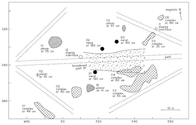
A Geophysical Survey of College Yard
28 September 2004
prepared for: Louise Lambert Kale
College of William and Mary
P.O. Box 8795
Williamsburg, VA 23187
by: Bruce Bevan
Geosight
356 Waddy Drive
Weems, VA 22576
A Geophysical Survey of College Yard
This work was done on the eastern side of the College of William and Mary. The survey revealed a broad, conductive band that extends 5 m to the north and south of the central brick walk. This band may be caused by buried remnants of a broader and earlier path; it may also be caused by the application of fertilizer or other chemicals in the area. The geophysical survey detected three objects underground at unusually large depths; these objects appear to be metallic and their depths range between 1.5 and 2 m underground. The survey also revealed a distinctive flat interface that is about 2 m wide and 0.4 m underground; this flat surface is about 20 m north of Brafferton Hall. The most important findings of this survey are plotted in Figure 4.
The Site
This geophysical survey was done in College Yard, a triangular park that is at the eastern entrance to the College of William and Mary, in Williamsburg, Virginia. The area of work is illustrated in Figure 1.
This exploration was done in order to detect features that are now underground; this is an early step in the study of the gardens that were formerly in College Yard. In the 1930's, archaeological trenches were dug along diagonals in this area (information from Andrew Edwards, Colonial Williamsburg Foundation), but the findings of that investigation are not known.
An early drawing of College Yard is available (a copy was supplied to me by Andrew Edwards); this Bodleian plate from 1740 shows eight rows of short trees extending east-west along lines across the yard. Underground evidence of these plantings or other gardens was sought with this geophysical survey.
A grid and coordinate system were set up for this survey. The reference point (called E0 N0) was defined as the southwest corner of the President's House; bushes are less dense at this corner than at the SE corner or at Brafferton Hall. The north direction was defined as the line of the west side of the President's House; this line is a magnetic bearing of about 8.6 degrees. Since this wall of the house was shaded at the time of setting up the grid, the direction is less accurate than usual. Rectangular areas of survey were set up with the aid of an optical right angle sight and a tape measure; the closure error of a grid rectangle at point E46 S70 was 0.25 m. Some features that were visible at the surface were located during the course of the survey, and these are mapped in Figure 3. These features provide a check on the location of this work; the primary check point is the corner of the lamp post at E47.6 S68. The GPS coordinate of this property is W76° 42.52' N37° 16.25'.
Page 2Several pipes and wires are underground in the yard; the known utility lines are plotted in Figure 2. This shows that electric wires are most dense in the western part of the yard. Several lines on the utility map are not labeled. One is a line that goes diagonal to the southwest from the President's House. Another is a line that wanders in the western end of the yard; it is possible that this is a topographic contour. In addition to these mapped utilities, one or more drain inlets are visible on the north side of the yard, and there must be pipes below these. There are no overhead electrical lines in the yard. While there are underground steam pipes on the campus, none show on the utility map in the area of survey.
The utility map (Figure 1 and Figure 2) locates the brick walkways that cross the yard; the thickness and the materials at the base of these walks are not known. This map also locates the nearby buildings and trees in the area. Figure 3 shows the few trees whose locations I approximated during this survey; there are differences between my survey and the utility map. Some trees have clearly been removed within the last few years, for memorial markers are visible where no trees now stand. One or two trees have grounding wires from lightning rods on them. A few small trees that have recently been planted have rings of bark mulch around them. There are no bushes in the area that was surveyed, and the ground surface is covered by mown grass. The surface is almost completely level; no topographic relief is visible. It is likely that there are few stones naturally in the soil and bedrock is probably at a depth of more than 10 m. The statue in Figure 2 was located from a historical map supplied by Andrew Edwards; the location of the cannon in Figure 3 is approximated.
Vehicular traffic is heavy on the adjacent roads. Many pedestrians cross the yard during the day; these are students, professors, and visitors to the Wren Building. Since it appeared that garden lineaments extend east-west, it was best to make geophysical measurements along north-south lines that extended completely across the yard. The guide rope that marked these lines of measurement caused little difficulty for pedestrians and bicyclists where it crossed the walks. Because of the density of trees, the guide rope could not be shifted sideways; instead, it needed to be picked up and replaced for most lines of traverse.
The main part of the college campus is to the west, while a shopping center and Colonial Williamsburg are to the east. There are no industries in the vicinity, and there are no high voltage power lines, radio transmitter antennas, or electrified railroads nearby.
The Survey
Two geophysical instruments were applied to this survey; these are sketched in Figure 21. Most of the field time was devoted to a survey with a ground-penetrating radar. This radar was a model SIR System-7, manufactured by Geophysical Survey Systems. A high frequency antenna was suitable for this survey; this was a model 3102 antenna which has a predominant frequency of 315 MHz. The main traverses were made going toward the north, and parallel lines progressed toward the west. Figure 7 locates the lines of profile. At the end of the survey, a traverse was made along line S53 as a check on features that were detected during the main survey. The control and recording equipment for the radar was stationed in my car, which was parked on the central walk during the survey.
The velocity of the radar pulse was estimated from the echoes of some underground objects, and the results are plotted in Figure 23. The radar echoes are mapped in Figure 6; clusters of similar echoes from similar depths are summarized in Figure 4.
The reverberation of the radar pulse on line E14 at S53 (Figure 18) shows at least two repeated echoes, and perhaps three. The apparent distance from the surface to the first, second, Page 3 and third echoes does not remain constant, but increases. This may be because the later echoes are represented only by lower radar frequencies, and the velocity of the radar pulse decreases with decreasing frequency.
Before the radar survey was started, a reconnaissance was made of the yard with a Geonics EM38 conductivity meter. This initial test found broad areas with high conductivity on the western part of the yard. This high conductivity indicated that the radar would not be able to profile very deeply into the soil in that western area, and therefore the radar survey emphasized the eastern side of the yard. After the radar survey was finished, the western part of the yard was mapped with the conductivity instrument. This mapped survey revealed that the readings of high conductivity were caused by pipes or wires that are probably more than 1 m underground, and not by conductive soil. Deep utility lines are rare, and these were not recognized as utilities during the reconnaissance.
The mapped conductivity survey was made with traverses along the same lines as those that were profiled with the radar; these lines were spaced by 4 m. Recorded measurements were made going toward the north at intervals of 0.5 m. The readings were recorded with a Metrosonics model dl-3200 data logger that was programmed to sample the voltage from the EM38 meter at intervals of 1 s; the traverse speed was set at 0.5 m/s. In order to correct for the measurement lag and averaging of the EM38 and data logger, the readings were shifted back by 1 m from the points where the values were recorded. Since the locations of the lamp wire from the radar and EM38 surveys agree, this shift was correct.
The conductivity meter was operated in its normal mode. The magnetic dipoles were vertical and the length of the instrument was aligned with the direction of traverse. Only conductivity readings were recorded. The instrument was operated within a thermal shell composed of slabs of Styrofoam that were one inch thick; this reduced changes in the readings caused by warming and cooling. The bottom of the EM38 was at a height of about 10 cm above the ground surface; the conductivity measurements and the interpreted depths have not been adjusted for this height.
The noisiness of the measurements was tested at two times and locations and the findings are plotted in Figure 24; electrical interference did not cause a significant difficulty for the survey.
The measurements of conductivity within the range of 18 and 80 mS/m are plotted in Figure 9. Since the actual range of the readings was much wider, three additional maps illustrate different spans in the amplitudes of the measurements. The most important intermediate values are mapped in Figure 10. Negative values, which indicate shallow metal, are plotted in Figure 11. High positive values, which usually mean deep metal, are plotted in Figure 12.
While shallow metallic objects are often detected at archaeological sites, deep metallic objects are rarely found. During this conductivity survey, three such deep objects were located by the EM38. The lines of measurement that cross each of these objects are plotted in Figures 14 - 16. Geophysical tests that were made at the Petersburg National Battlefield (Geophysical Exploration for Archaeology, NPS print, 1998, p. 33 and Figure B61) indicate that the depth of a compact metallic object that causes unusually high readings is about equal to the width of the anomaly at half its maximum amplitude. This interpretation has been applied to the estimation of the depths of the three objects that are marked with filled circles in Figure 4.
Many other objects were detected by the EM38 with negative readings; these objects are almost certainly metal. While their depth cannot be interpreted, these depths are probably less than 0.5 m underground.
A magnetic survey was not attempted in this yard because of the heavy trucks that pass on the nearby roads. At a distance of 10 m, these trucks would cause a magnetic gradient of at least 23 Page 4 nT/m; at a distance of 20 m, the gradient would probably be more than 2 nT/m. This geophysical survey was done on September 1 and 2, 2004. There was no rainfall during those two days, and temperatures were warm to cool.
Findings of the Geophysical Survey
The most important results of this survey are plotted in Figure 4; secondary findings are shown in Figure 5.
The clearest and most certain finding of the radar survey was a flat surface that is located in the central part of the southern yard; this is feature R1 in Figure 4, where it is marked with cross-hatching. There is a sharp change in the soil at a depth of 0.4 m at this location; Figure 18 is a radar profile that crosses this feature. The soils that are above and below at this feature cannot be determined from the radar, but the feature could be caused by a layer of clay, ash, or cinders, since these materials have electrical properties that are very different from the normal sandy soil. Little is known about the shape of the feature since it was detected on only two perpendicular lines of profile.
Several other features were detected that have planar interfaces; these are indicated in Figure 4 with diagonal hatching and the letter P. These features have flat surfaces where there is a large change in the soil with depth. Therefore, some of these features could be caused by cultivation or mulching. An illustration of a radar profile with a planar feature is shown in Figure 19; the echo at S28 is mapped in Figure 4 as planar feature P1.
Another class of feature was revealed by the radar because of a greater complexity of its echo patterns. These findings are plotted in Figure 4 with X patterns that fill the area of the features. The radar profile of Figure 17 shows this complex pattern between S50 and S40; this is part of feature C3 in Figure 4. The roots of larger trees in the yard can also cause this complex type of echo pattern; the findings of complex echoes in the vicinity of large trees have been excluded in the summary of Figure 4. The undecayed roots of large trees that have been removed can cause the same complex pattern.
The conductivity survey traced at least five underground pipes or wires; these were primarily on the western, southern, and northern sides of the yard. The spatial density of these utility lines prevented the detection of archaeological features of interest in the vicinity of the metallic pipes and wires. Fortunately, the eastern part of the yard has few buried utilities.
The survey in the eastern yard revealed a broad feature with high electrical conductivity. Figure 13 shows its width as compared to that of the central walk. The unusual conductivity could be caused by buried remnants of a broad former walk that was constructed of ash, cinders, or clay. It is possible that the materials of the path were spread to the north and south by pedestrians walking on the path. The high conductivity band could also be caused by the fertilization of plants that were once on the north and south sides of the walk. If de-icing salts have been spread on the current brick walk on icy winter days, these salts might also be the cause of the high conductivity. The radar and conductivity surveys both give hints that there may be segments of a buried pipe or wire beneath some spans of the central walk; if there is a buried utility line there, it is unlikely to be the primary cause of this geophysical pattern.
There is a suggestion on the conductivity map (Figure 10) that the readings may also be high at the northern walk; underground wires or pipes near the southern walk prevent an evaluation there.
The conductivity survey located a number of metallic objects that are at a shallow depth (less than 0.5 m), and these are indicated in Figure 5 with asterisks. In addition, three objects were very clearly detected, and these are located in Figure 4 with filled circles. These objects are probably Page 5 metallic, and they are probably deep (1.5 - 2 m underground). These types of objects are rarely detected during conductivity surveys, and none have been excavated; therefore, the interpretations of metal and the large depths are not certain. The three objects are near the middle of the yard. In principle, the stump of a metallic flagpole might cause a conductivity pattern that is similar to these; metal in a well or privy could also cause these patterns, but these features are probably unlikely in this area. The lines of measurement during the conductivity survey were 4 m apart, and this affects the findings in two ways. First, there may be additional objects like these that remain undetected between lines of measurement. Second, the objects could be as much as 1 m or so to the east or west from the points that are marked at the centers of the filled circles in Figure 4.
Figure 5 shows the paths of buried pipes or wires that were traced by this geophysical survey; many of these are not included in the utility map of Figure 2. This may be because these pipes or wires are old or abandoned. The buried wires that supply electrical power to the lamps that border the yard were readily traced with both the radar and the conductivity meter. Most of the other utility lines were detected by only one of the two instruments. The radar profile of line W6 (Figure 19) shows a flat interface at S54 and just north of the southern path. The perpendicular profile revealed that this echo actually was not caused by a flat interface, but was apparently due to a buried pipe or wire that is extended along the line of the north-south profile. This feature, U9 in Figure 5, is probably part of utility line U8. The line of utility U7, at the northwest side of Figure 5, could not be traced accurately because there are so many other objects in its vicinity. Utility line U3 may have been detected on a few radar profiles at a depth of about 52 cm. The possible utility line U10 on the east side of the yard may simply be a coincidental alignment of conductivity anomalies.
At two locations along the brick paths, the radar detected soil interfaces on the north sides of the path; these interfaces dip down toward the north. The two locations are labeled I1 and I2 in Figure 4. While the cause of these echoes is not known, they may not have any archaeological importance.
The radar found few echoes on the north side of the central walk; this finding is plotted in Figure 5. It is possible that this effect may be a result of past landscaping in the area. The typical radar echo in the yard was from a depth of about 0.6 m (Figure 20). The depths of radar echoes in different parts of the yard are plotted in Figure 8. There are two areas where clusters of echoes are shallower than normal; echoes are also generally deeper in the northern half of the yard. These effects can be due to landscaping and the thickness of fill soil; they may also just be coincidences.
The approximate orientations of the three main buildings that are on the sides of College Yard are indicated in Figure 25 along with an estimate of the changing direction of magnetic north at Williamsburg (the declination data is from the computer program USHD from the National Geophysical Data Center). The declination data do not extend back to the construction of the Wren Building (1695), but perhaps historical declination data are available for that period from early surveyors or navigators.
Conclusions
While this geophysical survey has suggested that the central path in College Yard may once have been much broader, this finding is not certain. It is possible that fertilization or de-icing salts are the cause of the broad geophysical anomaly. It is not impossible that fragments of a pipe or wire below the path might be part of the cause of the high readings.
It is most likely that three deep metallic objects have been detected near the middle of College Yard. While it is certain that three objects were detected, the interpretation of metal and large depth Page 6 is not absolutely certain. There is a good chance that other, similar objects were not detected in the yard because of the wide spacing between lines of measurement. Should it ever be desired to test these locations with excavations, it could be beneficial to accurately determine the exact locations of the objects with a small resurvey with a conductivity meter.
While there remain some geophysical uncertainties about the width of the path and the source of the apparently deep objects that cause the high conductivity anomalies, the finding of the flat surface north of Brafferton Hall is certain. If excavation should find that the depth of this surface is not 0.4 m, the actual depth will allow the other radar-estimated depths to be corrected.
Both the radar and conductivity surveys were suitable for this exploration. The geophysical data suggest that it was better that both instruments were applied with a coarse spacing between of measurements rather than the alternative of using only one instrument with a finer line spacing. In the western part of the yard, the conductivity survey detected only buried pipes and wires; any patterns from archaeological features of interest were obliterated by the strong patterns from these utility lines.
Neither geophysical survey detected any evidence of the earlier rows of trees that were once in the yard. While the surveys did provide hints of possible landscaping, no clear geometric patterns were revealed that might suggest garden plots. The geophysical surveys also did not detect the archaeological trenches of the 1930's. Excavations, like garden beds, are difficult to detect with normal geophysical procedures where these features are shallow.
The utility of geophysical exploration for the exploration of gardens would increase if detailed geophysical measurements could be made where archaeological excavations have already revealed garden features. If the geophysical characteristics of garden features are found to differ significantly from nearby non-garden soils, then economical and reliable procedures of exploring gardens may be possible.
Cultivation depth is a particularly important garden variable that might be quantified by geophysical tests. These soil interfaces may be at a depth of only 10 - 30 cm, and normal geophysical procedures are not particularly suitable for their location or study. Prior experiments have suggested that seismic refraction surveys may be able to provide this information (because of the softness of cultivated soil), but refraction measurements are slow. Soil penetrometer measurements may also be able to estimate the depth of cultivation; penetrometers are used by farmers to quantify the compaction of soils in their fields. It is possible that modern vehicular traffic on the present soil surface (such as lawn mowers) may compress the soil and make refraction and penetrometers surveys less certain.
It is possible that organic processes in the cultivated soil of a garden bed have made that cultivated soil more magnetic. The thickness of this magnetic layer (and therefore the cultivated layer) may be determined with measurements of the magnetic susceptibility of the soil in bored holes. A new procedure called magnetic susceptibility sounding may provide an alternative procedure, and no bored holes are needed.
If shallow garden beds are discovered in excavations, geophysical tests could be made on the adjacent undisturbed soil to see if a very high resolution radar antenna could detect the shallow soil interface.
Geophysical measurements could also be made on the soils that have been removed from garden beds; the magnetic and electrical properties of these soils may differ from the properties of uncultivated soils that are found at the same depth. These comparative tests may aid future geophysical surveys in detecting these garden features.
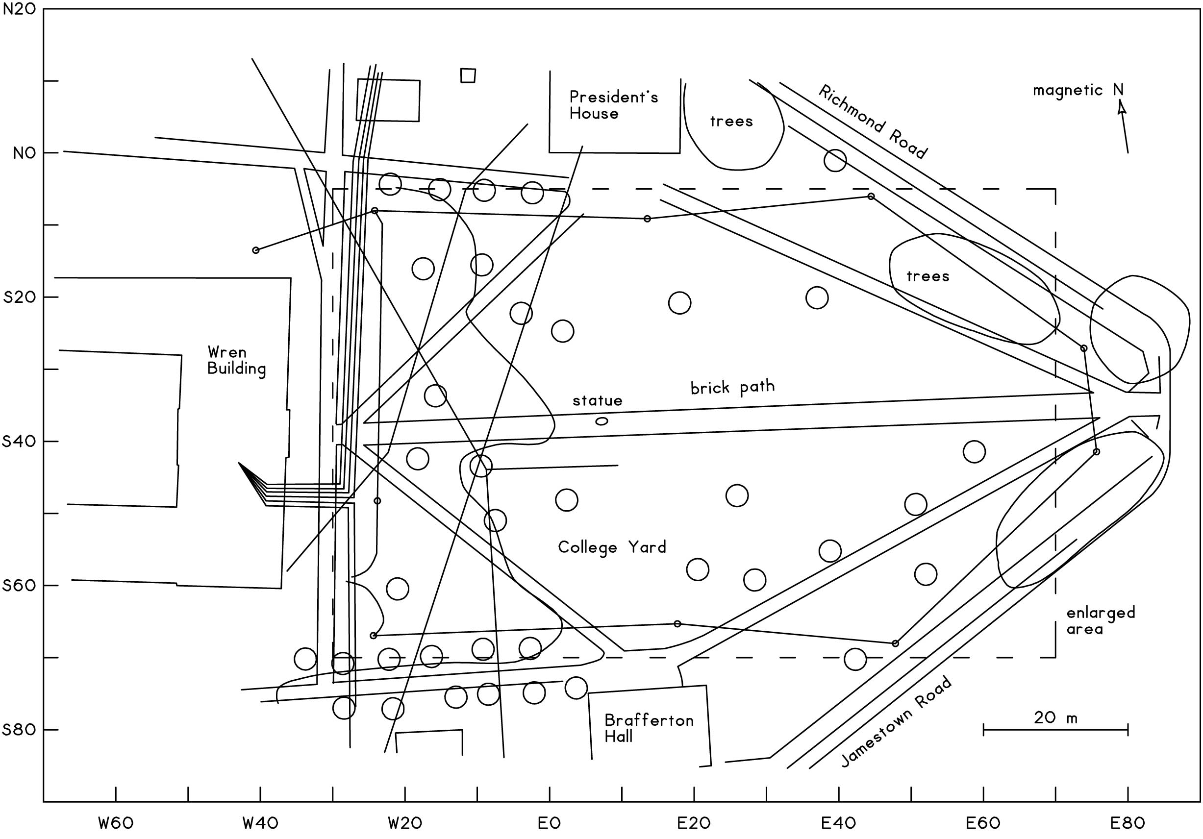 Figure 1: The vicinity of the surveyed area. The work was done in the College Yard at the east side of the
College of William and Mary. The broken line rectangle shows the area that is enlarged in the following figures.
This is a tracing of a utility map that was supplied by Loise Kale.
Figure 1: The vicinity of the surveyed area. The work was done in the College Yard at the east side of the
College of William and Mary. The broken line rectangle shows the area that is enlarged in the following figures.
This is a tracing of a utility map that was supplied by Loise Kale.
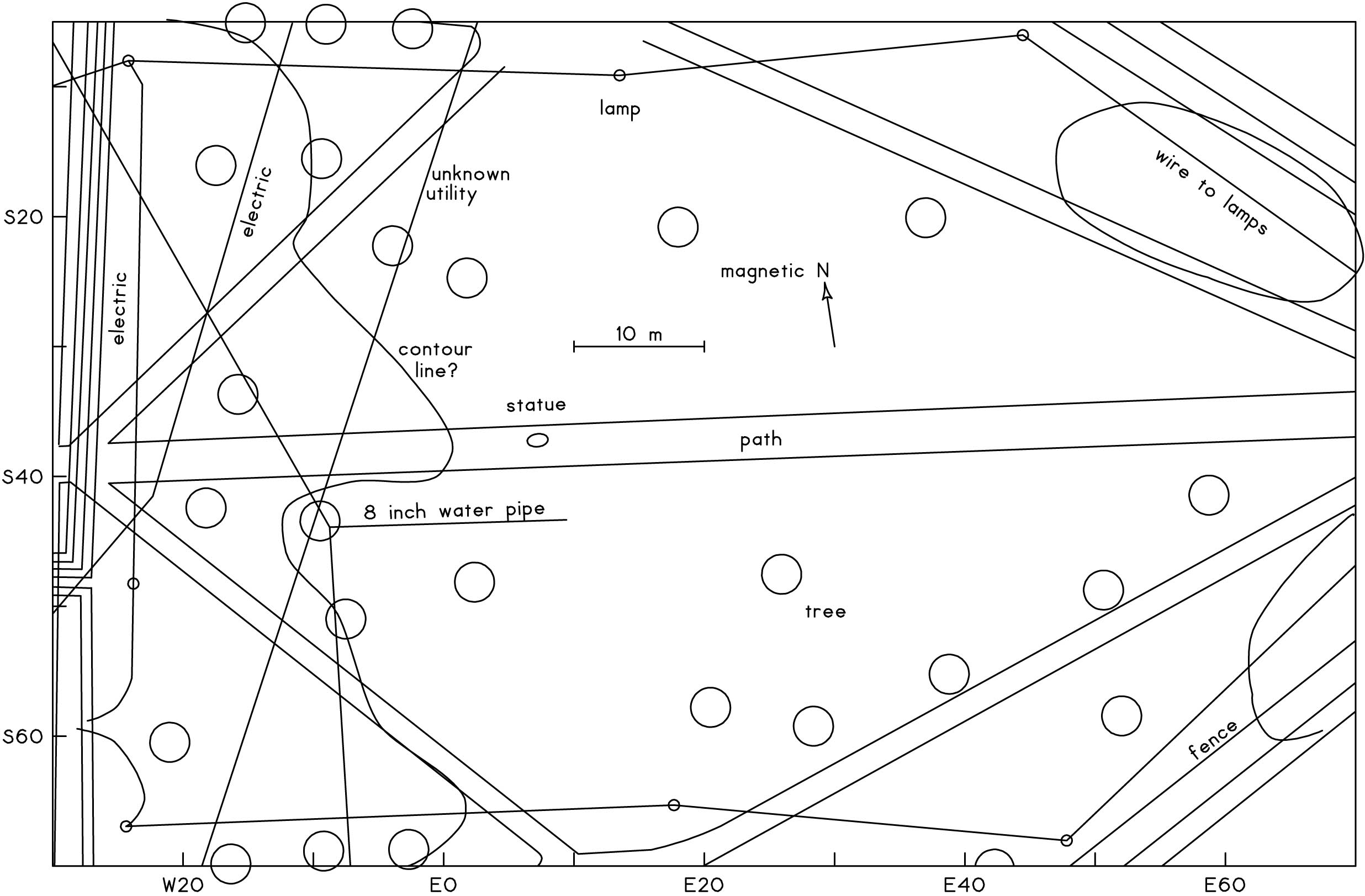 Figure 2: The area of survey. Radar and conductivity surveys were done within this area. Many pipes and wires
are underground in the western part of the area, and a wire going to some lamps encircles the yard. This is an
enlargement of the central part of Figure 1.
Figure 2: The area of survey. Radar and conductivity surveys were done within this area. Many pipes and wires
are underground in the western part of the area, and a wire going to some lamps encircles the yard. This is an
enlargement of the central part of Figure 1.
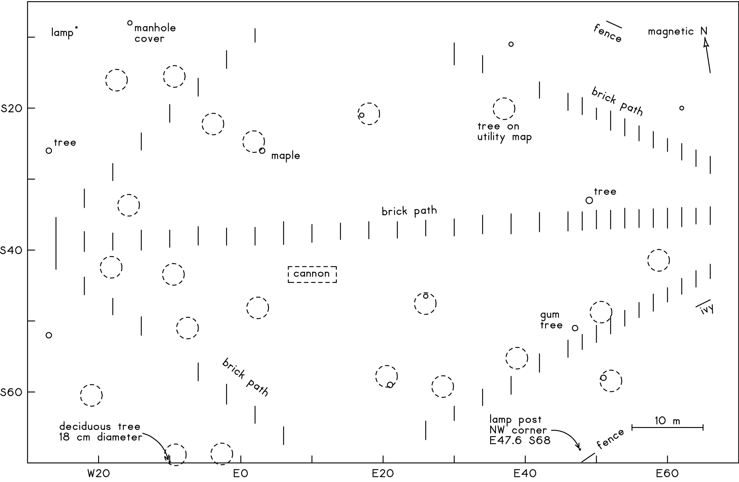 Figure 3: Surface features in the area of survey. Broken line circles indicate the trees in Figure 2. The remaining features were mapped during the geophysical survey. Small circles show the trunk diameters of some trees. Vertical line segments locate where the brick path was detected on the radar profiles.
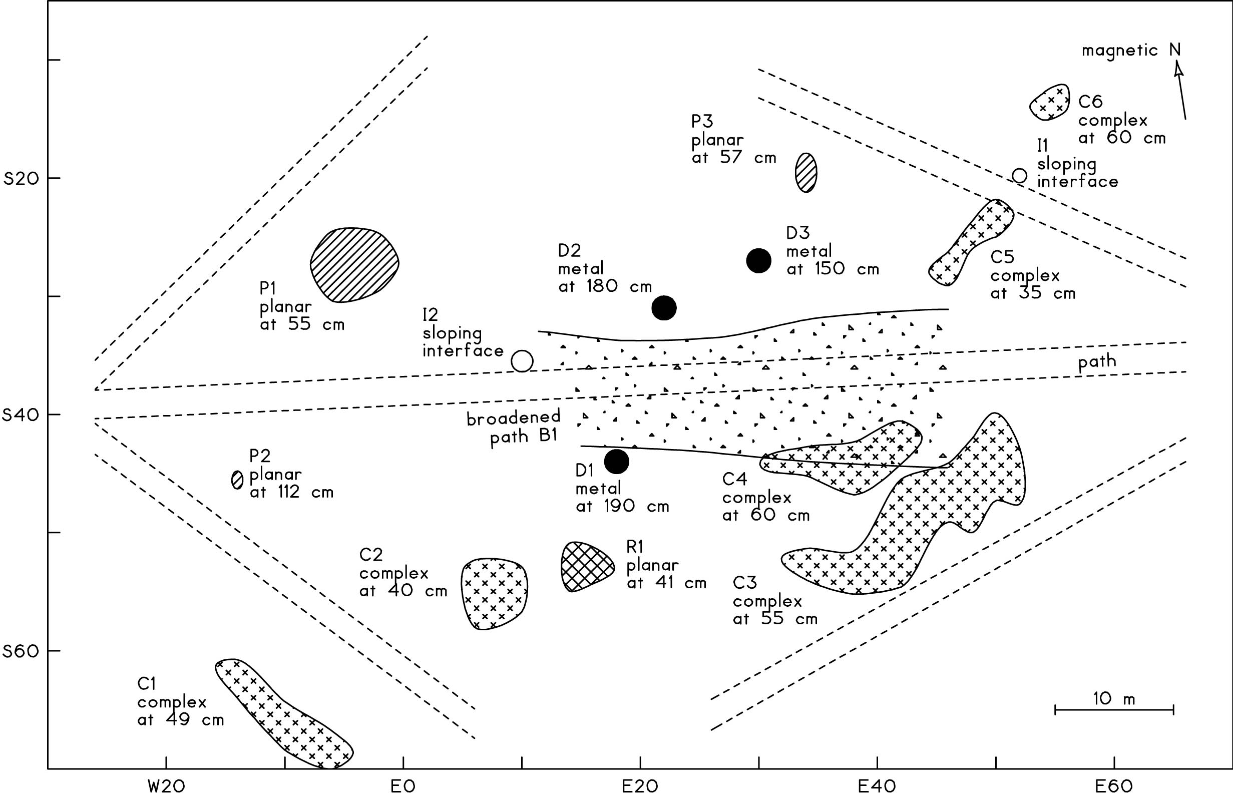 Figure 4: The main findings of this survey. The central dotted pattern shows a conductive band that is broader
than the visible brick path. Three filled circles locate objects that are at a depth of 1.5 - 2 m. The most distinctive
finding of the radar was a flat surface (R1 at E18 S54) that is north of Brafferton Hall.
Figure 4: The main findings of this survey. The central dotted pattern shows a conductive band that is broader
than the visible brick path. Three filled circles locate objects that are at a depth of 1.5 - 2 m. The most distinctive
finding of the radar was a flat surface (R1 at E18 S54) that is north of Brafferton Hall.
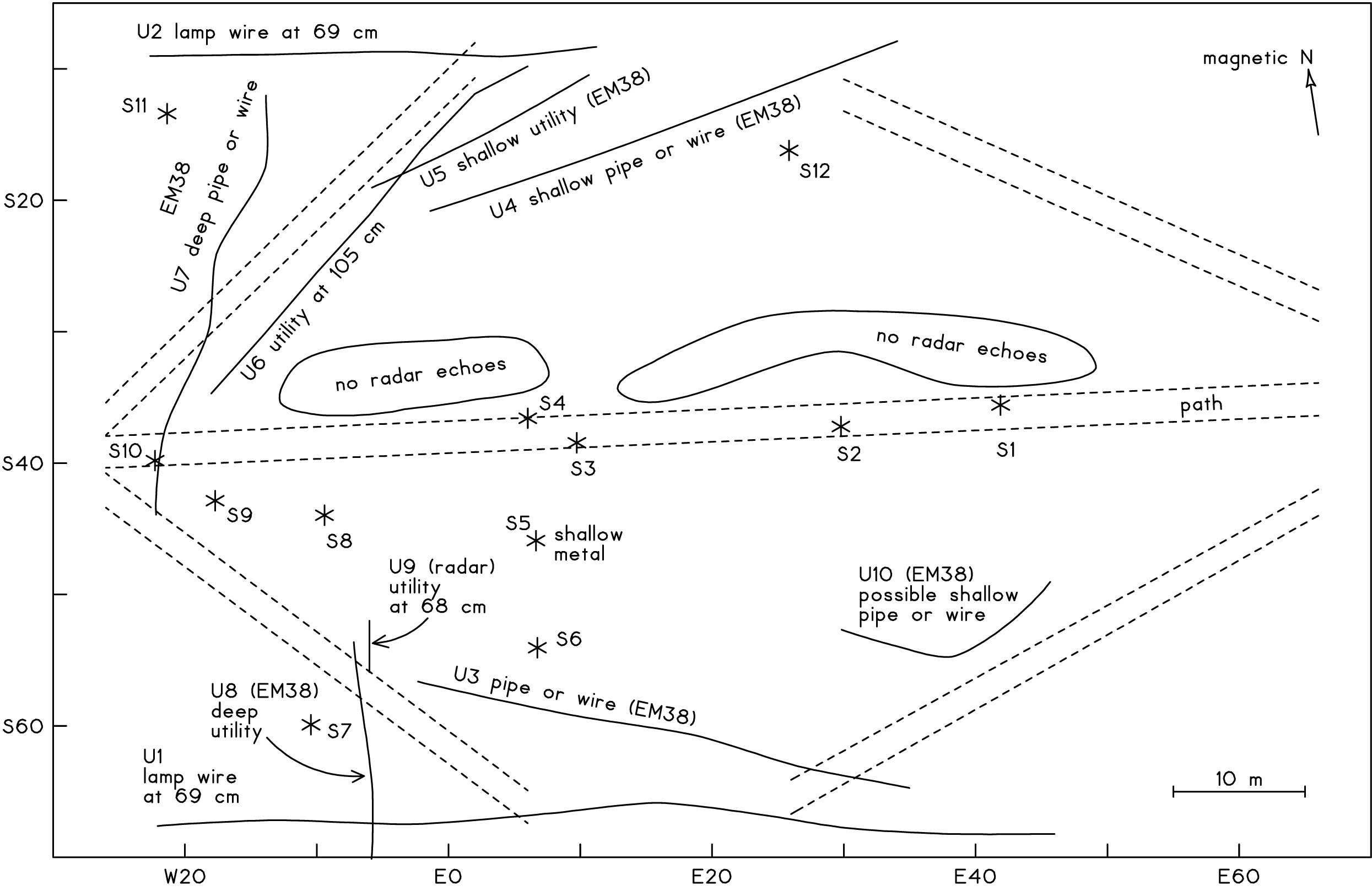 Figure 5: Other findings of the geophysical survey. Solid lines mark segments of several possible underground pipes or wires. Asterisks locate where a dozen shallow metallic objects were detected. There were bands on the north side of the central brick path where very few objects were detected by the radar.
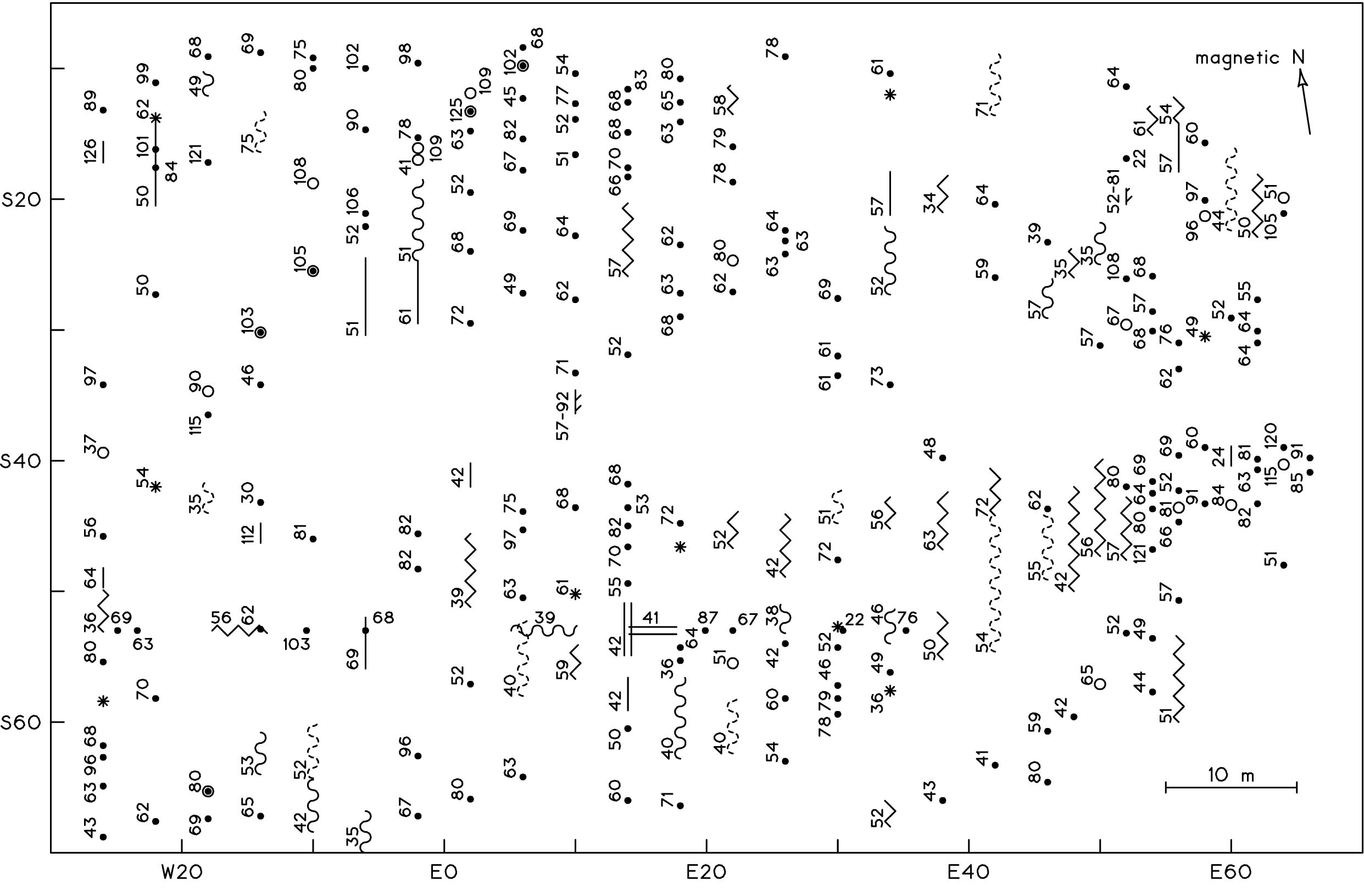 Figure 6: The radar echoes. The symbols are described in Figure 22. The numbers next to the symbols list the estimated depths of the objects that cause the echoes; these numbers are in centimeters (their precision is greater than their accuracy). A total of 248 echoes are plotted here.
 Figure 7: The lines of radar profile. These were spaced by 2 m on the eastern part of the area, but 4 m in the remaining area. A total of 30 lines were profiled, and the sum of their lengths was 1604 m. A single line was profiled in an east-west direction; for the remaining lines, the traverse direction was toward the north.
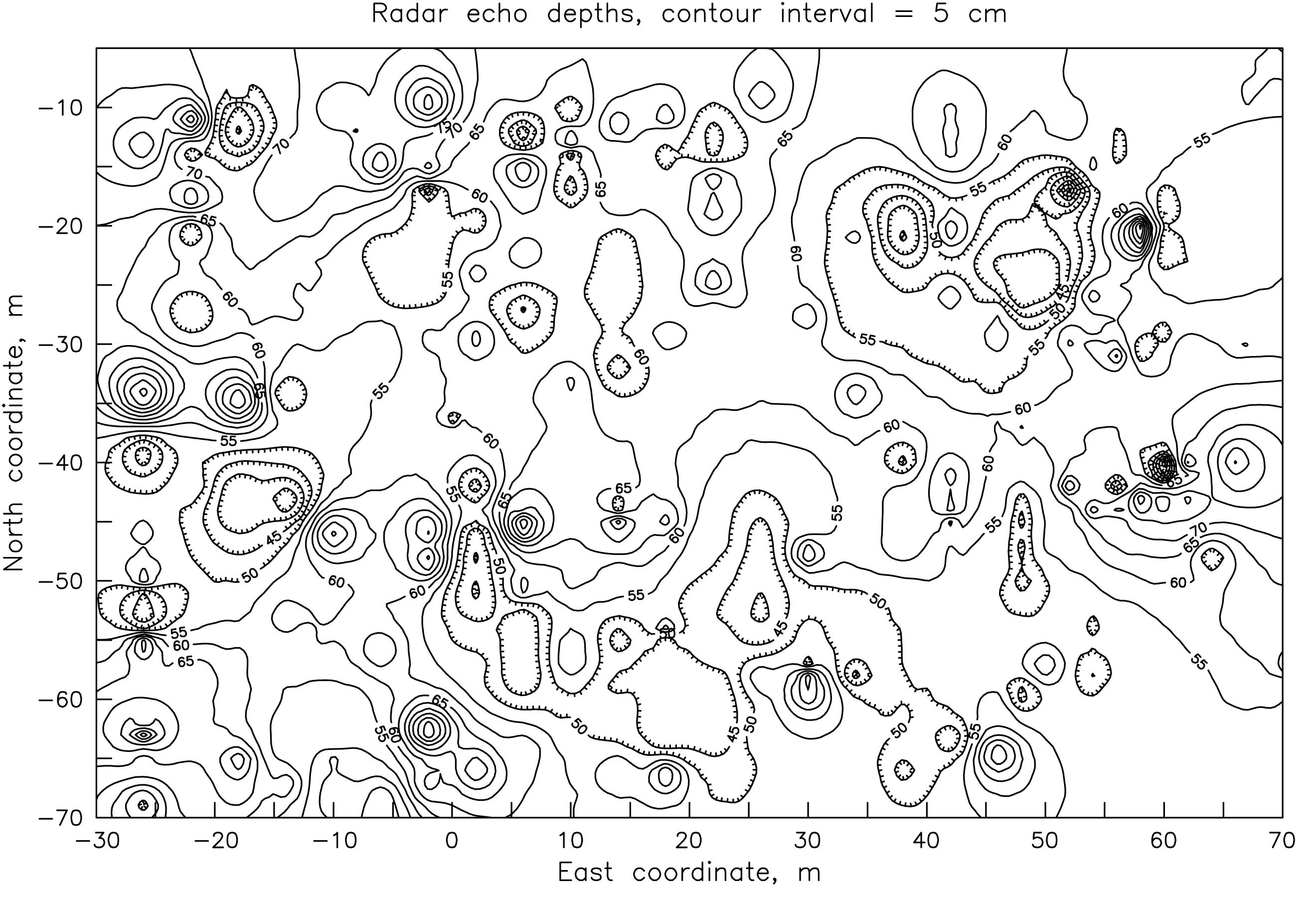 Figure 8: The average depth of the radar echoes. Echoes were most shallow near E45 S25 and E20 S60. Objects also appear to be generally deeper in the north half of the area as compared to the south. Echo depths greater than 1 m were not included in the averaging, which had an inverse-distance-squared weighting to a radius of 20 m.
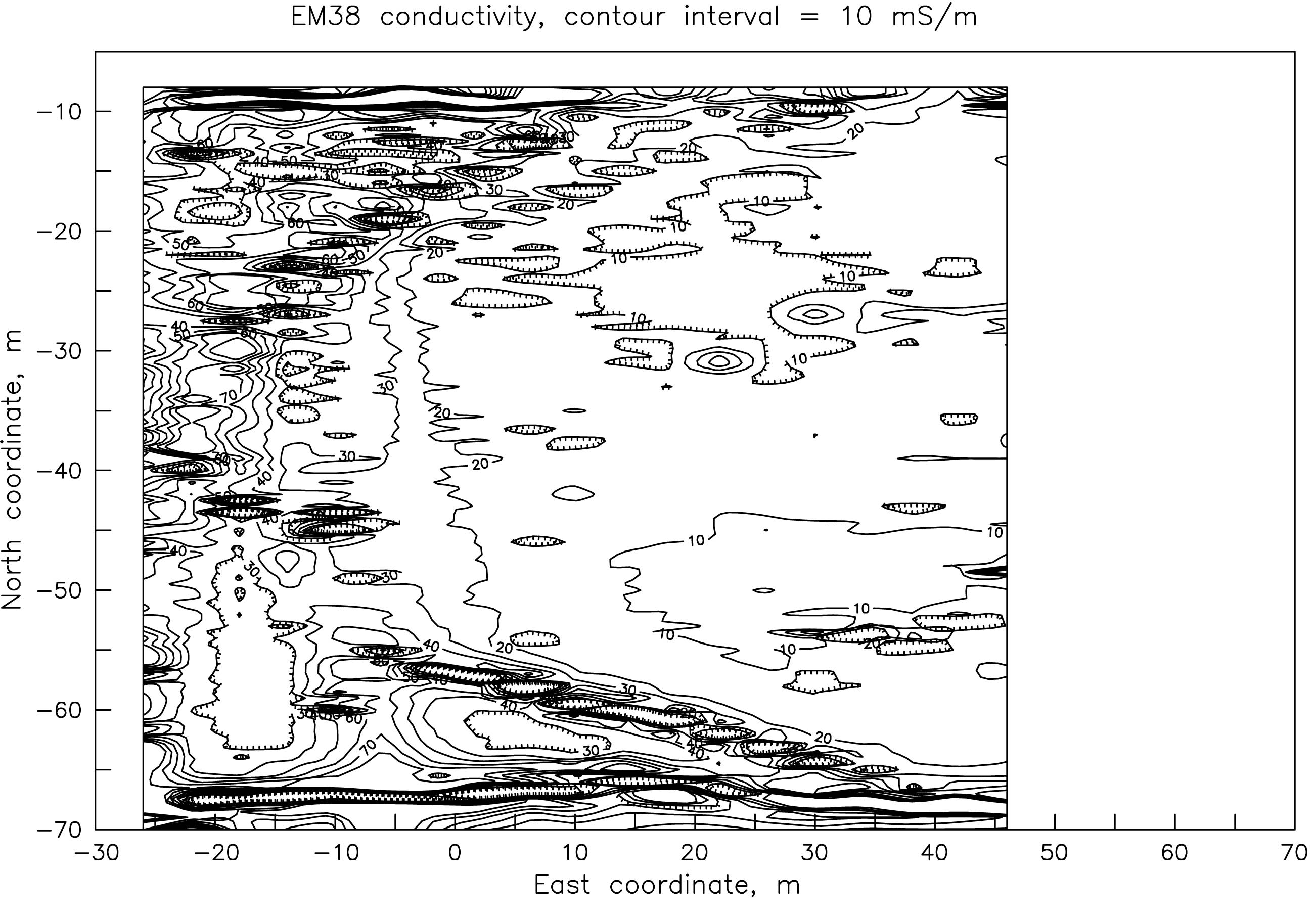 Figure 9: The conductivity map. This was measured with the Geonics EM38 meter. Buried pipes and wires cause the large and linear patterns in the western, northern, and southern parts of the area. In the less-affected triangular area on the east, the electrical conductivity of the soil is less than 10 millisiemens per meter.
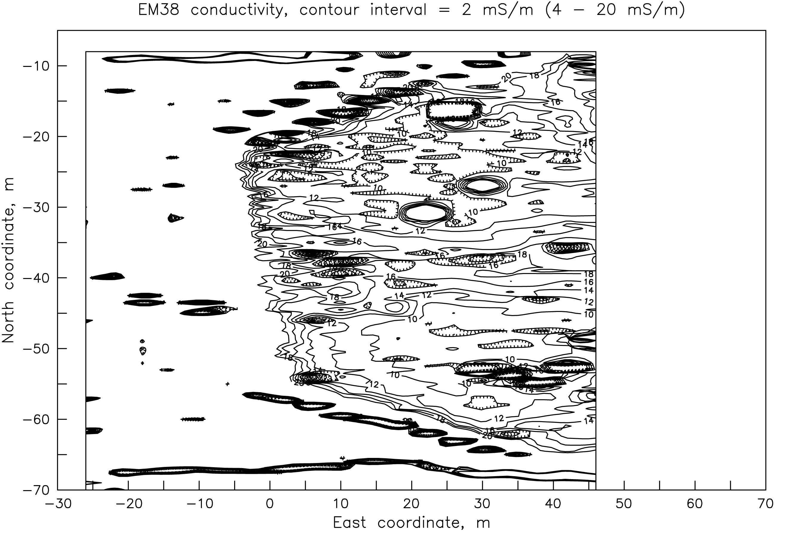 Figure 10: An amplification of the important conductivity patterns. This clarifies the smaller changes in conductivity in
the eastern area and reveals the high readings that border the central path. Small-area anomalies are elongated
east-west because the lines of measurement were spaced by 4 m.
Figure 10: An amplification of the important conductivity patterns. This clarifies the smaller changes in conductivity in
the eastern area and reveals the high readings that border the central path. Small-area anomalies are elongated
east-west because the lines of measurement were spaced by 4 m.
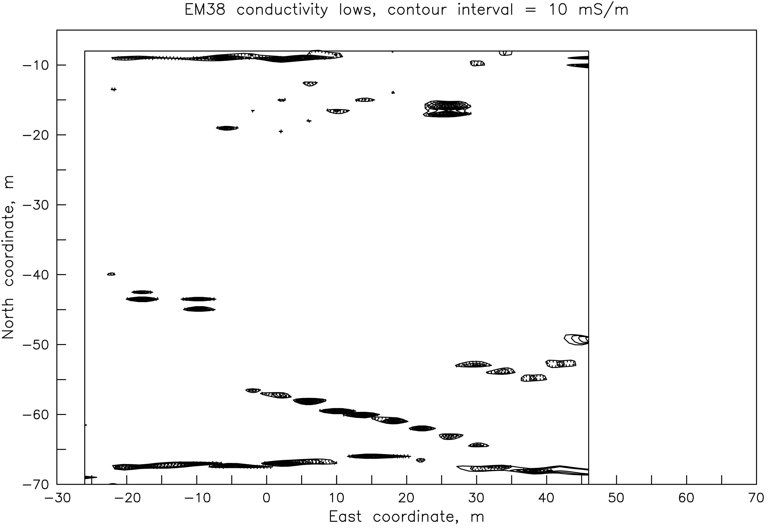 Figure 11: Negative readings of conductivity. The EM38 gave values of less than zero in these areas. These
"impossible" readings are caused by metallic objects that are rather shallow underground (probably less than 0.5 m).
These negative readings typically form lines; these lines are caused by buried pipes or wires.
Figure 11: Negative readings of conductivity. The EM38 gave values of less than zero in these areas. These
"impossible" readings are caused by metallic objects that are rather shallow underground (probably less than 0.5 m).
These negative readings typically form lines; these lines are caused by buried pipes or wires.
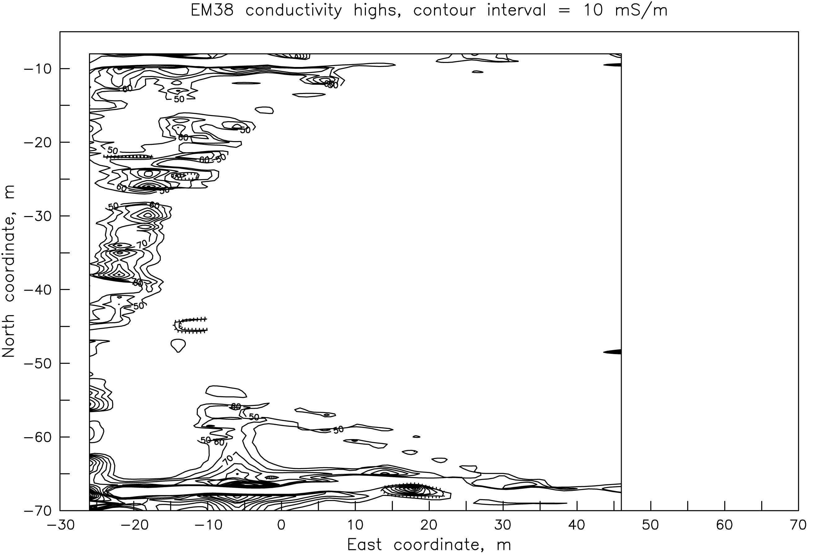 Figure 12: Unusually high conductivity. The readings in these areas are higher than is natural for the soil here.
Almost all of these extreme readings (conductivity > 50 mS/m) are caused by metallic pipes or wires that are rather
deep underground (perhaps greater than 1 m).
Figure 12: Unusually high conductivity. The readings in these areas are higher than is natural for the soil here.
Almost all of these extreme readings (conductivity > 50 mS/m) are caused by metallic pipes or wires that are rather
deep underground (perhaps greater than 1 m).
 Figure 13: Average conductivity in the eastern yard. The straight line segment locates the path. The soil is unusually conductive for a distance of about 5 m to the north and south of the path. These conductive bands may be caused by ash or cinders of a former and broader path, or by fertilization in this area.
 Figure 14: A conductivity profile of line E18. This shows a small area of high readings
around S44 (North -44); this may be caused by a metallic object (perhaps to the east or
west) that is at a depth of roughly 1.9 m. Small symbols locate the measurements, which
were at intervals of 0.5 m.
Figure 14: A conductivity profile of line E18. This shows a small area of high readings
around S44 (North -44); this may be caused by a metallic object (perhaps to the east or
west) that is at a depth of roughly 1.9 m. Small symbols locate the measurements, which
were at intervals of 0.5 m.
 Figure 15: A conductivity profile of line E22. The sharp peak at S31 is probably caused by
a metallic object that is at a depth of 1.8 m. The large swings in the readings at the north
and south ends of the profile are caused by metallic utility lines.
Figure 15: A conductivity profile of line E22. The sharp peak at S31 is probably caused by
a metallic object that is at a depth of 1.8 m. The large swings in the readings at the north
and south ends of the profile are caused by metallic utility lines.
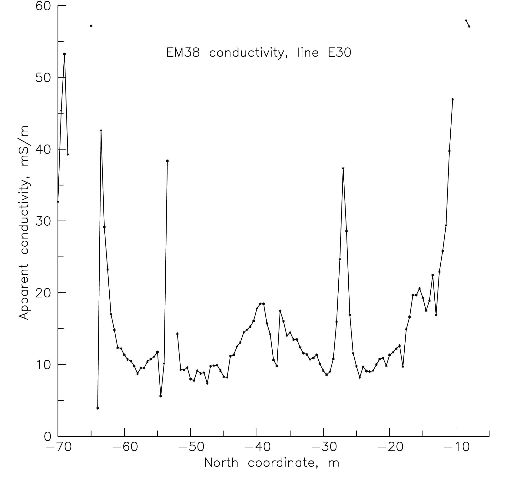 Figure 16: A conductivity profile of line E30. A third deep metallic object is revealed by the high readings at S27. This object may be at a depth of 1.5 m underground. The conductivity is low right at the path, which is at S38 -S35.6 on this line. To the north and south of the path, the conductivity is high.
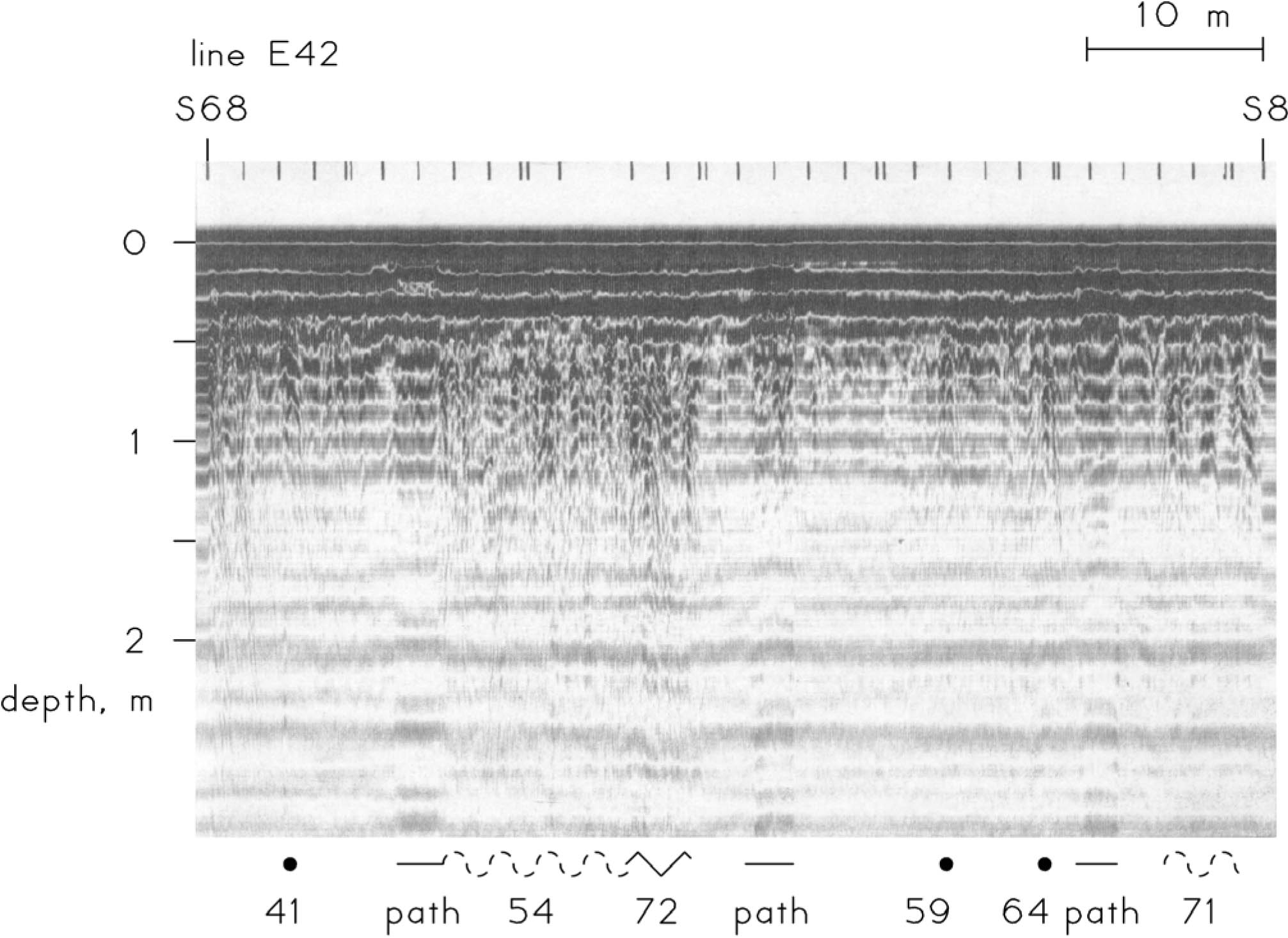 Figure 17: A radar profile of line E42. This shows an area of complex stratigraphy near S50. While there is a gum tree about 5 m to the east, its roots may not be the source of this complexity. Tick marks at the top of the profile are at intervals of 2 m.
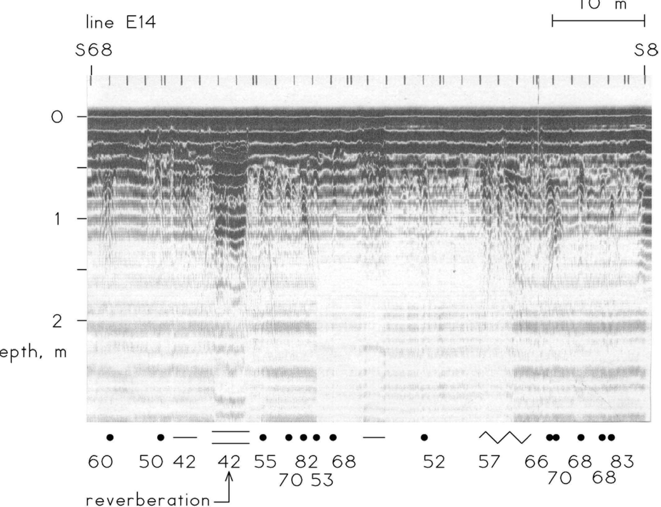 Figure 18: A radar profile of line E14. The planar echo bands on the left side (S52) of this profile are caused by a flat surface that is 2 m wide and at a depth of about 0.4 m. The change in the soil at this feature is so large that the radar pulse reverberates between the interface and the earth's surface.
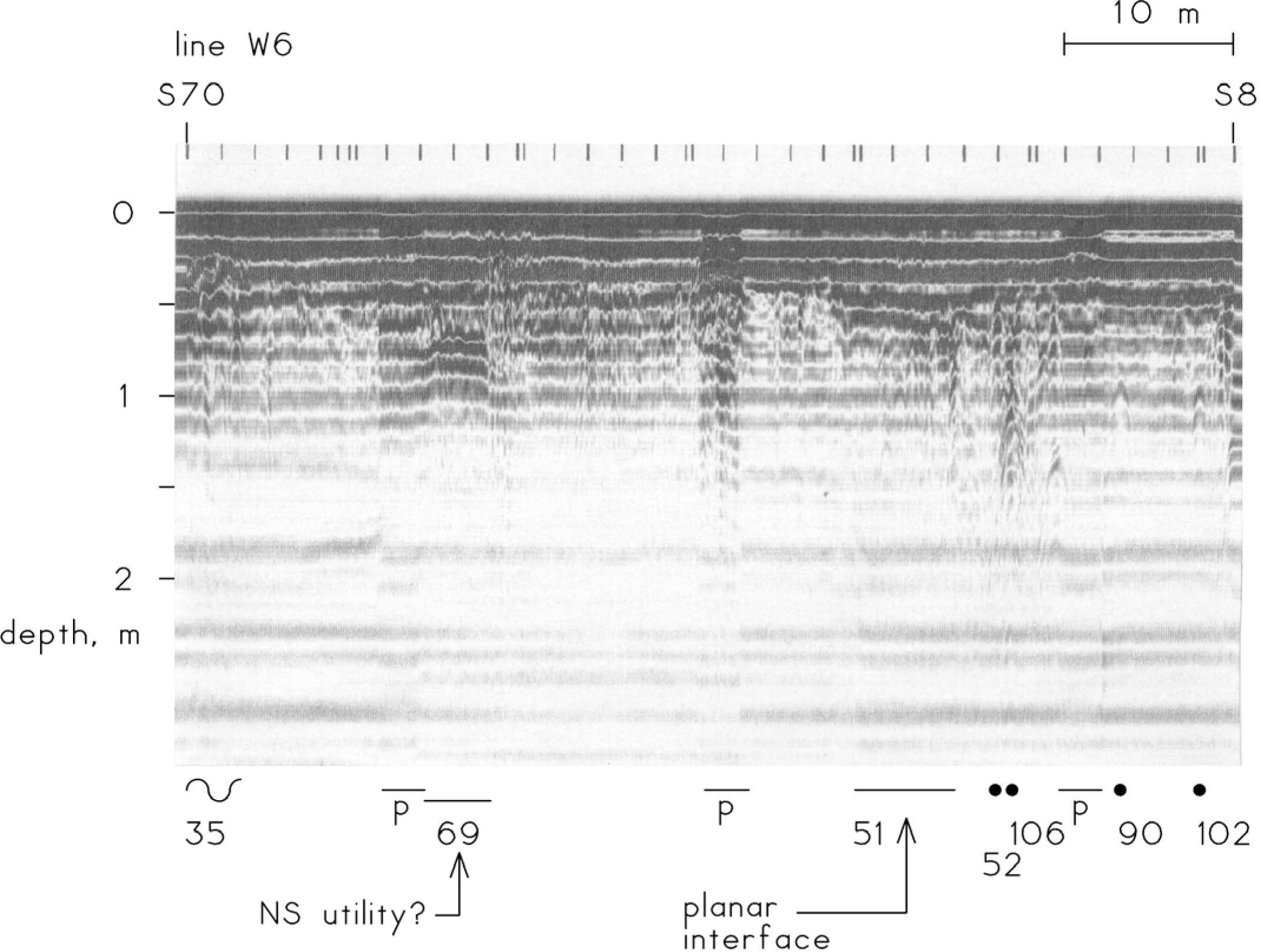 Figure 19: A radar profile of line W6. Echoes at the three brick paths are marked "p". Just north of the southern path, and at S54, a planar echo may be caused by a buried pipe or wire that goes in a north—south direction.
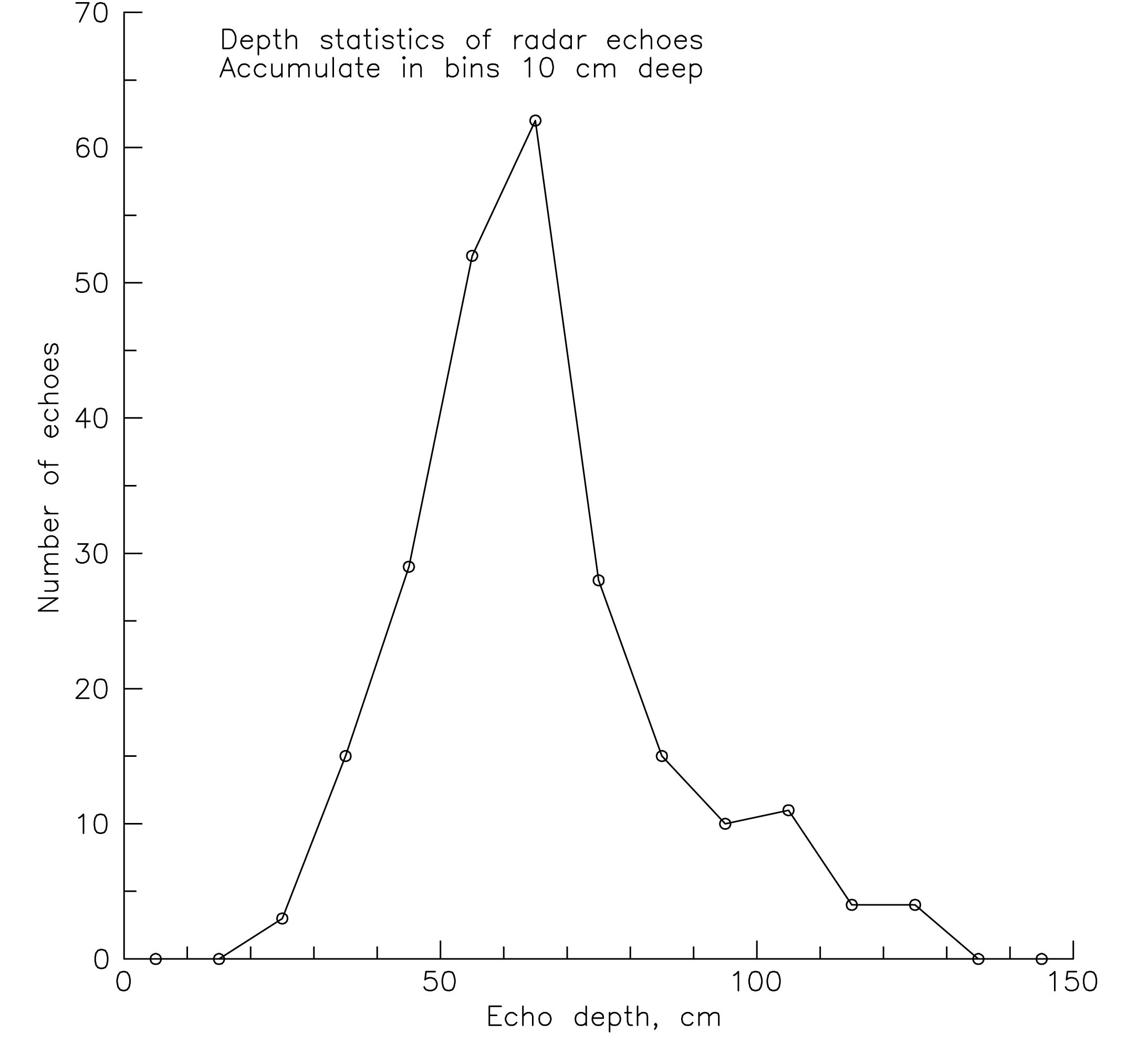 Figure 20: The depths of the radar echoes. They were most frequently detected at a depth of about 0.65 m. The range of depths that are plotted in Figure 6 is 0.22 to 1.26 m. Most of the deepest echoes were caused by a utility line at the northwest side of the area.
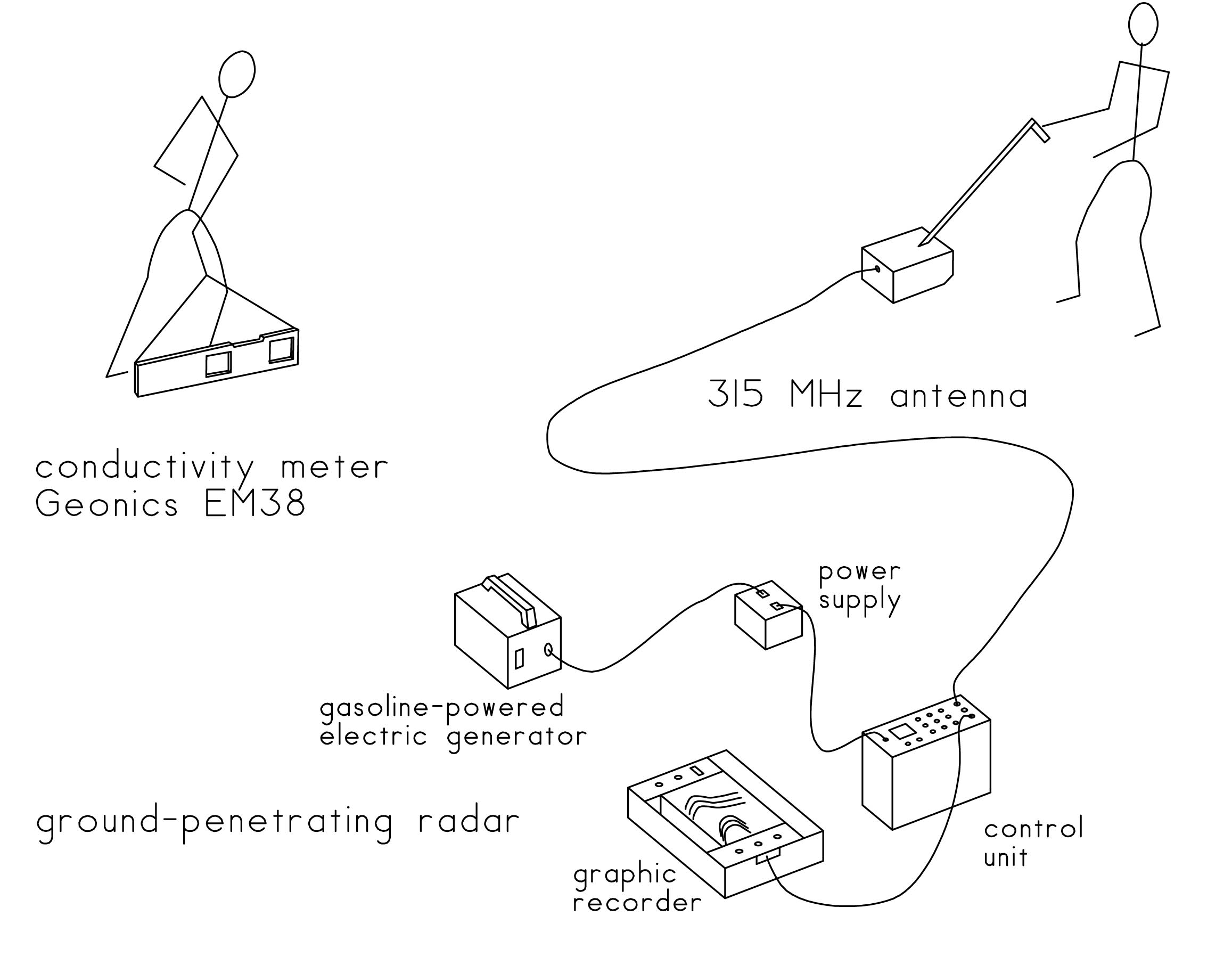 Figure 21: The equipment of this survey. Both the radar and the conductivity meter were suitable for this site. A high resolution, model 3102, radar antenna profiled the soil to a depth of about 2 m. The conductivity meter measured the surface—weighted electrical conductivity of the soil to a depth of about 1.5 m.
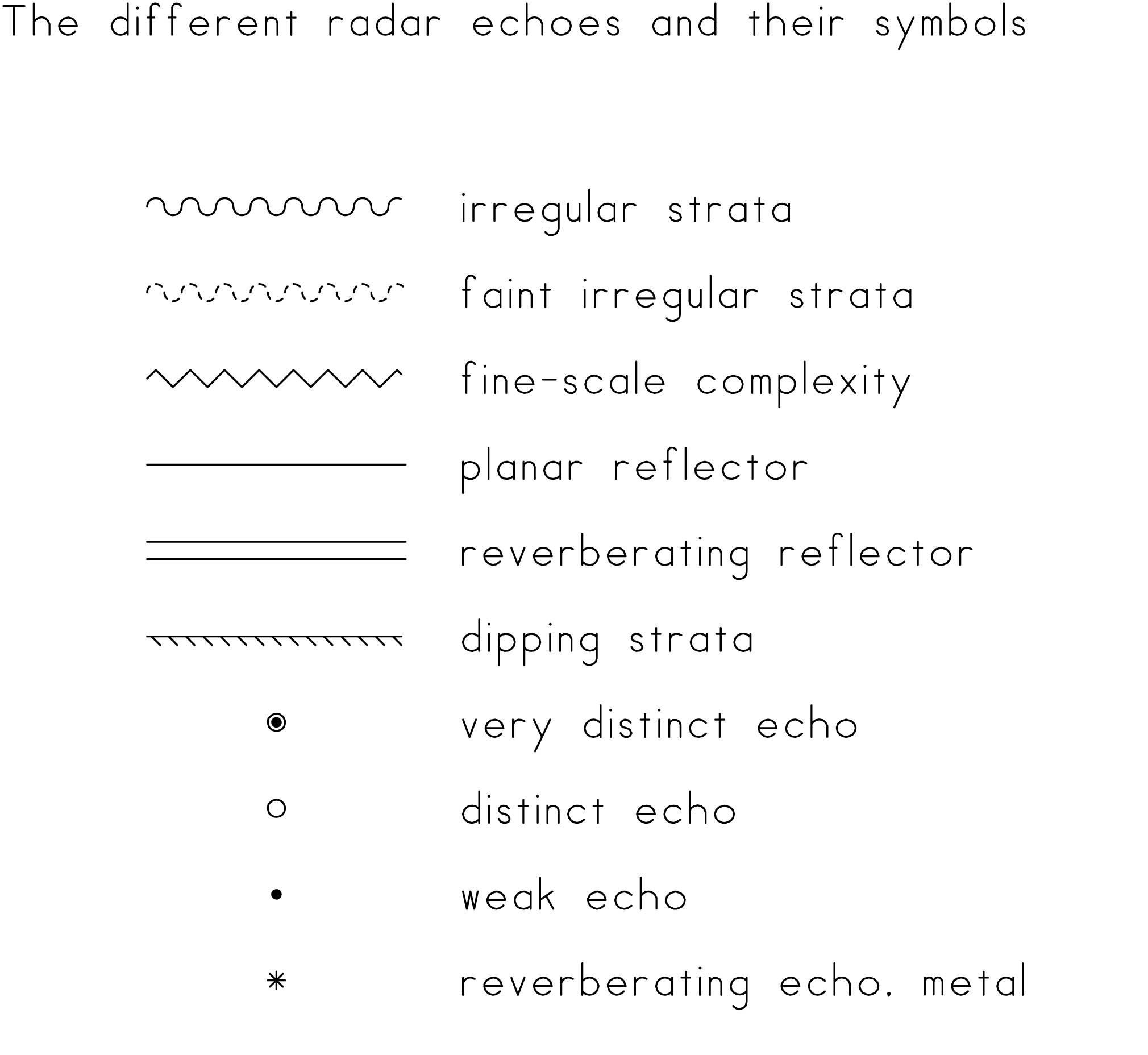 Figure 22: The echo symbols. Extended symbols indicated broad reflectors. The symbols for irregular strata mark those echoes that vary over a width of 0.5 m or more; fine-scale complexity marks the span of smaller echoes. Circular symbols indicate compact objects, and the symbols mark the clarity of the echoes.
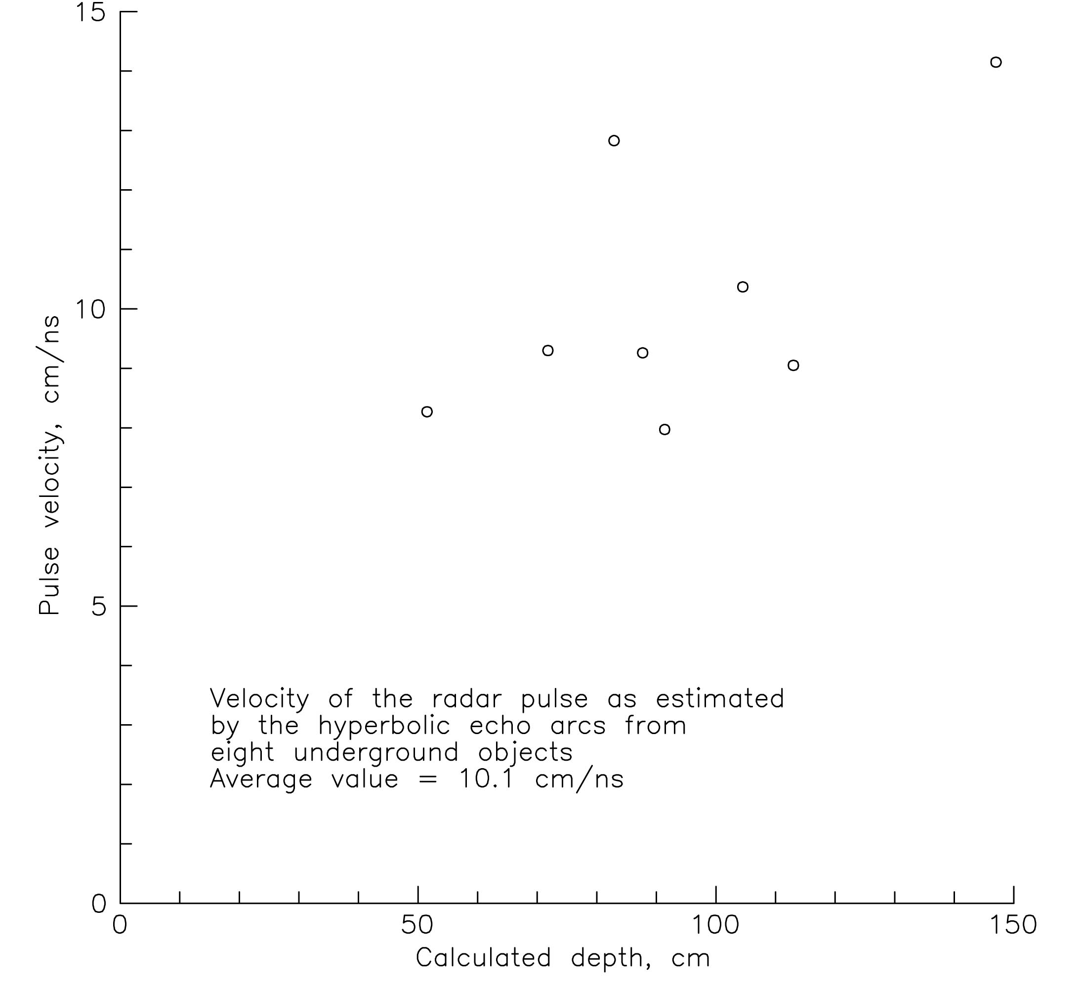 Figure 23: The velocity of the radar pulse. It was estimated by a geometrical analysis of the hyperbolic echoes from eight underground reflectors. An average value of 10.1 cm/ns has calibrated the depth scales on the radar profiles. This plot suggests that the velocity of the radar pulse increases with depth.
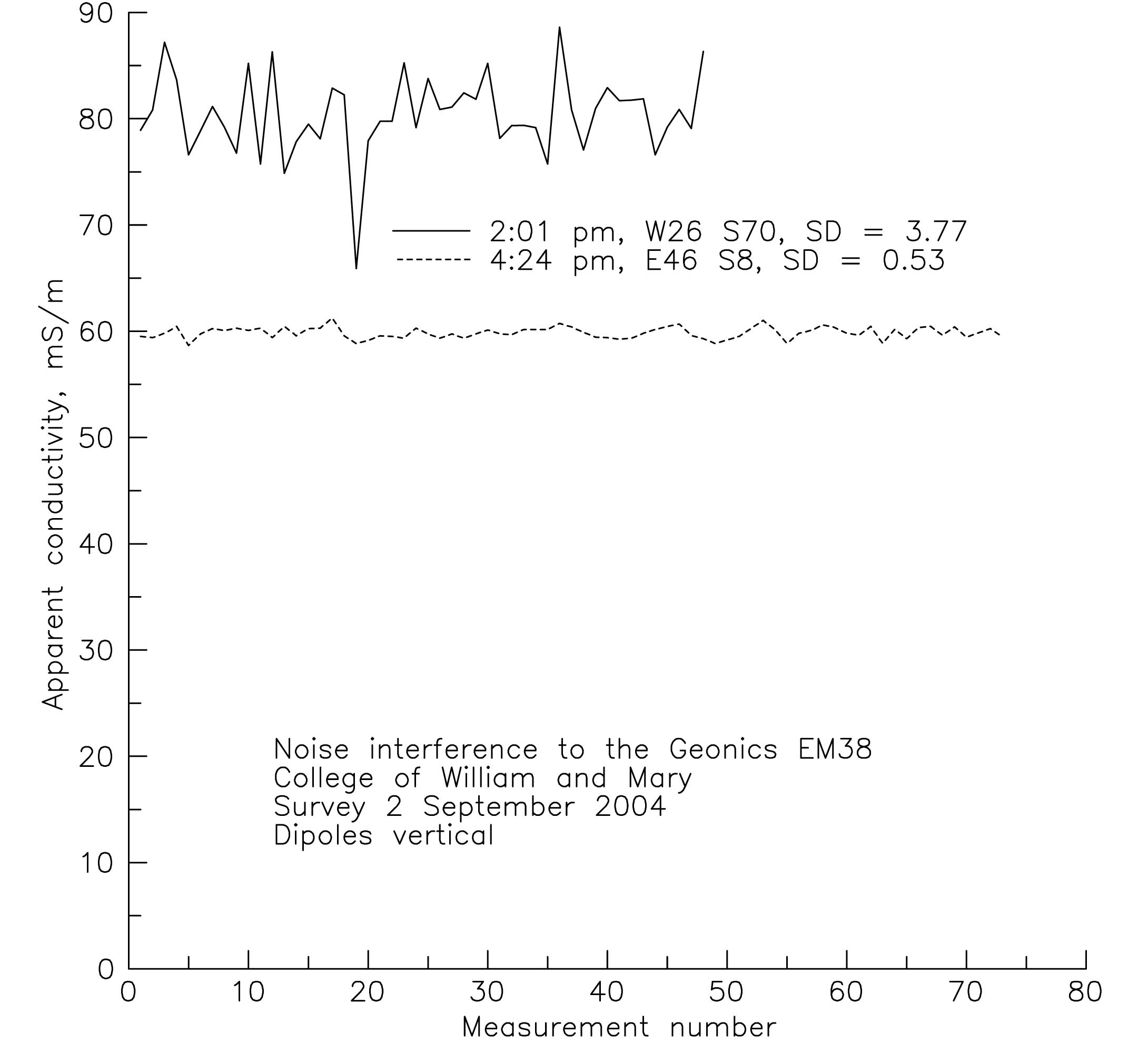 Figure 24: Electrical interference to the conductivity meter. It was high in the southwestern corner of the survey area; this is probably due to the buried electrical cables there. The noise at the end of the survey was more typical. The standard deviations of the readings are listed in the legend.
 Figure 25: Changing magnetic declination. Magnetic north is currently about 10.4 degrees west of true north, but these directions were closer together in the past. The horizontal dashed lines approximate the orientations of the three main buildings in the area.
Appendix 4
Context Records
Page 1 of 13| Context | Description | Grid North | Grid East |
|---|---|---|---|
| 16GA-00000 | Spoil | 465 | 484 |
| 16GA-00001 | Topsoil/sod | — | — |
| 16GA-00002 | Plowzone | — | — |
| 16GA-00003 | Clay loam layer-fill | — | — |
| 16GA-00004 | Brown fill | — | — |
| 16GA-00005 | Topsoil layer | — | — |
| 16GA-00006 | Layer ?-TU 2 | — | — |
| 16GA-00007 | TU 2 - layer 3 | — | — |
| 16GA-00008 | Test unit 1, layer 5 | — | — |
| 16GA-00009 | Topsoil/sod | — | — |
| 16GA-00010 | Layer 2 | — | — |
| 16GA-00011 | Layer 3 | — | — |
| 16GA-00012 | Layer 4 | — | — |
| 16GA-00013 | TU 3 - layer 5 | — | — |
| 16GA-00014 | Topsoil | 498 | 512 |
| 16GA-00015 | Topsoil | 496 | 510 |
| 16GA-00016 | Topsoil | 494 | 512 |
| 16GA-00017 | Topsoil | 492 | 510 |
| 16GA-00018 | Topsoil | 490 | 512 |
| 16GA-00019 | Brown clay loam | 496 | 510 |
| 16GA-00020 | Brown clay loam | 490 | 512 |
| 16GA-00021 | Brown clay loam | 498 | 512 |
| 16GA-00022 | Brown clay loam | 494 | 512 |
| 16GA-00023 | Trench cut | 498 | 512 |
| 16GA-00024 | Trench fill | 498 | 512 |
| 16GA-00025 | Brown clay loam | 492 | 510 |
| 16GA-00026 | Topsoil | 488 | 510 |
| 16GA-00027 | Brick clay loam | 494 | 512 |
| 16GA-00028 | Brick clay loam | 496 | 510 |
| 16GA-00029 | Orange clay fill | 498 | 512 |
| 16GA-00030 | Dark olive loam | 498 | 512 |
| 16GA-00031 | Brick clay loam layer | 490 | 512 |
| Page 2 of 13 | |||
| 16GA-00032 | Brick clay loam | 492 | 510 |
| 16GA-00033 | Orange clay fill | 496 | 510 |
| 16GA-00034 | Orange clay fill | 512 | 494 |
| 16GA-00035 | Orange clay fill | 490 | 512 |
| 16GA-00036 | Orange clay fill | 492 | 510 |
| 16GA-00037 | Linear feature cut | 490 | 512 |
| 16GA-00038 | Linear feature fill | 490 | 512 |
| 16GA-00039 | Orange clay fill II | 490 | 512 |
| 16GA-00040 | Dark olive loam | 496 | 510 |
| 16GA-00041 | Dark olive loam B | 496 | 510 |
| 16GA-00042 | Dark olive loam A | 492 | 510 |
| 16GA-00043 | Dark olive loam A | 490 | 512 |
| 16GA-00044 | Dark olive loam | 494 | 512 |
| 16GA-00045 | Terra cotta pipe fill | 496 | 510 |
| 16GA-00046 | Terra cotta pipe cut | 496 | 510 |
| 16GA-00047 | Sewage pipe cut | 496 | 510 |
| 16GA-00048 | Sewage pipe fill | 496 | 510 |
| 16GA-00049 | Dark olive loam B | 492 | 510 |
| 16GA-00050 | Dark olive loam B | 490 | 512 |
| 16GA-00051 | Dark olive loam B | 494 | 512 |
| 16GA-00052 | Light clay mottle | 490 | 512 |
| 16GA-00053 | Light gray mottled | 496 | 510 |
| 16GA-00054 | Light gray mottled | 492 | 510 |
| 16GA-00055 | Linear feature cut | 490 | 512 |
| 16GA-00056 | Linear feature fill | 490 | 512 |
| 16GA-00057 | Topsoil | 494 | 508 |
| 16GA-00058 | Topsoil | 486 | 512 |
| 16GA-00059 | Dark olive loam B | 498 | 512 |
| 16GA-00060 | Brown clay loam | 486 | 512 |
| 16GA-00061 | Topsoil | 498 | 508 |
| 16GA-00062 | Brown clay loam | 494 | 508 |
| 16GA-00063 | Brick clay loam | 486 | 512 |
| 16GA-00064 | Orange clay fill | 486 | 512 |
| 16GA-00065 | Brick clay loam | 494 | 508 |
| 16GA-00066 | Brown clay loam | 498 | 508 |
| 16GA-00067 | Utility trench fill | 498 | 508 |
| 16GA-00068 | Utility trench cut | 498 | 508 |
| 16GA-00069 | Dark olive loam A | 486 | 512 |
| 16GA-00070 | Orange clay fill | 494 | 508 |
| Page 3 of 13 | |||
| 16GA-00071 | Layer X SW of yellow loam trench | 494 | 512 |
| 16GA-00072 | Deaccession context | 494 | 512 |
| 16GA-00073 | Layer X NE of yellow loam trench | 494 | 512 |
| 16GA-00074 | Deaccession context | 494 | 512 |
| 16GA-00075 | Brick clay loam | 478 | 508 |
| 16GA-00076 | Layer X SW of yellow loam trench | 496 | 510 |
| 16GA-00077 | Layer X southwest of yellow loam trench | 496 | 510 |
| 16GA-00078 | Layer X NE at yellow loam trench | 496 | 510 |
| 16GA-00079 | Layer X northeast of yellow loam trench | — | — |
| 16GA-00080 | Yellow loam trench | 496 | 510 |
| 16GA-00081 | Light gray mottled | 498 | 512 |
| 16GA-00082 | Yellow loam trench fill | 494 | 512 |
| 16GA-00083 | Topsoil | 484 | 510 |
| 16GA-00084 | Orange clay fill | 498 | 508 |
| 16GA-00085 | Brown clay loam | 484 | 510 |
| 16GA-00086 | Terra cotta pipe trench fill | 486 | 512 |
| 16GA-00087 | Terra cotta pipe trench cut | 486 | 512 |
| 16GA-00088 | Dark olive loam | 494 | 508 |
| 16GA-00089 | Brick clay loam | 484 | 510 |
| 16GA-00090 | Brick trench fill | 486 | 512 |
| 16GA-00091 | Brick trench cut | 486 | 512 |
| 16GA-00092 | Brown clay loam | 488 | 510 |
| 16GA-00093 | Terra cotta pipe trench fill | 498 | 508 |
| 16GA-00094 | Dark olive loam B | 494 | 508 |
| 16GA-00095 | Trench cut for terra cotta pipe | 498 | 508 |
| 16GA-00096 | Orange clay fill | 484 | 510 |
| 16GA-00097 | Topsoil | 490 | 516 |
| 16GA-00098 | Brown clay loam | 490 | 516 |
| 16GA-00099 | Brick clay loam | 490 | 516 |
| 16GA-00100 | Orange clay fill | 490 | 516 |
| 16GA-00101 | Brick clay loam | 488 | 510 |
| 16GA-00102 | Postmold | 494 | 508 |
| 16GA-00103 | Posthole fill | 494 | 508 |
| 16GA-00104 | Posthole cut | 494 | 506 |
| 16GA-00105 | Interior terra cotta pipe fill | 486 | 512 |
| 16GA-00106 | 288 | 510 | |
| 16GA-00107 | Dark olive loam | 484 | 510 |
| 16GA-00108 | Sloppy linear feature fill | 490 | 516 |
| 16GA-00109 | Linear feature cut | 490 | 516 |
| Page 4 of 13 | |||
| 16GA-00110 | Dark olive clay loam B | 486 | 512 |
| 16GA-00111 | Light gray mottle | 486 | 512 |
| 16GA-00112 | Topsoil | 478 | 510 |
| 16GA-00113 | Pipe fill | 498 | 508 |
| 16GA-00114 | Dark olive loam | 488 | 510 |
| 16GA-00115 | Dark olive loam A | 498 | 508 |
| 16GA-00116 | Dark olive loam B | 498 | 508 |
| 16GA-00117 | Terra cotta pipe fill 1 | 484 | 510 |
| 16GA-00118 | Terra cotta pipe cut 1 | 484 | 510 |
| 16GA-00119 | Terra cotta pipe fill 2 | 484 | 510 |
| 16GA-00120 | Terra cotta pipe cut 2 | 484 | 510 |
| 16GA-00121 | Trample | 484 | 510 |
| 16GA-00122 | Dark olive loam B | 484 | 510 |
| 16GA-00123 | "Rectangular" feature fill | 486 | 512 |
| 16GA-00124 | "Rectilinear" feature cut | 486 | 512 |
| 16GA-00125 | Light gray mottled | 494 | 508 |
| 16GA-00126 | Dark olive loam B | 488 | 510 |
| 16GA-00127 | Dark olive loam A | 490 | 516 |
| 16GA-00128 | Dark olive loam B | 490 | 516 |
| 16GA-00129 | Light gray mottled | 488 | 510 |
| 16GA-00130 | TC pipe cut | 490 | 516 |
| 16GA-00131 | TC pipe fill | 490 | 516 |
| 16GA-00132 | Trample | 490 | 516 |
| 16GA-00133 | Light gray mottle | 498 | 508 |
| 16GA-00134 | Brown clay loam | 478 | 510 |
| 16GA-00135 | Brick clay loam | 478 | 510 |
| 16GA-00136 | Layer X transition to subsoil | 494 | 508 |
| 16GA-00137 | Light gray mottle | 484 | 510 |
| 16GA-00138 | Orange clay fill | 478 | 510 |
| 16GA-00139 | Layer X Transition to subsoil | 492 | 510 |
| 16GA-00140 | Brick chunk concentration cut | 490 | 516 |
| 16GA-00141 | Brick crumb concentration fill | 490 | 516 |
| 16GA-00143 | Yellow loam trench cut | 494 | 512 |
| 16GA-00146 | Light gray mottle | 490 | 516 |
| 16GA-00147 | Posthole fill | 484 | 510 |
| 16GA-00148 | Posthole cut | 484 | 510 |
| 16GA-00150 | Southwest layer X | 498 | 508 |
| 16GA-00151 | Northeast layer X | 498 | 508 |
| 16GA-00152 | Yellow loam trench | 498 | 508 |
| Page 5 of 13 | |||
| 16GA-00153 | Layer X | 490 | 512 |
| 16GA-00154 | Dark olive loam A | 478 | 510 |
| 16GA-00155 | Clay feature cut | 490 | 516 |
| 16GA-00156 | Clay feature fill | 490 | 516 |
| 16GA-00157 | Dark olive loam B | 478 | 510 |
| 16GA-00158 | Tree splat fill | 494 | 508 |
| 16GA-00159 | Small brown silty loam rectangle | 494 | 508 |
| 16GA-00160 | Cut for small silty loam rectangle | 494 | 508 |
| 16GA-00161 | Dark East-West trench cut | 494 | 512 |
| 16GA-00162 | Park East-West trench fill | 494 | 512 |
| 16GA-00163 | Yellow corner | — | — |
| 16GA-00164 | Cut for yellow corner | 494 | 512 |
| 16GA-00165 | Yellow feature cut | 498 | 508 |
| 16GA-00166 | Yellow feature fill | — | — |
| 16GA-00167 | Yellow clay possible subsoil | 478 | 510 |
| 16GA-00168 | Mottled yellowish feature fill | 494 | 508 |
| 16GA-00169 | Mottled yellowish feature cut | — | — |
| 16GA-00170 | Olive brown in SE corner of unit | 494 | 508 |
| 16GA-00171 | Olive brown in SE corner-cut | — | — |
| 16GA-00172 | Gray subsoil under clay feature | 490 | 516 |
| 16GA-00173 | Topsoil/sod | 458 | 471 |
| 16GA-00174 | TU 4 layer 2 | 458 | 471 |
| 16GA-00175 | TU 4 layer 3 | 458 | 471 |
| 16GA-00178 | Trench cut | 458 | 471 |
| 16GA-00179 | Trench fill | 458 | 471 |
| 16GA-00180 | Brown NE corner layer | 458 | 471 |
| 16GA-00183 | Topsoil | 461 | 491 |
| 16GA-00184 | Recent fill under topsoil | 461 | 491 |
| 16GA-00185 | Sewage pipe trench cut | 458 | 471 |
| 16GA-00186 | Sewage pipe trench fill | — | — |
| 16GA-00187 | Brick and shell layer | 461 | 491 |
| 16GA-00188 | Clay brick and shell | 461 | 491 |
| 16GA-00189 | Loam layer | 461 | 491 |
| 16GA-00190 | Light brown loam | 471 | 458 |
| 16GA-00191 | Yellowish clay loam | 461 | 491 |
| 16GA-00200 | Topsoil | 447 | 478 |
| 16GA-00201 | Topsoil | 447 | 482 |
| 16GA-00202 | Topsoil | 447 | 486 |
| 16GA-00203 | Brown clay loam | 447 | 486 |
| Page 6 of 13 | |||
| 16GA-00204 | Utility trench fill | 447 | 478 |
| 16GA-00205 | Utility trench cut | 447 | 478 |
| 16GA-00206 | Brown clay loam | 447 | 482 |
| 16GA-00207 | 20th century trench fill | 447 | 486 |
| 16GA-00208 | 20th century trench cut | — | — |
| 16GA-00209 | Fill-20th century trench | 447 | 482 |
| 16GA-00210 | Cut, 20th century trench | 447 | 482 |
| 16GA-00211 | Topsoil | 447 | 474 |
| 16GA-00212 | Topsoil | 449 | 484 |
| 16GA-00213 | Brown clay loam | 447 | 474 |
| 16GA-00214 | Brown clay loam | 449 | 484 |
| 16GA-00215 | Light brown clay loam | 447 | 478 |
| 16GA-00216 | Yellow mottled clay with coal inclusions | 444 | 474 |
| 16GA-00217 | Yellow mottled clay with coal inclusions (cut) | 447 | 474 |
| 16GA-00218 | Sandy orange loam | 447 | 474 |
| 16GA-00219 | Brick rubble | 449 | 484 |
| 16GA-00220 | Iron pipe trench cut | 447 | 478 |
| 16GA-00221 | Iron pipe trench fill | 447 | 478 |
| 16GA-00222 | Brick rubble | 447 | 478 |
| 16GA-00223 | Dark charcoal layer | 448 | 478 |
| 16GA-00224 | Topsoil | 447 | 468 |
| 16GA-00225 | Brick clay loam | — | — |
| 16GA-00226 | Clay SW corner feature cut | 447 | 468 |
| 16GA-00227 | Clay SW corner feature fill | 447 | 468 |
| 16GA-00228 | Ditch fill (tree root) | 449 | 484 |
| 16GA-00229 | Ditch cut (tree root) | 449 | 484 |
| 16GA-00230 | Brick w | 449 | 484 |
| 16GA-00231 | Brick rubble fill | 449 | 484 |
| 16GA-00232 | 2nd brick rubble layer | 449 | 484 |
| 16GA-00233 | 2nd brick rubble layer | 447 | 478 |
| 16GA-00234 | Yellow mottled clay with coal inclusions | 447 | 474 |
| 16GA-00235 | Root hole | 449 | 484 |
| 16GA-00236 | Brown clay loam | 447 | 478 |
| 16GA-00237 | Postmold | 447 | 474 |
| 16GA-00238 | Posthole | 447 | 474 |
| 16GA-00239 | Posthole cut | 447 | 474 |
| 16GA-00240 | Shallow soil feature cut | 447 | 478 |
| 16GA-00241 | Shallow soil feature | 447 | 478 |
| 16GA-00242 | Light brown clay layer | 447 | 478 |
| Page 7 of 13 | |||
| 16GA-00243 | Topsoil | 443 | 468 |
| 16GA-00244 | Topsoil | 449 | 478 |
| 16GA-00245 | Dark grayish brown layer | 447 | 474 |
| 16GA-00246 | N-S utility trench fill | 449 | 478 |
| 16GA-00247 | N-S utility trench cut | 449 | 478 |
| 16GA-00248 | Brown clay loam | 443 | 468 |
| 16GA-00249 | Gray round feature | 447 | 474 |
| 16GA-00250 | Brick rubble | 443 | 468 |
| 16GA-00251 | Gray round feature cut | 447 | 474 |
| 16GA-00252 | Light brown clay layer | 447 | 474 |
| 16GA-00253 | First rubble layer | 449 | 478 |
| 16GA-00254 | Brown clay loam | 443 | 468 |
| 16GA-00255 | Trench fill | 443 | 468 |
| 16GA-00256 | Brick rubble | 443 | 468 |
| 16GA-00257 | Brown clay loam | 443 | 466 |
| 16GA-00258 | Brick rubble | 443 | 468 |
| 16GA-00259 | Trench cut | 443 | 468 |
| 16GA-00260 | Trench cut | 443 | 468 |
| 16GA-00261 | Trench cut | 443 | 465 |
| 16GA-00262 | Brown clay loam | 449 | 478 |
| 16GA-00263 | Topsoil | 451 | 474 |
| 16GA-00264 | Topsoil | 458 | 503 |
| 16GA-00265 | 2nd brick rubble layer | 449 | 478 |
| 16GA-00266 | Yellow clay loam | 451 | 474 |
| 16GA-00267 | Mottled tan clay loam | 458 | 503 |
| 16GA-00268 | Northeast clay feature fill | 447 | 468 |
| 16GA-00269 | Northeast clay feature cut | 447 | 468 |
| 16GA-00270 | Gray layer | 447 | 468 |
| 16GA-00271 | Orange 20th century clay fill | 458 | 503 |
| 16GA-00272 | Trench fill | 451 | 474 |
| 16GA-00273 | Trench cut | 451 | 474 |
| 16GA-00274 | Light orange gray mottled clay | 458 | 503 |
| 16GA-00275 | Dark grayish brown layer | 458 | 503 |
| 16GA-00276 | Brick and mortar rubble/orange clay | 447 | 468 |
| 16GA-00277 | Light gray clay loam | 451 | 474 |
| 16GA-00278 | Rubble transition layer | 449 | 478 |
| 16GA-00279 | Dark yellowish-tan mottled clay loam | 458 | 503 |
| 16GA-00280 | Brick rubble | 451 | 474 |
| 16GA-00281 | Subsoil transition layer | 458 | 503 |
| Page 8 of 13 | |||
| 16GA-00282 | Gray clay loam | 447 | 468 |
| 16GA-00283 | Cannonball layer fill | 449 | 478 |
| 16GA-00284 | Gray loam/olive loam | 451 | 474 |
| 16GA-00285 | Brick layer — 2nd layer | 451 | 474 |
| 16GA-00286 | Rubble transition layer | 451 | 474 |
| 16GA-00287 | Light brown clay layer | 447 | 468 |
| 16GA-00288 | Cannon ball layer | 451 | 474 |
| 16GA-00289 | Cut for cannon ball layer | 449 | 478 |
| 16GA-00290 | Brick and mortar layer | 449 | 478 |
| 16GA-00291 | Cannon ball fill wt | 451 | 474 |
| 16GA-00292 | Gray loam layer above marl feature | 451 | 474 |
| 16GA-00293 | Gray round feature fill | 447 | 468 |
| 16GA-00294 | Gray round feature cut | 447 | 468 |
| 16GA-00295 | Marl layer | 449 | 478 |
| 16GA-00296 | Gray loam below marl | 449 | 478 |
| 16GA-00297 | Brick and mortar trench fill | 449 | 478 |
| 16GA-00298 | Gray feature fill | 451 | 474 |
| 16GA-00299 | Gray feature cut | 451 | 474 |
| 16GA-00300 | Brick and mortar cut | 449 | 478 |
| 16GA-00301 | Subsoil | 451 | 474 |
| 16GA-00302 | Ash pocket | 449 | 478 |
| 16GA-00303 | Brown clay loam | 449 | 478 |
| 16GA-00304 | Round feature fill "A" | 449 | 478 |
| 16GA-00305 | Round feature cut A | 449 | 478 |
| 16GA-00308 | Marl layer | 451 | 474 |
| 16GA-00309 | Trench feature fill | 449 | 478 |
| 16GA-00310 | Trench feature cut | 449 | 478 |
| 16GA-00311 | Marl lens | 449 | 478 |
| 16GA-00312 | Gray loam below marl | 451 | 474 |
| 16GA-00313 | Tan yellow sandy clay loam | 449 | 478 |
| 16GA-00314 | Brick and mortar layer below marl | 451 | 474 |
| 16GA-00315 | Gray loam | 451 | 474 |
| 16GA-00316 | Trench cut | 451 | 474 |
| 16GA-00317 | Trench fill | 451 | 474 |
| 16GA-00318 | Mixed context | 451 | 474 |
| 16GA-00319 | Topsoil | 455 | 478 |
| 16GA-00320 | Topsoil | 451 | 478 |
| 16GA-00321 | Utility trench fill | 451 | 478 |
| 16GA-00322 | Utility trench cut | 451 | 478 |
| Page 9 of 13 | |||
| 16GA-00323 | Utility trench fill | 455 | 478 |
| 16GA-00324 | Utility trench cut | 455 | 478 |
| 16GA-00325 | Topsoil | 453 | 480 |
| 16GA-00326 | Utility trench cut | 00453 | 00480 |
| 16GA-00327 | Utility trench fill | 433 | 480 |
| 16GA-00328 | Gray loam | 455 | 478 |
| 16GA-00329 | Grey loam layer | 457 | 478 |
| 16GA-00330 | Gray loam | 453 | 480 |
| 16GA-00331 | Olive brown loam with brick mortar | 453 | 480 |
| 16GA-00332 | Yellow clay mottled | 455 | 478 |
| 16GA-00333 | Orange clay layer | 451 | 478 |
| 16GA-00334 | Yellow clay layer | 453 | 480 |
| 16GA-00335 | Destruction debris | 451 | 478 |
| 16GA-00336 | Yellow clay fill cut | 453 | 480 |
| 16GA-00337 | Dense clay | 455 | 478 |
| 16GA-00338 | L-shaped feature fill | 451 | 478 |
| 16GA-00339 | L shape feature cut | 451 | 478 |
| 16GA-00340 | Topsoil | 465 | 480 |
| 16GA-00341 | Marl layer | 451 | 478 |
| 16GA-00342 | Gray loam | 465 | 480 |
| 16GA-00343 | Marl walkway | 453 | 480 |
| 16GA-00346 | Topsoil | 451 | 482 |
| 16GA-00347 | Second debris layer | 451 | 478 |
| 16GA-00348 | Gray loam | 451 | 482 |
| 16GA-00349 | Rubble transition layer | 451 | 478 |
| 16GA-00350 | Olive brown loam with brick and mortar | 451 | 482 |
| 16GA-00351 | 2 marl layer | 451 | 478 |
| 16GA-00352 | Olive brown loam | 451 | 478 |
| 16GA-00353 | Debris layer | 465 | 480 |
| 16GA-00354 | Possible tree hole cut | 451 | 482 |
| 16GA-00355 | Possible tree hole fill | 457 | 482 |
| 16GA-00356 | Brick and mortar debris | 451 | 482 |
| 16GA-00357 | Mottled loam | 465 | 489 |
| 16GA-00358 | Third debris layer | 451 | 478 |
| 16GA-00359 | Yellow clay cap | 465 | 480 |
| 16GA-00360 | Linerar feature fill | 451 | 482 |
| 16GA-00361 | Linear feature cut | 451 | 482 |
| 16GA-00362 | Tree hole fill | 451 | 478 |
| 16GA-00363 | Planting bed cut | 451 | 478 |
| Page 10 of 13 | |||
| 16GA-00364 | Pale yellow clay loam | 451 | 478 |
| 16GA-00365 | yellow mottled layer | 465 | 480 |
| 16GA-00366 | Linear feature fill | 465 | 480 |
| 16GA-00367 | Linear feature cut | 465 | 480 |
| 16GA-00368 | Rectangular feature fill | 465 | 480 |
| 16GA-00369 | Rectangular feature cut | 465 | 480 |
| 16GA-00370 | Yellow clay fill | 451 | 482 |
| 16GA-00371 | Drainage trench step | 451 | 482 |
| 16GA-00372 | Planting hole fill | 451 | 478 |
| 16GA-00373 | Planting hole dark fill | 451 | 478 |
| 16GA-00374 | Utility pipe fill | 465 | 480 |
| 16GA-00375 | Utility pipe cut | 465 | 480 |
| 16GA-00376 | Brown loam | 465 | 480 |
| 16GA-00377 | Yellow clay cut | 00451 | 00482 |
| 16GA-00378 | Yellow clay fill east | 00451 | 00482 |
| 16GA-00379 | Marl walkway | 451 | 482 |
| 16GA-00380 | Marl Walkway second layer | 451 | 482 |
| 16GA-00382 | Topsoil | 467 | 482 |
| 16GA-00383 | Grey loam | 467 | 482 |
| 16GA-00384 | Topsoil | 469 | 484 |
| 16GA-00385 | Topsoil | 471 | 486 |
| 16GA-00386 | Topsoil | 471 | 482 |
| 16GA-00387 | Mottled gray loam | 469 | 484 |
| 16GA-00388 | Mottled gray loam | 471 | 486 |
| 16GA-00389 | Mottled gray loam | 471 | 482 |
| 16GA-00390 | Utility trench fill | 467 | 482 |
| 16GA-00391 | Utiliy trench cut | 467 | 482 |
| 16GA-00392 | Brick and shell fill | 469 | 484 |
| 16GA-00393 | Marl walkway | 465 | 480 |
| 16GA-00394 | Bricks and shells | 471 | 482 |
| 16GA-00395 | Marl layer | 00471 | 00486 |
| 16GA-00396 | Mottled brown loam | 469 | 484 |
| 16GA-00397 | Linear trench fill | 471 | 482 |
| 16GA-00398 | Linear trench cut | 471 | 482 |
| 16GA- 00399 | Linear feature fill | 471 | 486 |
| 16GA-00400 | Linear feature cut | 471 | 486 |
| 16GA-00401 | Eastern circular feature fill | 471 | 486 |
| 16GA-00402 | Eastern circular feature cut | 471 | 486 |
| 16GA-00403 | Western circular feature fill | 471 | 486 |
| Page 11 of 13 | |||
| 16GA-00404 | Western circular feature cut | 471 | 486 |
| 16GA-00405 | Corner feature cut | 469 | 484 |
| 16GA-00406 | Corner feature fill | 469 | 484 |
| 16GA-00407 | Brick bat trench fill | 471 | 482 |
| 16GA-00408 | Brick bat trench cut | 471 | 482 |
| 16GA-00409 | Topsoil | 469 | 488 |
| 16GA-00410 | Mottled gray loam | 469 | 488 |
| 16GA-00411 | Topsoil | 471 | 490 |
| 16GA-00412 | Mottled gray loam | 471 | 490 |
| 16GA-00413 | Marl layer | 471 | 482 |
| 16GA-00414 | Diagonal walk (Brafferton-Wren) fill | 451 | 482 |
| 16GA-00415 | Brick and mortar paving base | 451 | 482 |
| 16GA-00416 | Diagonal walk second fill | 451 | 482 |
| 16GA-00417 | Diagonal walk (Brafferton-Wren) cut | 451 | 482 |
| 16GA-00418 | Diagonal walk #2 fill | 451 | 482 |
| 16GA-00419 | Yellow clay cap | 469 | 488 |
| 16GA-00420 | Diagonal walk #2 cut | 451 | 482 |
| 16GA-00421 | Rubble layer | 469 | 488 |
| 16GA-00422 | Orange clay cap | 471 | 490 |
| 16GA-00423 | Dark gray loam | 469 | 488 |
| 16GA-00424 | Linear feature fill | 471 | 482 |
| 16GA-00425 | Linear feature cut | — | — |
| 16GA-00426 | Circular feature West fill | 471 | 482 |
| 16GA-00427 | Circular feature West cut | 471 | 482 |
| 16GA-00428 | Circular feature East fill | 471 | 482 |
| 16GA-00429 | Circular feature East cut | 471 | 482 |
| 16GA-00430 | Dark grey loam | 471 | 490 |
| 16GA-00431 | Oval brick feature cut | 469 | 488 |
| 16GA-00432 | Oval brick feature fill | 469 | 488 |
| 16GA-00433 | Brick spread | 471 | 490 |
| 16GA-00434 | Marl layer | 00471 | 00490 |
| 16GA-00435 | Marl layer | 469 | 488 |
| 16GA-00436 | Topsoil | 469 | 492 |
| 16GA-00437 | Mottled gray loam | 469 | 492 |
| 16GA-00438 | Orange clay cap | 469 | 492 |
| 16GA-00439 | Gray loam | 469 | 492 |
| 16GA-00440 | Linear feature cut | 471 | 490 |
| 16GA-00441 | Linear feature fill | 471 | 490 |
| 16GA-00442 | Large circular feature cut | 471 | 490 |
| Page 12 of 13 | |||
| 16GA-00443 | Large Circular feature fill | 471 | 490 |
| 16GA-00444 | Small circular feature cut | 471 | 490 |
| 16GA-00445 | Small circular feature fill | 471 | 490 |
| 16GA-00446 | North posthole cut | 471 | 496 |
| 16GA-00447 | North posthole fill | 471 | 490 |
| 16GA-00448 | North posthole mold | 471 | 490 |
| 16GA-00449 | South posthole cut | — | — |
| 16GA-00450 | South Posthole fill | 471 | 490 |
| 16GA-00451 | South posthole mold | 471 | 490 |
| 16GA-00452 | Topsoil | 465 | 484 |
| 16GA-00453 | Mottled gray loam | 465 | 484 |
| 16GA-00454 | Yellow clay feature cut | 469 | 492 |
| 16GA-00455 | Yellow clay feature fill | 469 | 492 |
| 16GA-00456 | Post | 469 | 49? |
| 16GA-00457 | Round clay feature cut | — | — |
| 16GA-00458 | Round clay feature fill | 469 | 492 |
| 16GA-00459 | Ovate feature fill | 471 | 490 |
| 16GA-00460 | Ovate feature cut | 471 | 490 |
| 16GA-00461 | Brick and shell fill | 465 | 484 |
| 16GA-00462 | Brick and mortar paving base | 453 | 480 |
| 16GA-00463 | Walkway loam | 453 | 480 |
| 16GA-00464 | Marl walkway cut | 453 | 480 |
| 16GA-00465 | Mottled brown loam | 465 | 484 |
| 16GA-00466 | Diagonal walkway #2 fill | 453 | 480 |
| 16GA-00467 | Concentrated marl | 465 | 484 |
| 16GA-00468 | Yellow clay spread | 465 | 484 |
| 16GA-00469 | Brick and mortar debris | 465 | 484 |
| 16GA-00470 | Mottled brown loam | 465 | 484 |
| 16GA-00471 | Diagonal walkway #2 cut | 00453 | 00480 |
| 16GA-00472 | Light brown loam with marl | 453 | 480 |
| 16GA-00473 | Topsoil | 471 | 492 |
| 16GA-00474 | Mottled gray loam | 471 | 492 |
| 16GA-00475 | Orange clay cap | 471 | 492 |
| 16GA-00476 | Gray loam | 471 | 492 |
| 16GA-00477 | Marl layer | 471 | 492 |
| 16GA-00478 | Linear feature fill | 471 | 492 |
| 16GA-00479 | Linear feature cut | 00471 | 00492 |
| 16GA-00480 | NW postholw cut | — | — |
| 16GA-00481 | NW posthole fill | 471 | 492 |
| Page 13 of 13 | |||
| 16GA-00482 | NW postmold | 471 | 492 |
| 16GA-00483 | SE posthole cut | 471 | 492 |
| 16GA-00484 | SE posthole fill | 471 | 492 |
| 16GA-00485 | SE postmold | 471 | 492 |
| 16GA-00486 | SW posthole 1 cut | 471 | 492 |
| 16GA-00487 | SW posthole 1 fill | 471 | 492 |
| 16GA-00488 | SW postmold | 471 | 492 |
| 16GA-00489 | SE posthole 2 cut | 471 | 492 |
| 16GA-00490 | SE posthole fill 2 | 471 | 492 |
| 16GA-00491 | SE posthole 2 mold | 471 | 492 |
| 16GA-NOCONTEXT | Wren Yard Garden 2005, 2006, 2007: Context not assigned or identified | — | — |
| 16GA-OVERVIEW | Wren Yard Garden 2005, 2007: Overview Shot | — | — |
| 16GA-TU4 | Wren Yard Garden 2005: Test Unit 4 | — | — |
| 16GA-WORKING | Wren Yard Garden 2005, 2006, 2007: Working Shot | — | — |
Appendix 5
Soil Chemistry
VIRGINIA COOPERATIVE EXTENSION
SOIL TESTING LABORATORY
Person Submitting: WILLIAMSBURG FOUNDATION, ANDREW EDWARDS
P 0 BOX 1776
WILLIAMSBURG VA 23187
095
Unit: JAMES CITY

Appendix 6
Geometry in the Wren Yard
Benjamin A. Skolnik
The 17th and 18th century European world was a carefully ordered place. In all aspects of life, everything had its place. From relations between people to the nature of the universe, there were rules for everything. Nowhere can this ordered worldview be seen more clearly than in the ordered, manmade landscapes of English formal gardens. These meticulously maintained ordered landscapes were carefully planned, built, and maintained following clearly established and well recognized rules. By understanding these rules, not only do seemingly unplanned, random alignments in the physical landscape become carefully planned and deliberate manipulations of the natural world, but we can also begin to predict where pieces of the past may lie buried and, more importantly, begin to understand the people who lived in the past.
Formal man-made landscapes in the 17th and 18th Century English speaking world followed certain predictable rules. Of these rules, the most important was a use of symmetry in landscape design. In courtyards and gardens, symmetry was maintained across major axes projected from the built environment and extending out into the natural environment. If a garden feature is found on one side of a formal space, a mirrored copy is to be expected on the other side.
Perhaps the second most important rule in English formal spaces was a reliance on certain ratios and proportions across the space. Frequently, designers of formal courtyards and gardens would incorporate and plan their space around a key measurement —usually the length or width of the building around which the designed space exists or a dimension of the room from which the yard was meant to be viewed. In addition to using certain key measurements, garden planners would also incorporate certain predictable ratios in their design. 2:1, 3:1, 4:1, and 6:1 as well as 1.61:1 (the golden ratio) are common ratios to find in planned English formal gardens. By using proportions and ratios, landscape designers can project important buildings off of their foundations and onto the landscape itself.
Following from this reliance on symmetry and proportions is the incorporation of certain angles in garden design. 30°, 45°, 60°, and 90° angles are all prevalent in gardens from this time period. The prevalence of these angles in garden design stem naturally from the use of both right angles and the reliance on certain proportions. By forming shapes with the same proportions garden designers were creating shapes with the same angles as well.
Page 2From these three principles of geometry, a set of rules for creating carefully organized landscapes emerges. By including one more geometric principle—the use of perspective—the designers of these formal spaces can manipulate the way the viewer perceives these spaces, creating elaborate optical illusions in an attempt to change the way in which the natural and built environment is experienced. This is accomplished mainly through the use of converging lines—which not only make small spaces seem much larger and grander, but also draw attention to and enhance a central focal point—usually a distant vista or grand building.
With this understanding of English formal spaces of the 17th and 18th Centuries, we can begin to bring order to the seemingly chaotic and ill-planned Wren Yard. In 1693, the College of William & Mary in Virginia was officially chartered. One year later in 1694, construction began on the main college building—today known as the Wren Building. At the time, the only other major building at Middle Plantation—the future site of the city of Williamsburg—was Bruton Parish Church. Because Williamsburg did not exist yet at this point, the designers of the Wren Building were free to align it any way they saw fit. As such, the building was laid out along an axis running due east/west.
To the east of the College exists a long, narrow, flat ridge running down the middle of the peninsula between the York and the James Rivers. It was along this ridge that Governor Nicholson placed the Duke of Gloucester Street—the main street of the city of Williamsburg—5 years later in 1699 when the site for the new capital was chosen. At the east end of the Duke of Gloucester Street was the site of the new capital building which was built in 1701. At the other end, approximately a mile to the west was the Wren Building and the College of William & Mary. This new thoroughfare did not, however, run due east/west like the college. Rather, it follows the topography of the ridgeline, which is approximately 5. off of the alignment of the college. Had the Duke of Gloucester Street been laid on the same axis as the Wren Building, instead of running flat and level for nearly a mile, it would fall into a ravine in the middle of downtown Williamsburg. So in order to avoid this, the main street—and by extension—the town was aligned with the top of the ridge and not the college.
By the 1720s, the town of Williamsburg had sprung up and the college had prospered—so much in fact that it sought to expand beyond the walls of the main college building. In 1722, a new building was planned and built in front of the Wren Building in the southern half of the yard. This building became known as the Brafferton. The placement of this building was far from arbitrary. Instead of aligning this satellite building with the rest of the college, the decision was made to align the Brafferton with the town. By aligning the new building with the Duke of Gloucester Street and not with Wren, the planners were further able to tie the college and the town together. The Page 3 placement of the Brafferton in the yard was dictated by the use of a key measurement from elsewhere in the yard. They used the length of 138'—the length of the east front of the Wren Building—as the key measurement in determining the placement of the Brafferton. It was placed 46' south and 138' east of Wren—forming a perfect 3:1 ratio.
This configuration lasted until 1732 when the college expanded yet again into a new building—the President's House. Similar to the Brafferton, the President's House was built on the north side of the Wren Yard. The construction of this building however posed a serious problem to its designers. Because the Wren Building faces due east while the Duke of Gloucester Street is aligned several degrees off of this axis, it is impossible to create perfect symmetry in the yard without running into serious jarring visual alignments. If symmetry is maintained across the axis projected due east from Wren, it becomes painfully obvious to anyone entering the college yard from the town of Williamsburg that something isn't quite right with the yard. In affect, this layout effectively closes off the yard—and by extension the college—to the town. If symmetry is maintained across the axis projected west from the Duke of Gloucester Street, then the entire garden diverges from the building it is supposed to be a natural extension of by 5°—just enough to be visually jarring and at odds with the entire philosophy behind 17th and 18th Century formal garden design. To maintain visual harmony between the buildings, the yard, and the town, the college planners counter-intuitively broke the rule of symmetry in formal space design. In an area where maintaining symmetry becomes visibly dissonant, the rules of symmetry were broken in order to maintain the illusion of symmetry. Compromising between the two orientations, the designers aligned the new President's House with the Wren Building. However, using the same 3:1 ratio as before to site the new building places the President's House too far east in the yard and too close to the centerline of the yard to maintain the appearance of symmetry. Instead, the President's House was built 104' east and 52' north of Wren. This perfect 2:1 ratio is based on the measurement of 52'—the length of the front of the Brafferton—the President's House's sister building across the yard. To further enhance this illusion of symmetry and make the President's House appear to be the same size as the Brafferton despite being located farther back in the yard, its dimensions were increased slightly from 52'x34' to 56'x38'—just enough to maintain the illusion of symmetry. To all but the most observant viewer, the Wren Yard appears symmetrical—despite clearly being asymmetrical as a result of the misalignment between the college and the town.
Now, the asymmetrical jumble of seemingly haphazardly placed buildings in the Wren Yard fall into a predictable order. We can use this newfound order to make predictions about the garden that would have surrounded this space that we could not have made before. At first glance, the front faces of the Brafferton and the President's House create a pair of diverging lines as one moves toward the college. This is the opposite of what one would expect to find in a planned
Page 4
 formal space. Diverging lines make spaces seem smaller and less important than they actually are. However, if the same lines are transposed by 138' (a key measurement in the garden) into the yard, they pass over one another and in doing so become converging lines which fall along the center path of through the yard and converge on the front face of the Wren Building. This has the
effect of not only making the yard seem larger than it actually is when viewed from the head of the Duke of Gloucester Street but also draws and focuses attention to the main building of the college—both of which cause the Wren Building to seem even grander and more impressive.
formal space. Diverging lines make spaces seem smaller and less important than they actually are. However, if the same lines are transposed by 138' (a key measurement in the garden) into the yard, they pass over one another and in doing so become converging lines which fall along the center path of through the yard and converge on the front face of the Wren Building. This has the
effect of not only making the yard seem larger than it actually is when viewed from the head of the Duke of Gloucester Street but also draws and focuses attention to the main building of the college—both of which cause the Wren Building to seem even grander and more impressive.
This overlap of lines has an important consequence for the archaeology of the Wren Yard. Based on the unique geometry of the Wren Yard, when looking for garden features, one should expect to find two different alignments of features. On the south side of the garden, one should expect to find features aligned with the President's House and Wren. On the north side of the garden, one should expect to find features aligned with the Brafferton and the Duke of Gloucester Street. In this formal garden, both axes are incorporated into a single, coherent, visually pleasing design. This changes the interpretation of the garden from one in which different garden alignments equate different time periods and garden iterations to one in which both axes exist simultaneously in the same yard at the same time in an attempt to mask and hide the misalignment of the college and the town. Page 5 Once one discovers and understands and applies the rules with which this space was designed, the interpretation of the space is informed and made easier.
Appendix 7
Additional Drawings
2005 Figures
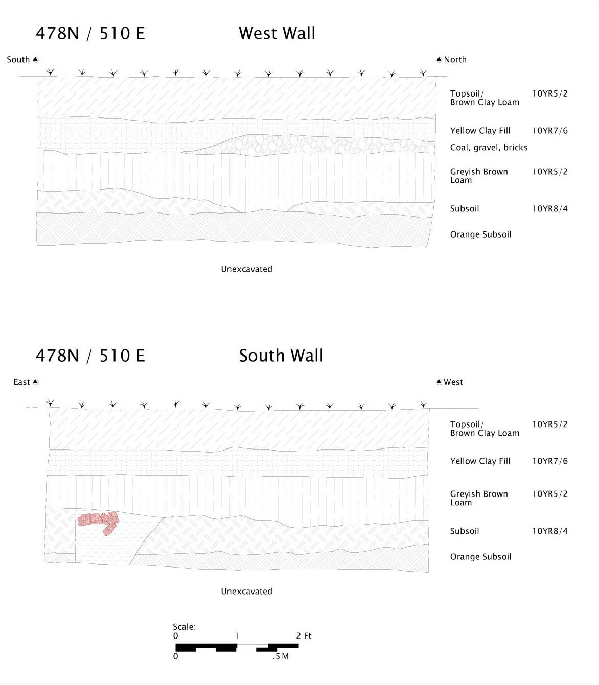 478N / 510 E
West and South Walls
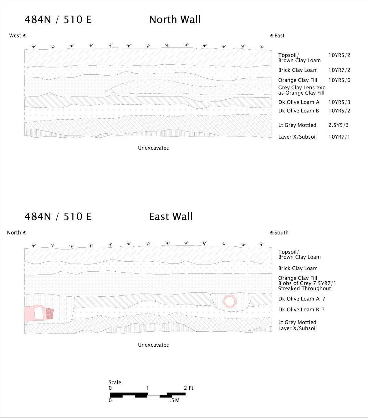 484N / 510 E
North and East Walls
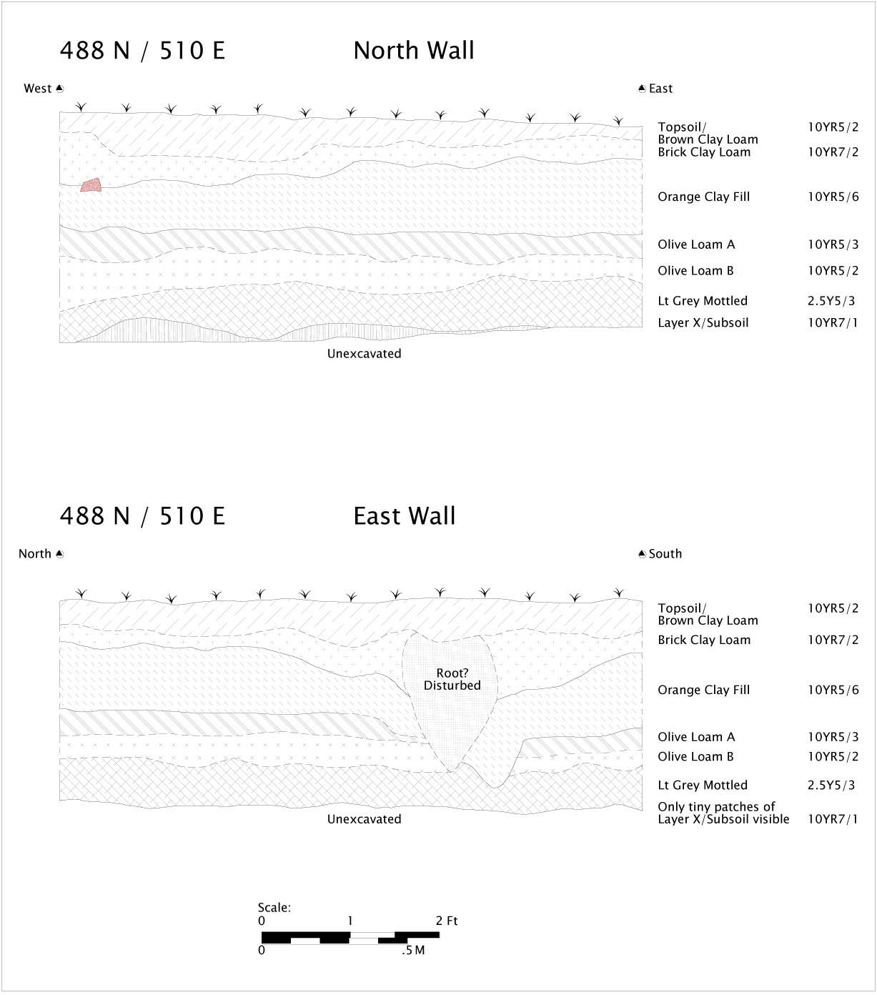 488 N / 510 E
North and East Walls
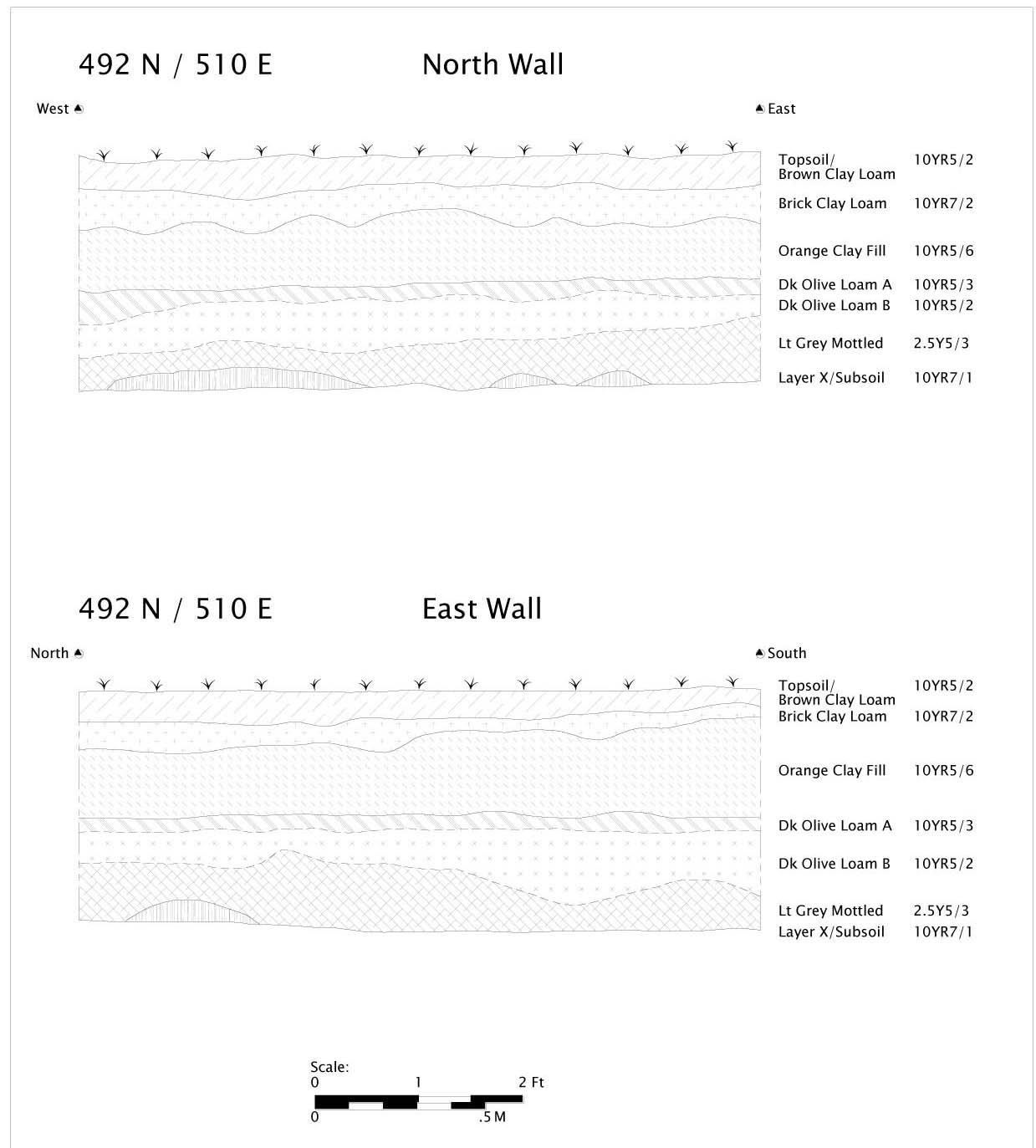 492 N / 510 E
North and East Walls
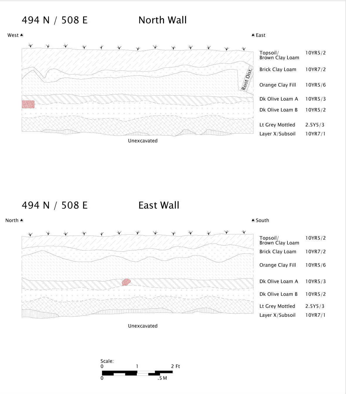 494 N / 508 E
North and East Walls
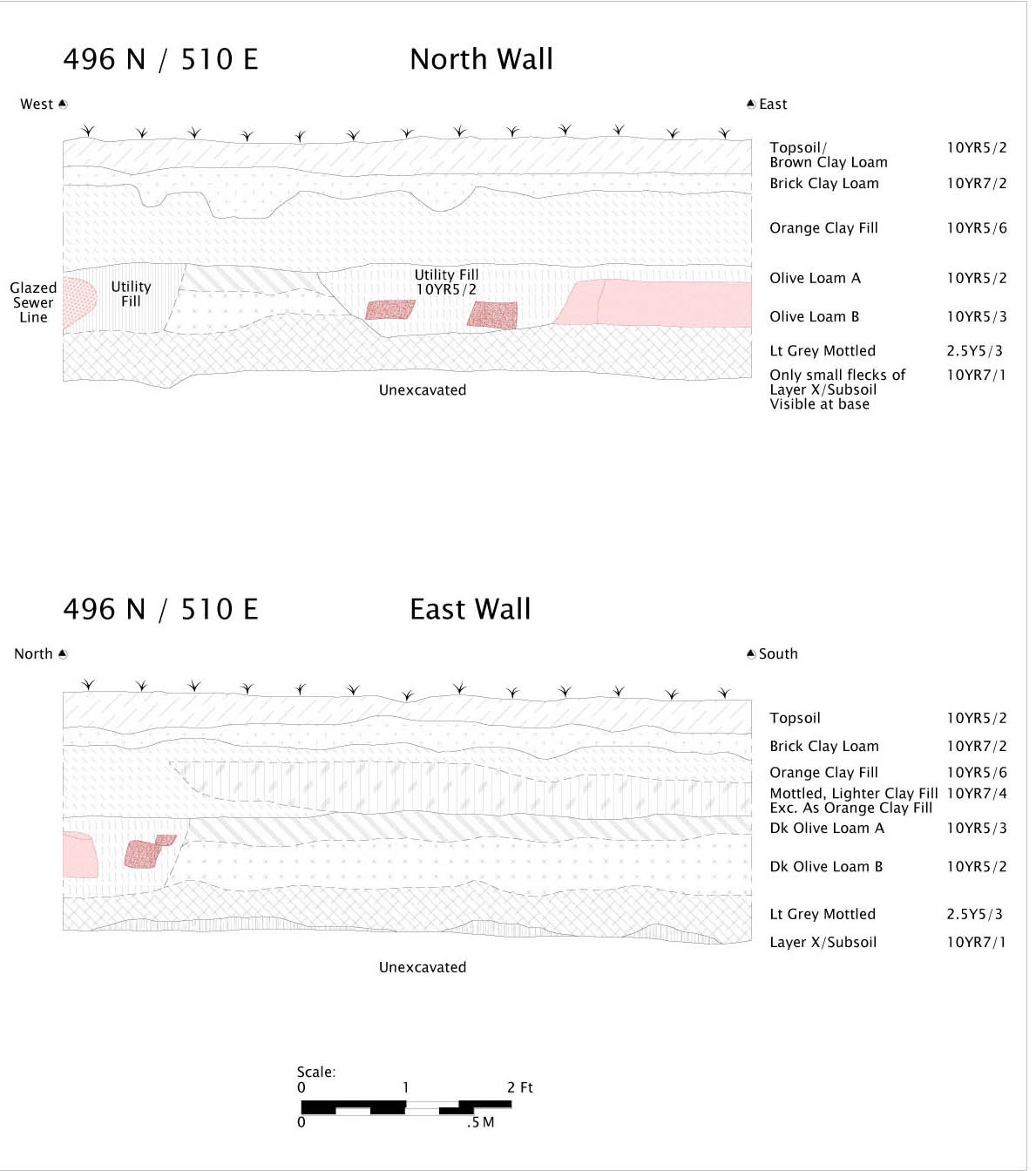 496 N / 510 E
North and East Walls
2006 Figures
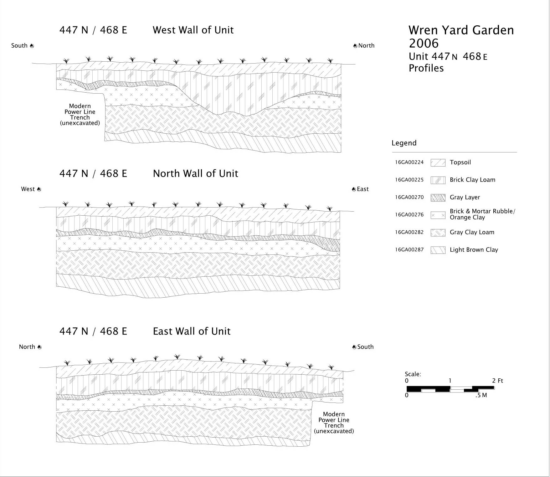 Wren Yard Garden
2006
Unit 447 N 468 E
Profiles
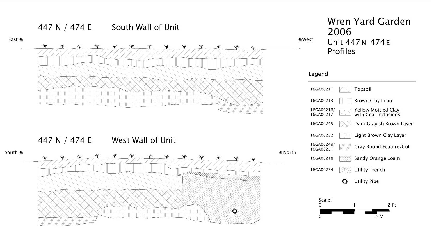 Wren Yard Garden
2006
Unit 447 N 474 E
Profiles
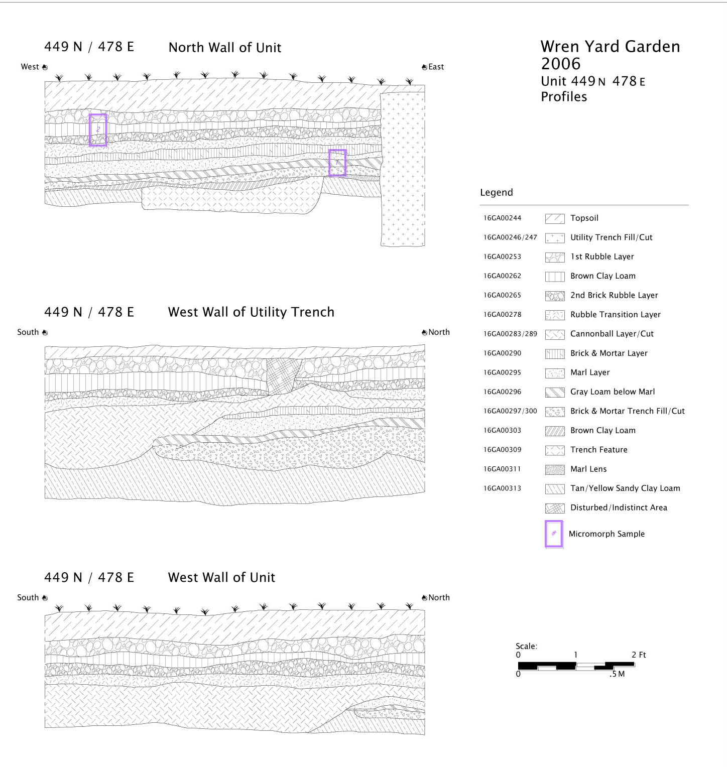 Wren Yard Garden
2006
Unit 449 N 478 E
Profiles
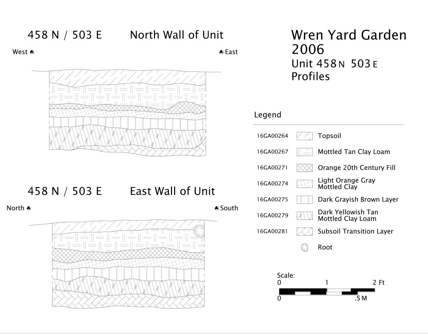 Wren Yard Garden
2006
Unit 458 N 503 E
Profiles
2007 Figures
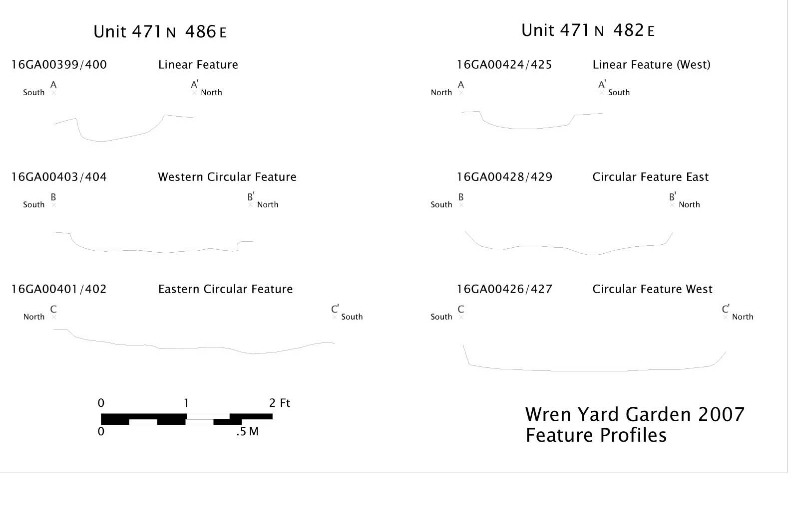 Wren Yard Garden 2007
Feature Profiles
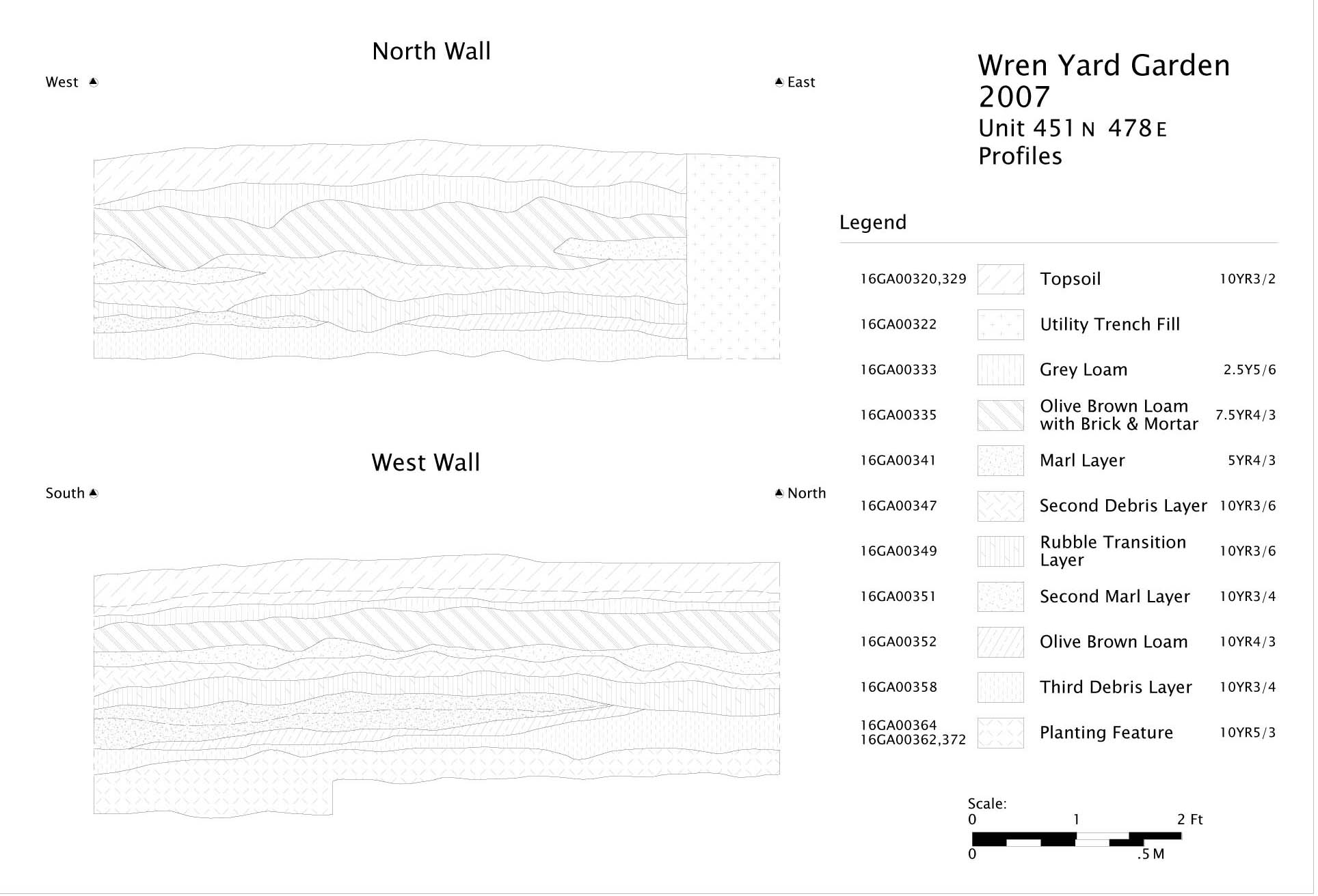 Wren Yard Garden
2007
Unit 451 N 478 E
Profiles
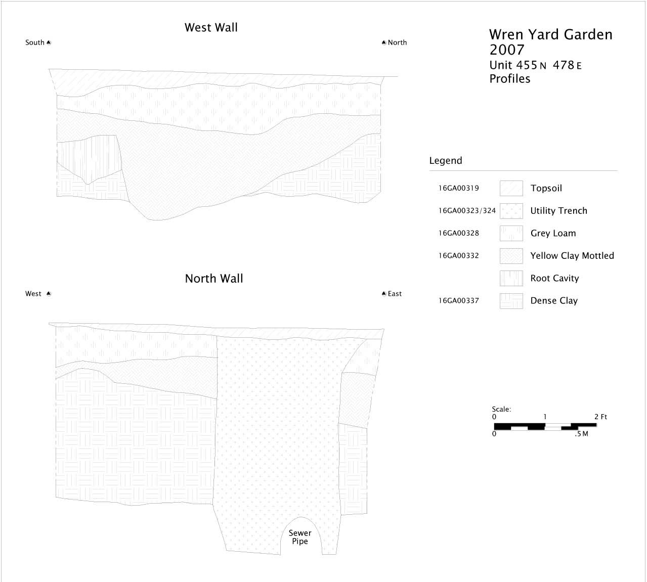 Wren Yard Garden
2007
Unit 455 N 478 E
Profiles
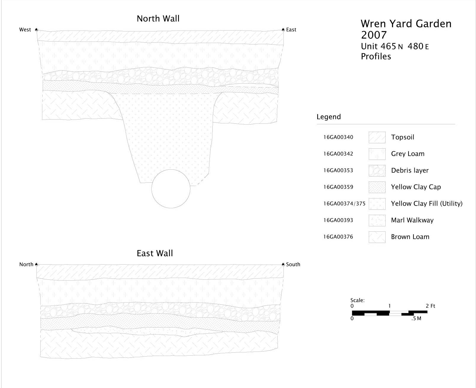 Wren Yard Garden
2007
Unit 465 N 480 E
Profiles
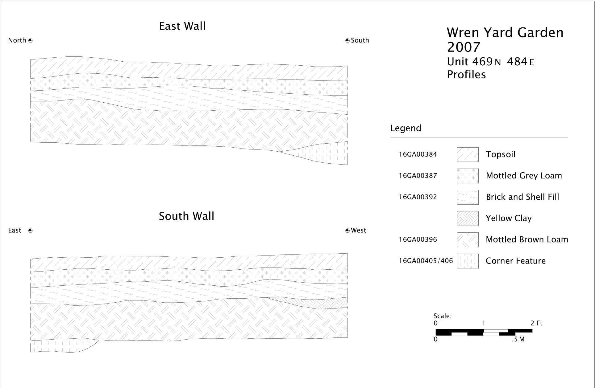 Wren Yard Garden
2007
Unit 469 N 484 E
Profiles
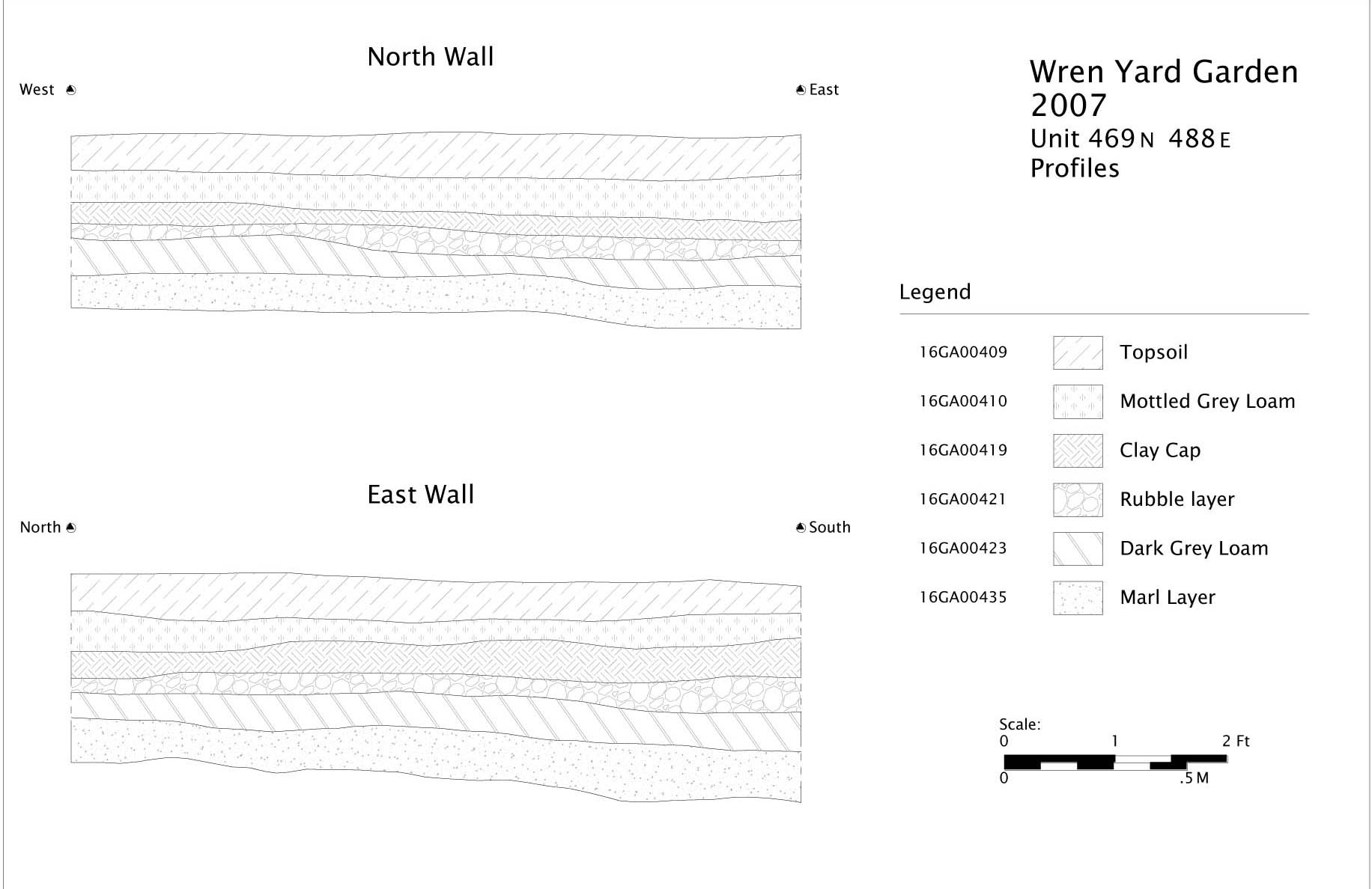 Wren Yard Garden
2007
Unit 469 N 488 E
Profiles
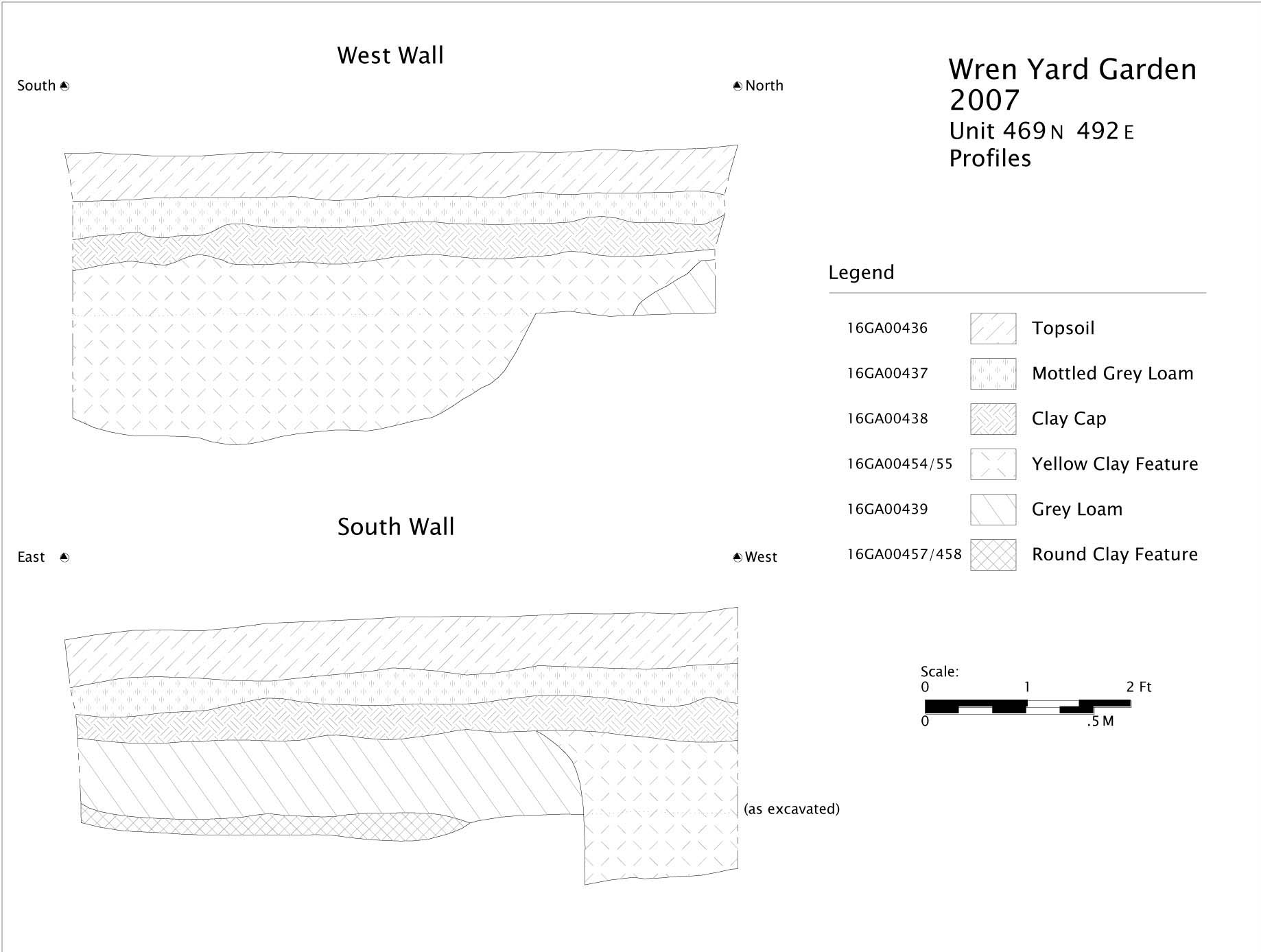 Wren Yard Garden
2007
Unit 469 N 492 E
Profiles
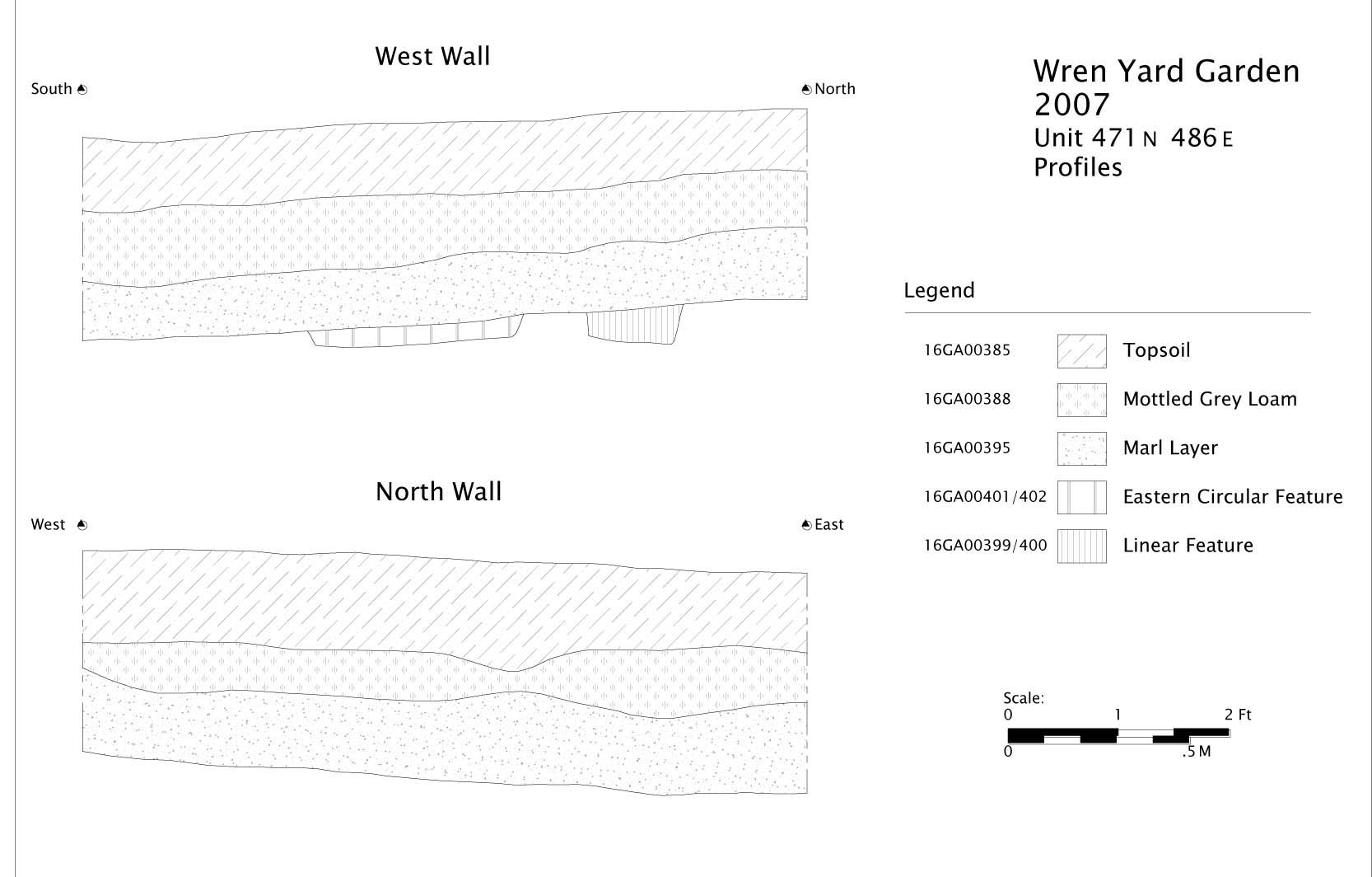 Wren Yard Garden
2007
Unit 471 N 486 E
Profiles
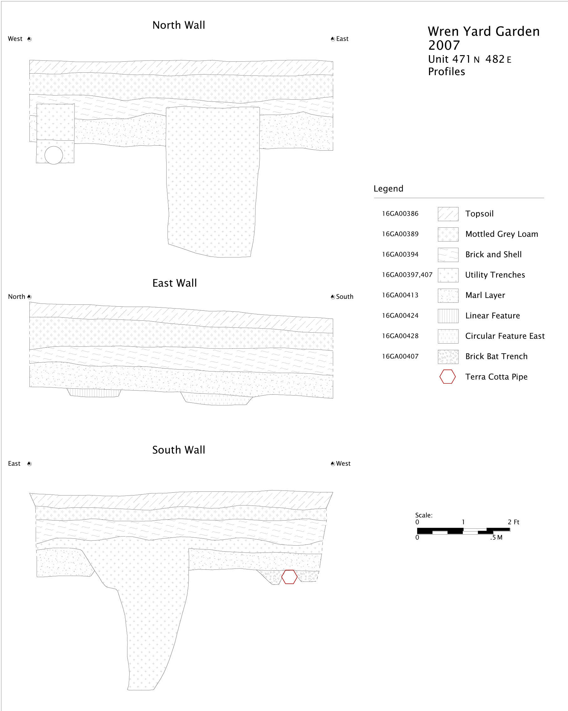 Wren Yard Garden
2007
Unit 471 N 482 E
Profiles
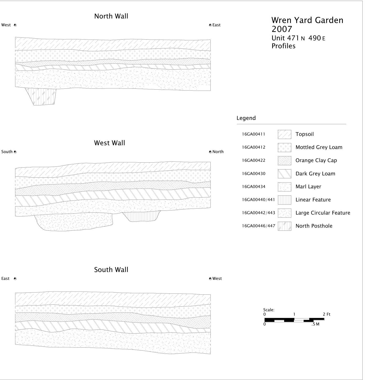 Wren Yard Garden
2007
Unit 471 N 490 E
Profiles
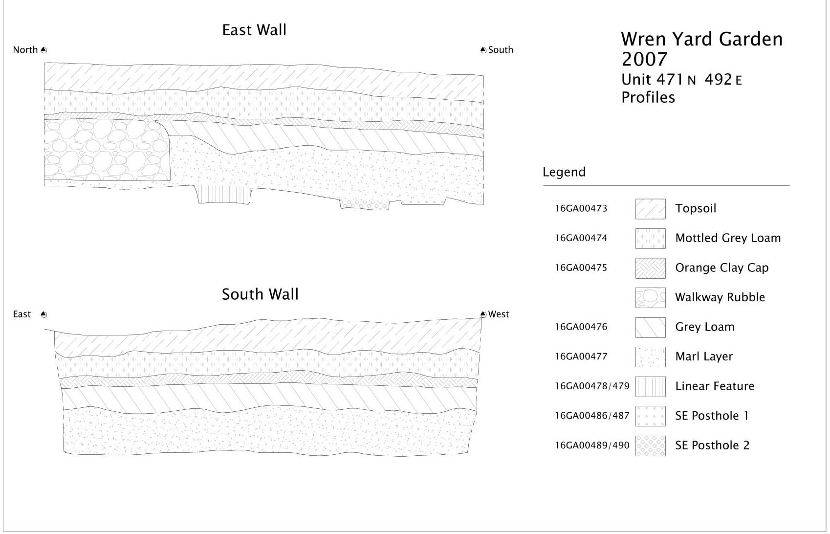 Wren Yard Garden
2007
Unit 471 N 492 E
Profiles